 Hiking Honaker Trail
Mexican Hat
Overview
|
Fri 79 | 47 |
Sat 79 | 46 |
Sun 70 | 45 |
Mon 69 | 40 |
Tue 72 | 42 |
| View Full Weather Details | ||||
|
Fri 79 | 47 |
Sat 79 | 46 |
Sun 70 | 45 |
Mon 69 | 40 |
Tue 72 | 42 |
| View Full Weather Details | ||||
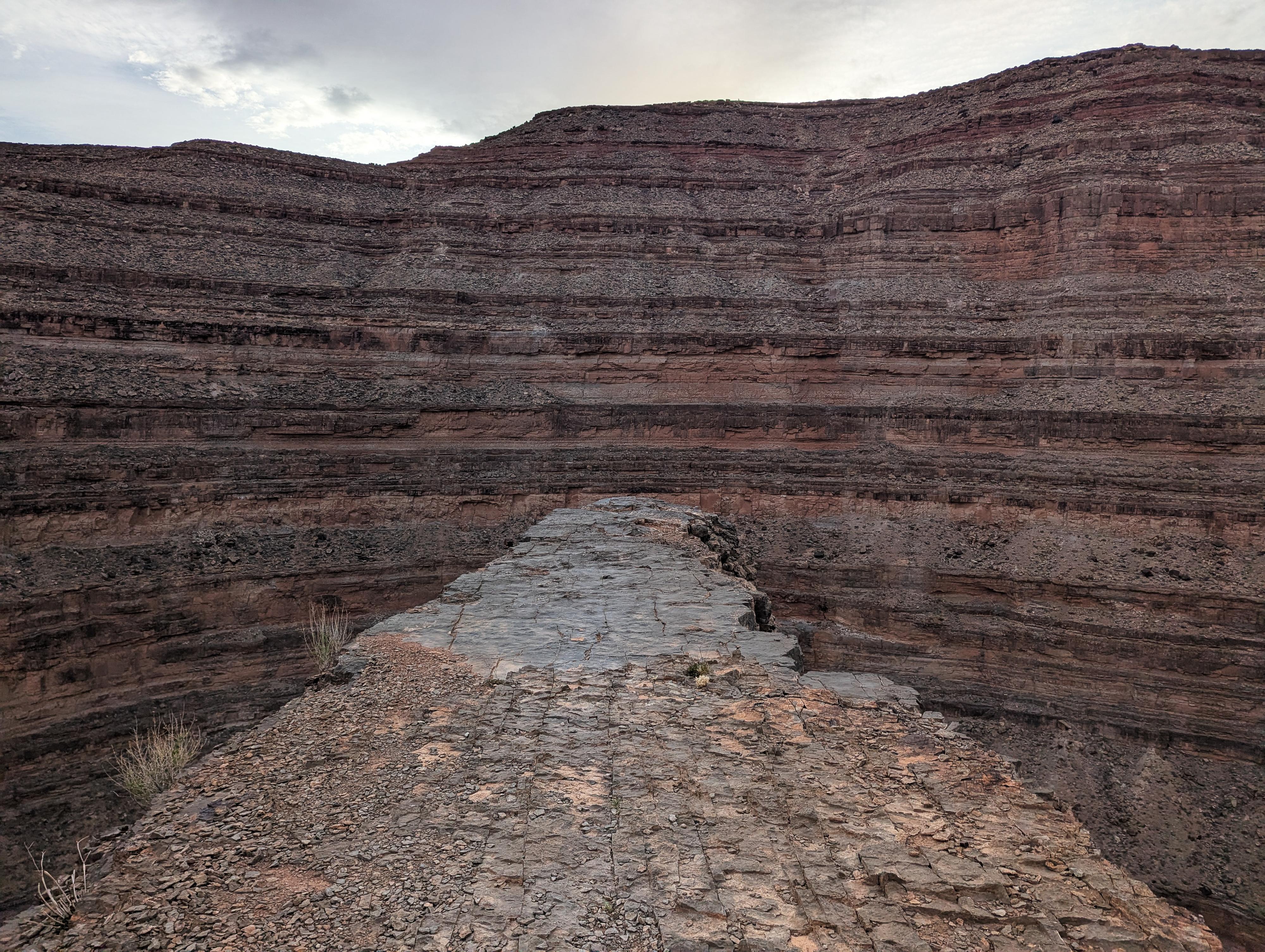
Looking out The Horn
This is one of the iconic mining trails in the area. Starting high above the San Juan River, the trail takes an improbable and winding path down to the river via a very laboriously constructed trail. It is a marvel to me how much work and difficulty must have gone into figuring out and building the trail.
This is a hike with outstanding views that, to me at least, feels a little like hiking into the Grand Canyon, only on a smaller scale.
The bottom of the trail, where it reaches the river, has several outstanding large campsites often used by rafters. These days, I think the trail sees more visitation from rafters on the river than from hikers from the rim.
Although some gold was found, mining efforts quickly faded. The trail remained in occasional use by ranchers and more recently by hikers and rafters.
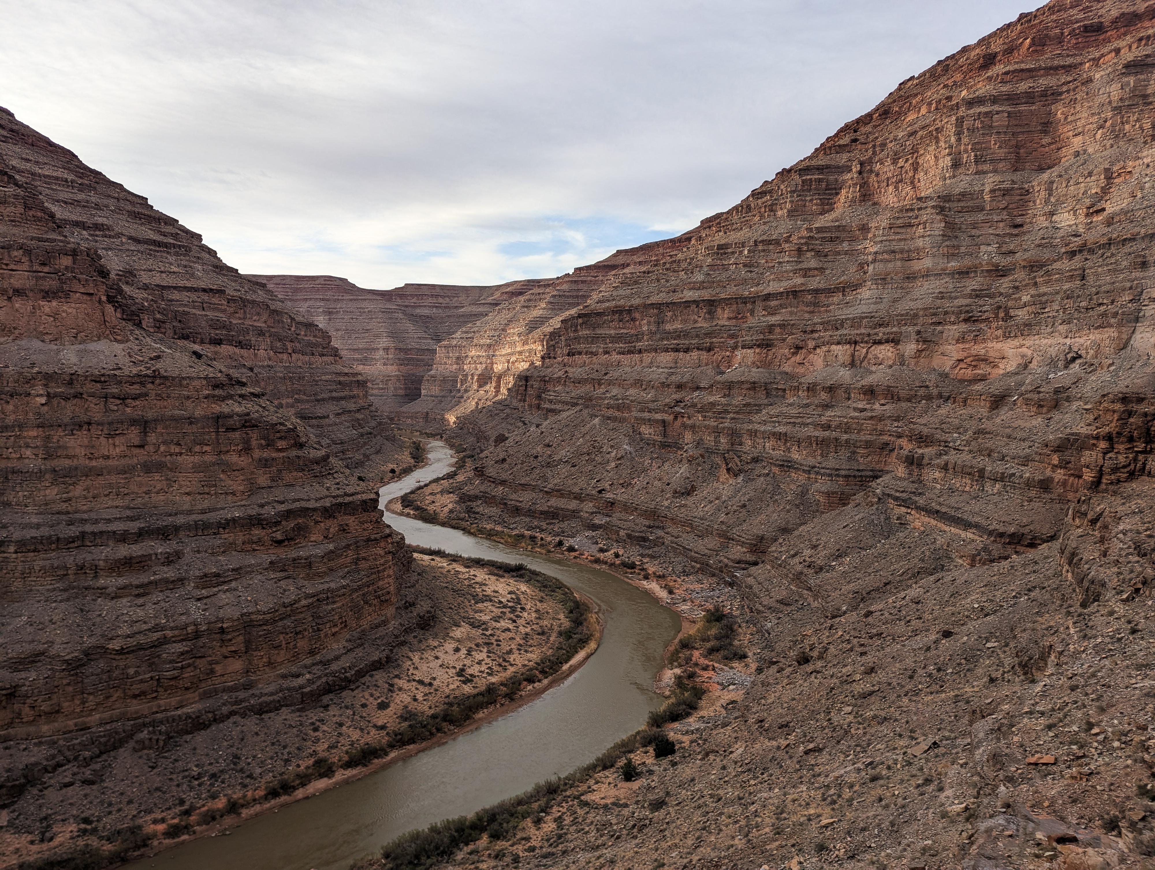
The San Juan River lazily ambling along.
Getting There
Reaching the trailhead has about 2 miles on a two-track dirt road. I would recommend medium clearance, though in most conditions you don't need high clearance or four wheel drive. This could be walked if needed, adding about 4 miles round-trip.
From Mexican Hat, drive east on US-163 North for about 4 miles. Turn left onto UT-261 North and continue for just under 1 mile.
Turn left onto UT-316 West toward Goosenecks State Park and drive for half a mile to where a good dirt road leaves on the right. This is the Johns Canyon Road.
Turn right onto Johns Canyon Road and follow it for about 2.6 miles to where a side road leaves on the left. Turn onto this rougher two-track road. Folllow it for 1.9 miles to where a short spur road leaves on the right and descends down to the Honaker Trailhead.
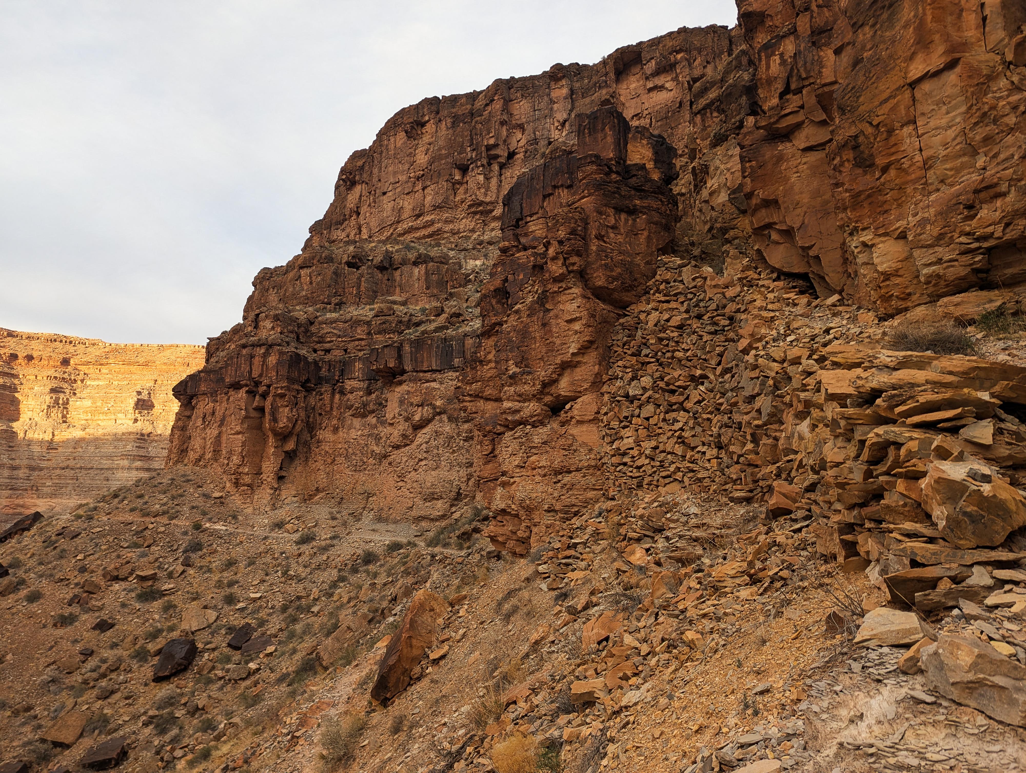
You can see some of the construction of the Honaker Trail in this photo.
Route
From the trailhead, the trail begins its descent immediately, with several switchbacks in short order. After a few quick switchbacks, it begins a long traversing descent to The Horn, about a mile from the trailhead.
The Horn is a flat rock outcropping. To walk out on it requires an easy step across a gap with immense exposure. Not for the timid! It is a dramatic spot and a frequent turnaround spot for rafters hiking up from the river.
From The Horn, the trail gets more dramatic and a bit more difficult. The trail drops through a cut, then begins a few short, steep switchbacks before making a long traverse downstream to a few more switchbacks through the cliff bands. The trail then traverses upstream and down to the San Juan River proper.
Even though I have hiked the trail a couple of times, I always marvel when looking up at the cliffs from the river. What a route to engineer! It looks improbably even after hiking it.
Return the same way.
Photos
Maps

| Honaker Trailhead |
12S 592897mE 4116289mN N37° 11' 18" W109° 57' 12" |
| The Horn |
12S 592145mE 4115745mN N37° 11' 01" W109° 57' 43" |
| Honaker Bottom |
12S 592166mE 4115962mN N37° 11' 08" W109° 57' 42" |
| Upper Honaker Camp |
12S 591965mE 4115729mN N37° 11' 01" W109° 57' 50" |
| Honaker Camp |
12S 592089mE 4115944mN N37° 11' 07" W109° 57' 45" |
| Juniper Camp |
12S 592353mE 4116223mN N37° 11' 16" W109° 57' 34" |