 Roadside Attraction Batty Pass Caves
Hole In The Rock
Overview
|
Sat 74 | 45 |
Sun 63 | 44 |
Mon 66 | 40 |
Tue 71 | 44 |
Wed 76 | 48 |
| View Full Weather Details | ||||
|
Sat 74 | 45 |
Sun 63 | 44 |
Mon 66 | 40 |
Tue 71 | 44 |
Wed 76 | 48 |
| View Full Weather Details | ||||
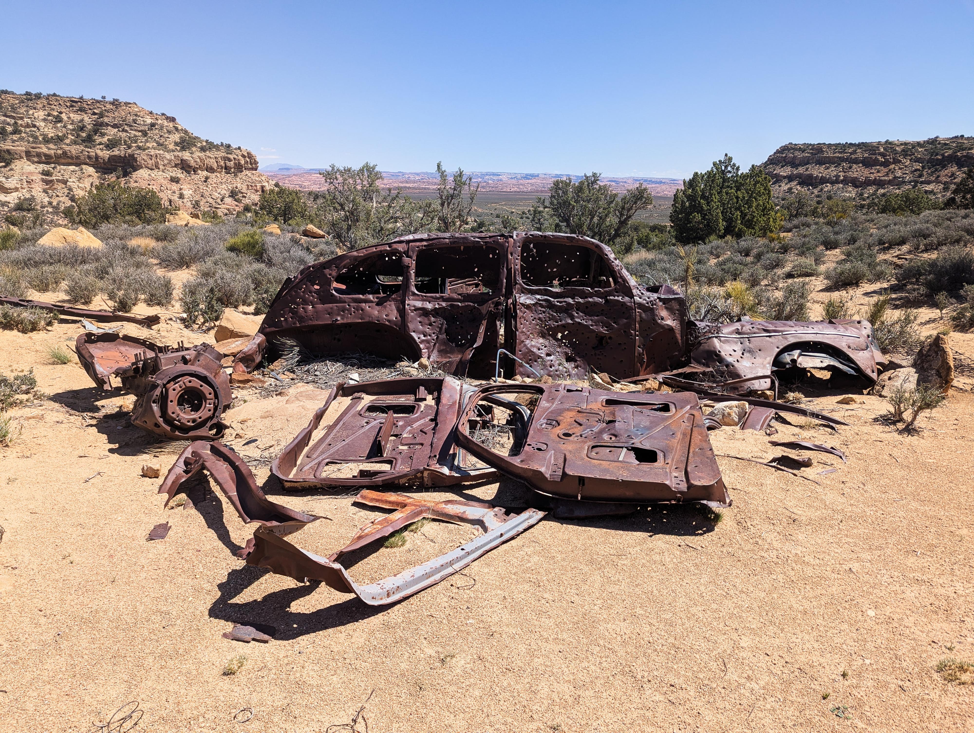
The old car at the trailhead.
I find the history of the people who lived on the Colorado Plateau fascinating. Perhaps part of me wishes I could walk out to the middle of the desert and carve out a life away from the modern world. Batty Pass Caves and the story of Bill and Cliff Lichtenhahn is one of those fascinating tales of people living a non-traditional life in the desert.
The Lichtenhahn's were primarily rock enthusiasts that did rock cutting, polishing, and mosaic work. In the 1950's, when uranium exploration was drawing prospectors to all corners of the Colorado Plateau, Bill and Cliff left Colorado and ended up in Escalante to join the hunt. Not far from Batty Pass, they found a spot they thought was likely to have uranium and started excavating into the cliff. The story goes that it started to rain, and their tent leaked, so they kept excavating until they had a large enough room to use as a shelter.
The initial shelter expanded into three large caves. Each cave has about a 10-12 foot ceiling, and is probably about 15-20 feet wide by 25 or 30 feet deep. These are massive rooms. They used one for living quarters, one as a machine shop, and the third appears to have also been a workshop space. Some of the rooms have doors and cement floors. One of the rooms has a considerable project in the space. I have no idea what it was intended to be.
As of 2025, the caves are still in good shape with some old machinery, a workbench, beds, and other original artifacts about. It is a very interesting place to visit. I couldn't find obituaries or additional information beyond Bill and Cliff lived in the caves for at least 10 years and would travel to Escalante once a week for supplies.
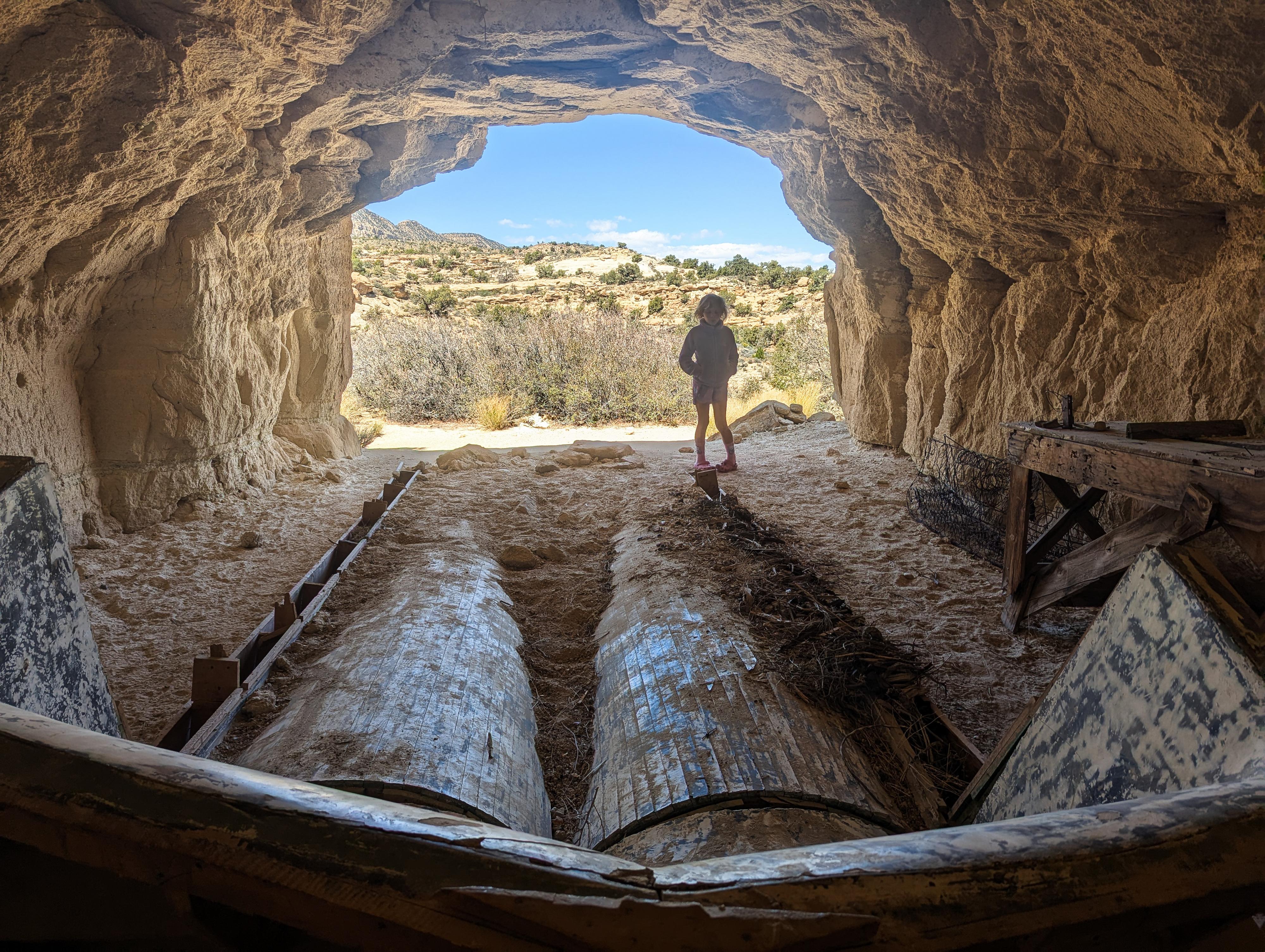
I am not sure what this cave was used for! Looks like they were building something big in this one.
Getting There
Head east out of the town of Escalante about 5 miles on highway 12 until the well signed Hole in the Rock road on the south side of highway 12. Reset the odometer as you turn onto this road.
- Mile 0 - Hole-In-The-Rock Road Turnoff ( 12S 453167mE 4175716mN / N37° 43' 39" W111° 31' 53" )
- 4.5 miles - Small parking area on the north side of the road. This is the trailhead for West Big Horn/Big Horn Canyon. ( 12S 457467mE 4170148mN / N37° 40' 39" W111° 28' 56" )
- 8.0 miles - Parking area after a cattle guard. This is the Zebra/Tunnel trailhead. ( 12S 460681mE 4165896mN / N37° 38' 22" W111° 26' 44" )
- 12.3 miles - Devil's Garden turn off on the right. The trailhead is about 1/4 of a mile down this road. No camping, but a pit toilet. ( 12S 463808mE 4160175mN / N37° 35' 17" W111° 24' 36" )
- 16.6 miles - Egypt road on the left. This access the Egypt and Neon trailheads ( 12S 468045mE 4154960mN / N37° 32' 28" W111° 21' 42" )
- 24.8 miles - Upper Dry Fork Trailhead on the right (south). This has a large parking area and pit toilet. ( 12S 478657mE 4148035mN / N37° 28' 44" W111° 14' 29" )
- 26.1 miles - Dry Fork Trailhead Road on the left (north). The trailhead is at the end of the road in about a mile. ( 12S 480198mE 4146661mN / N37° 27' 60" W111° 13' 26" )
- 26.1 miles - Batty Pass Caves road on the right (south) just across from the Dry Fork Trailhead road. This side road usually requires medium clearance. The caves are 2.4 miles from the Hole In The Rock Road. There are a few spur roads that generally go to primitive campsites, stay on the main dirt road through this section. ( 12S 480198mE 4146661mN / N37° 27' 60" W111° 13' 26" )
- Batty Caves Side Road - The caves are on the left at 2.4 miles next to an old rusted car. ( 12S 476782mE 4145054mN / N37° 27' 07" W111° 15' 45" )
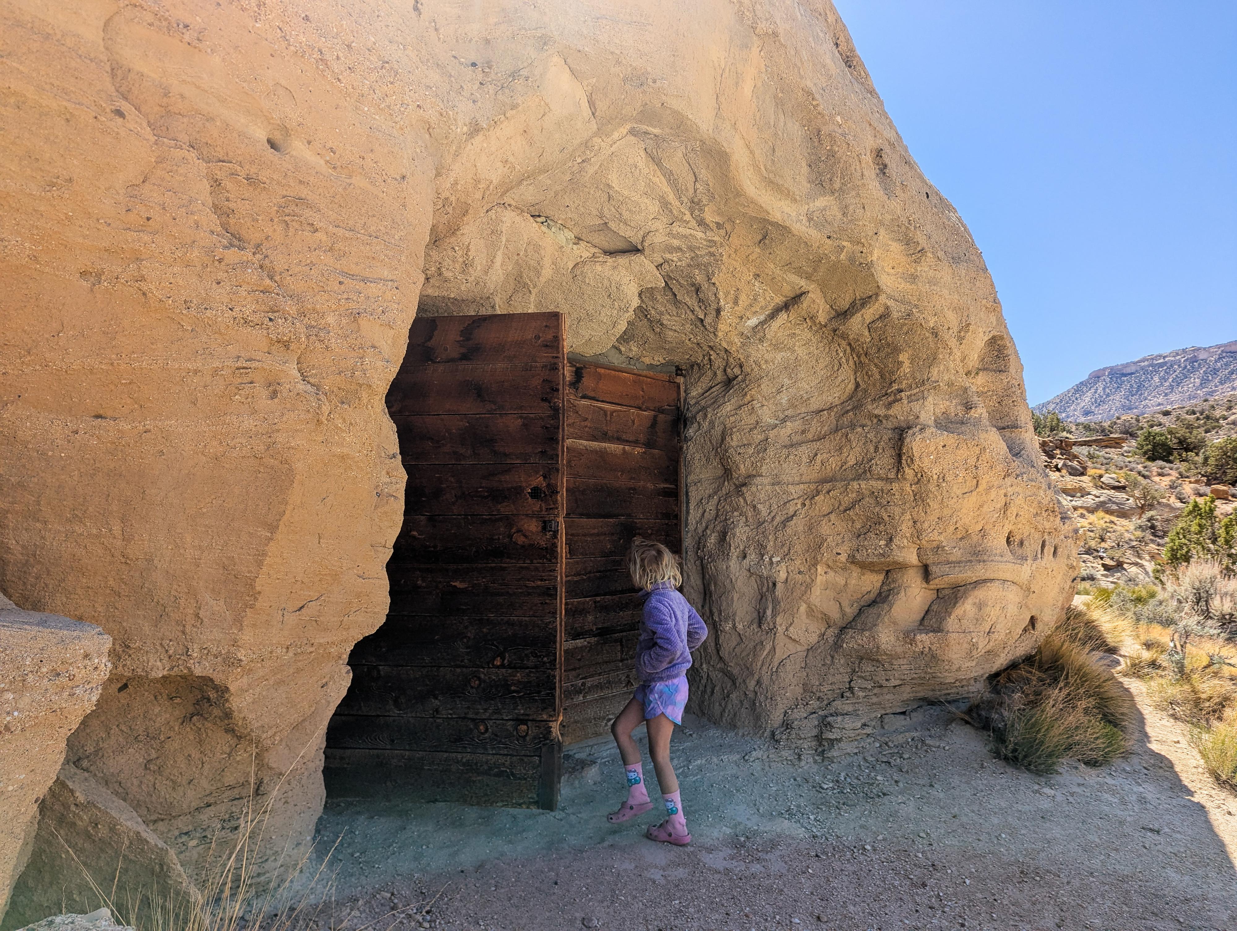
Checking out what is behind the biggest door.
Route
The caves are just a bit south of the parking area. All three are in close proximity. The spot has excellent views to the north of the Escalante canyons.
Photos
Maps

| 26.1 miles |
12S 480197mE 4146658mN N37° 27' 60" W111° 13' 26" |
| Trailhead |
12S 476782mE 4145054mN N37° 27' 07" W111° 15' 45" |
| Batty Pass Caves |
12S 476760mE 4145018mN N37° 27' 06" W111° 15' 46" |