 Hiking
Dead Horse Lake
Hiking
Dead Horse Lake
Uinta Mountains
Overview
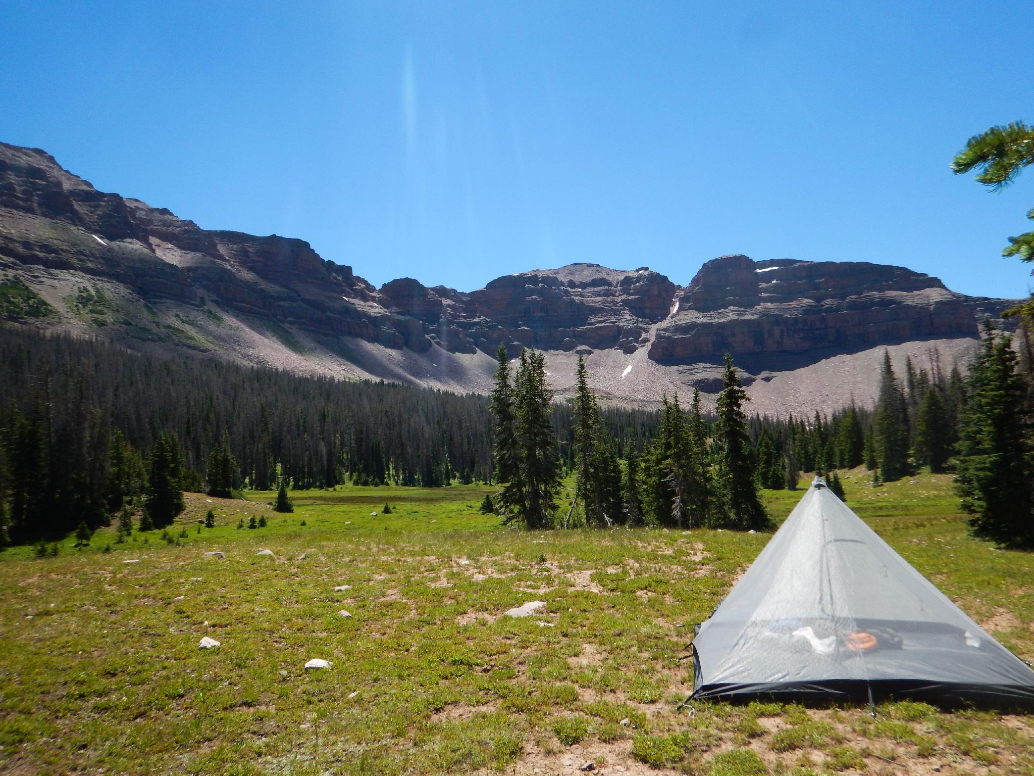
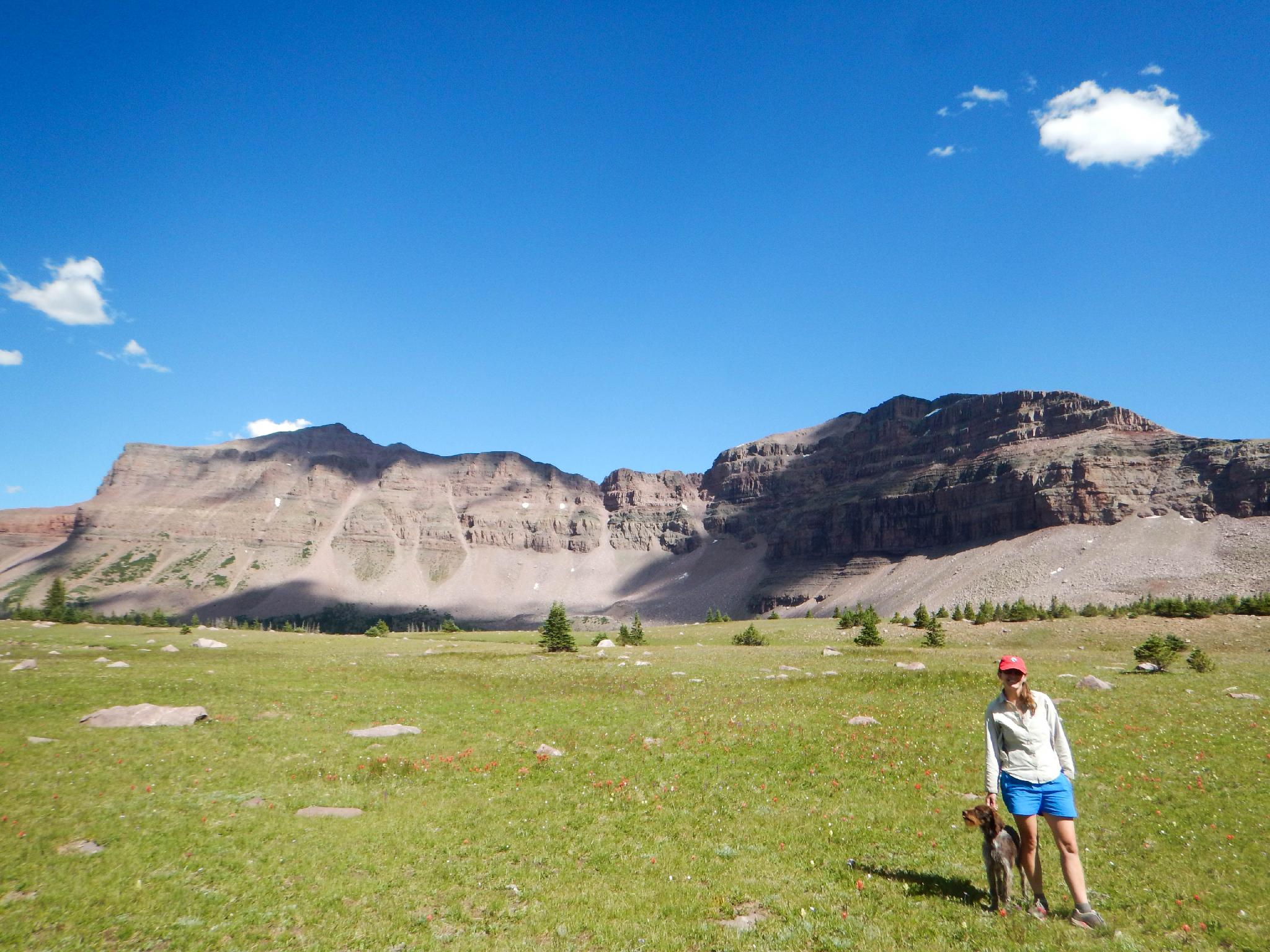
This hike epitomizes the cliche "sometimes the journey is the destination". The hike ambles gradually up the West Fork of the Blacks Fork River through a deeply carved valley with towering ridges surrounding the valley. What makes this hike so extraordinary is the valley is filled with wide, lush meadows that allow for big views of the ridges instead of just a forest hike.
Dead Horse Lake, tucked up along the top of the Uintas at nearly 11,000' is an excellent overnight backpacking destination, but Buck Pasture and the other meadows along the hike are equal or better destinations in my mind. The hike gains elevation slowly and makes for a good family outing because there are ample campsites for wherever the group’s motivation begins to wane.
Though stunning and gorgeous, the West Fork of the Blacks Fork sees much less visitation than many of the other areas in the Uintas that are closer to pavement. On a holiday weekend in July, we say only a couple of groups and felt we had to drainage to ourselves.
Getting There
The West Fork of the Black Fork trailhead is located off the North Slope Road in the Uinta Mountains. To get there, head south out of Evanston, Wyoming on highway 150. Follow this about 30 miles to where the signed North Slope Road takes off on the left. This is at Mile Post 48.7. Reset your odometer as you turn onto the North Slope Road. This is also Forest Road 058.
Follow the forest road for 17 miles to a 4-way junction. Left goes to Lyman Lake and a small campground. Go right here, on Forest Road 063 and reset your odometer.
- 0.4 miles - Right
- 2.8 miles - Right
- 3.6 miles - Left
- 4.9 miles - Left
- 5.2 miles - Trailhead on the left, just before the river crossing.
Route Description
To The First River Crossing (1.8 or 3.1 miles)
From the river crossing, follow the road as it goes south up the meadow. The road then wanders through the forest for 1.2 miles to a locked gate and the 4x4 trailhead.
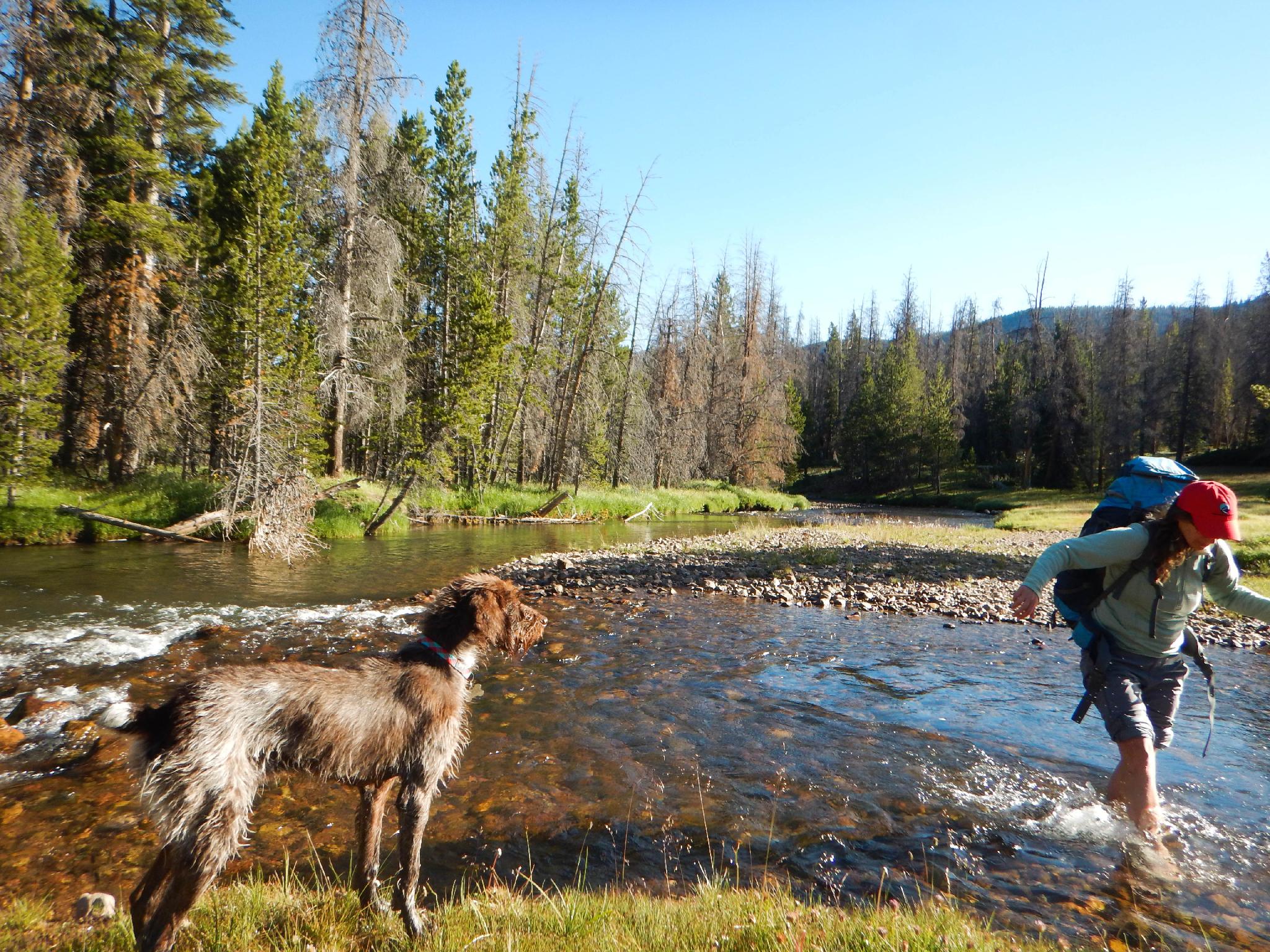
At the gate, continue on the West Fork of the Blacks Fork trail, which follows an old road to the south and crosses a small stream quickly. The Smith Bear River trail crosses the Blacks Fork trail at the gate. The old road is overgrown in a few spots but makes for easy travel. 1.85 miles from the gate, the trail reaches the first major crossing of the West Fork of the Blacks Fork River.
To Buck Pasture (1.9 miles from the first crossing)
Just past the crossing, an old fence marks the end of the old road and the start of the old trailhead before the road was closed. Continue on the trail. It follows the meadow and soon enters the High Uintas Wilderness Area. Good camping begins from here on up.
The trail skirts the edge of the meadow in the trees to a fence about 1.9 miles from the first major crossing. The trail crosses the very marshy meadow and river here, offering views all the way to the ridges that surround Dead Horse Lake. Excellent camping opportunities abound here.
To Deadhorse Lake (about 6 miles from the fence and crossing)
The trail, now on the east side of the drainage, follows along the many big meadows. After about 5 miles, it passes near a small pond on the left. Several good campsites are available here, be sure to camp a minimum of 200' from any water source.
Continue on about a mile to the junction with the Highline Trail that branches left here to cross Red Knob Pass. Go right instead about 0.25 miles to Dead Horse Lake.
There are quite a few good camping sites around Dead Horse Lake. Be sure to make the short hike to Ejod Lake as well, it is very photogenic.
Photos
Videos
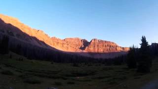
Sunset near Dead Horse Lake
Maps


12T 527797E 4525950N
40°53'03"N 110°40'12"W
12T 528054E 4524179N
40°52'06"N 110°40'01"W
12T 528649E 4522148N
40°50'60"N 110°39'36"W
12T 528723E 4521588N
40°50'41"N 110°39'33"W
12T 528683E 4521472N
40°50'38"N 110°39'35"W
12T 528687E 4521079N
40°50'25"N 110°39'35"W
12T 528595E 4518755N
40°49'10"N 110°39'39"W
12T 528530E 4514484N
40°46'51"N 110°39'43"W
12T 528394E 4518147N
40°48'50"N 110°39'48"W
12T 527940E 4510759N
40°44'50"N 110°40'09"W
12T 527679E 4510616N
40°44'46"N 110°40'20"W
12T 527370E 4511078N
40°45'01"N 110°40'33"W