 Hiking
Moonshine Arch
Hiking
Moonshine Arch
Vernal
Overview
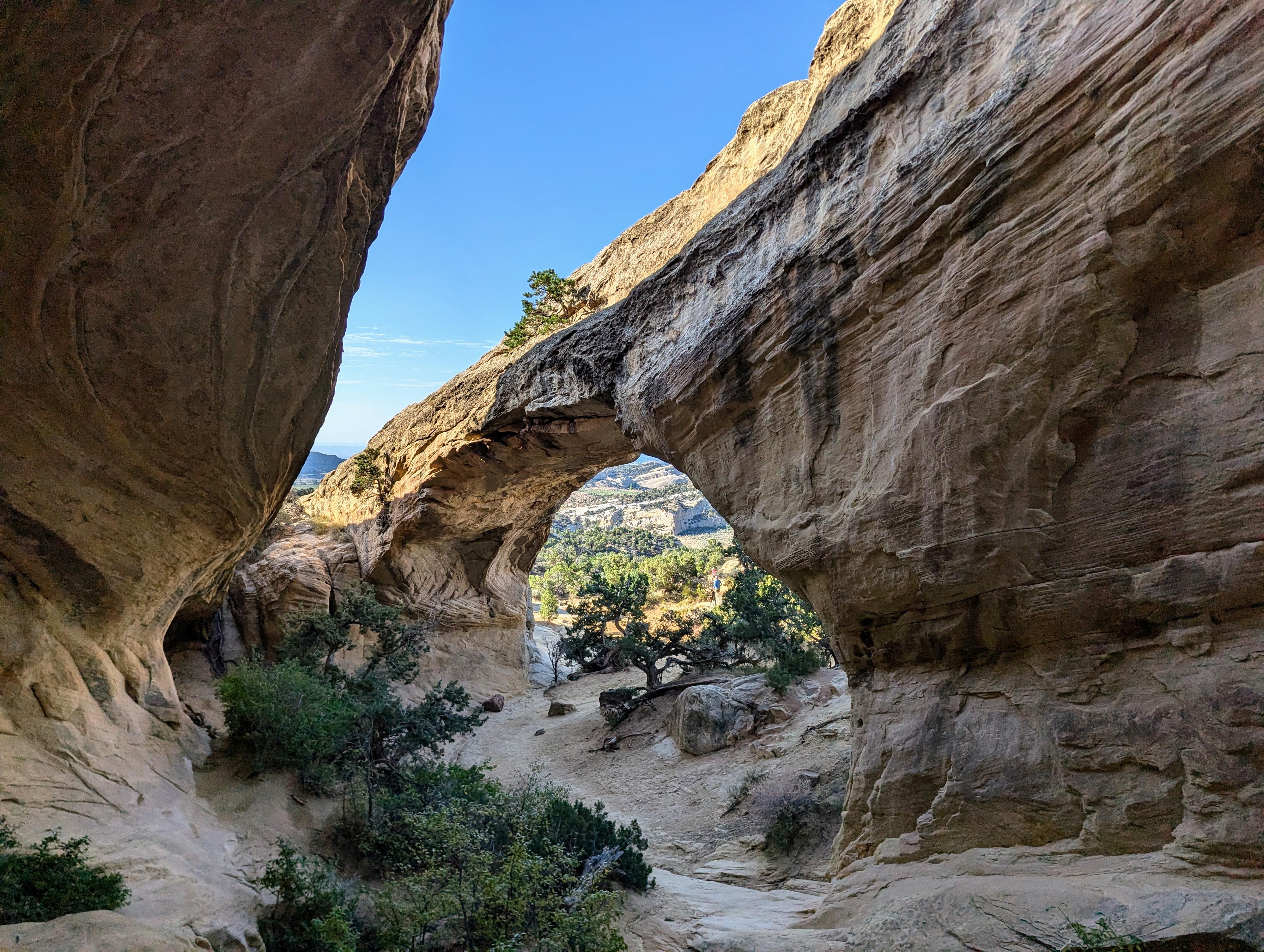
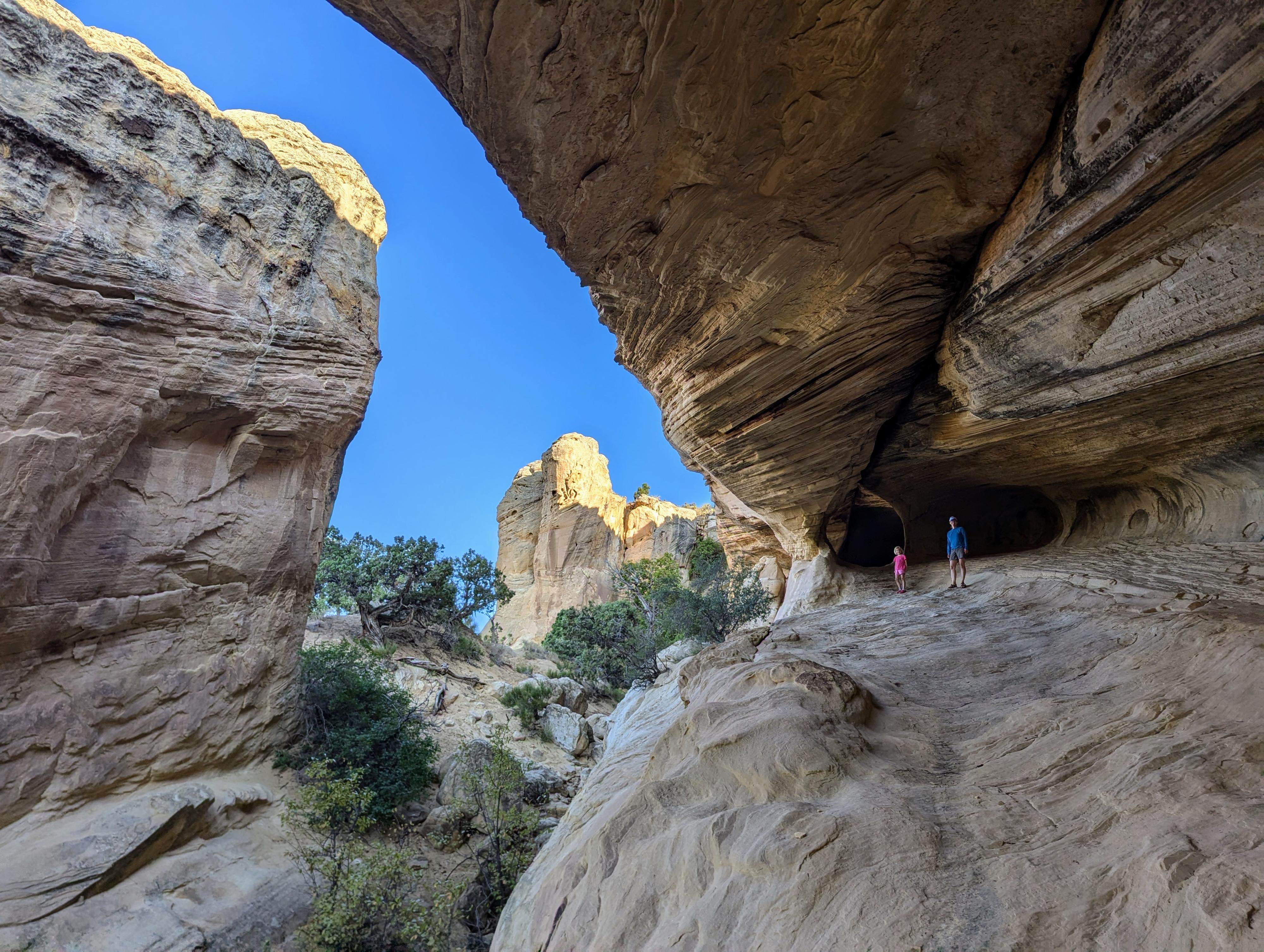
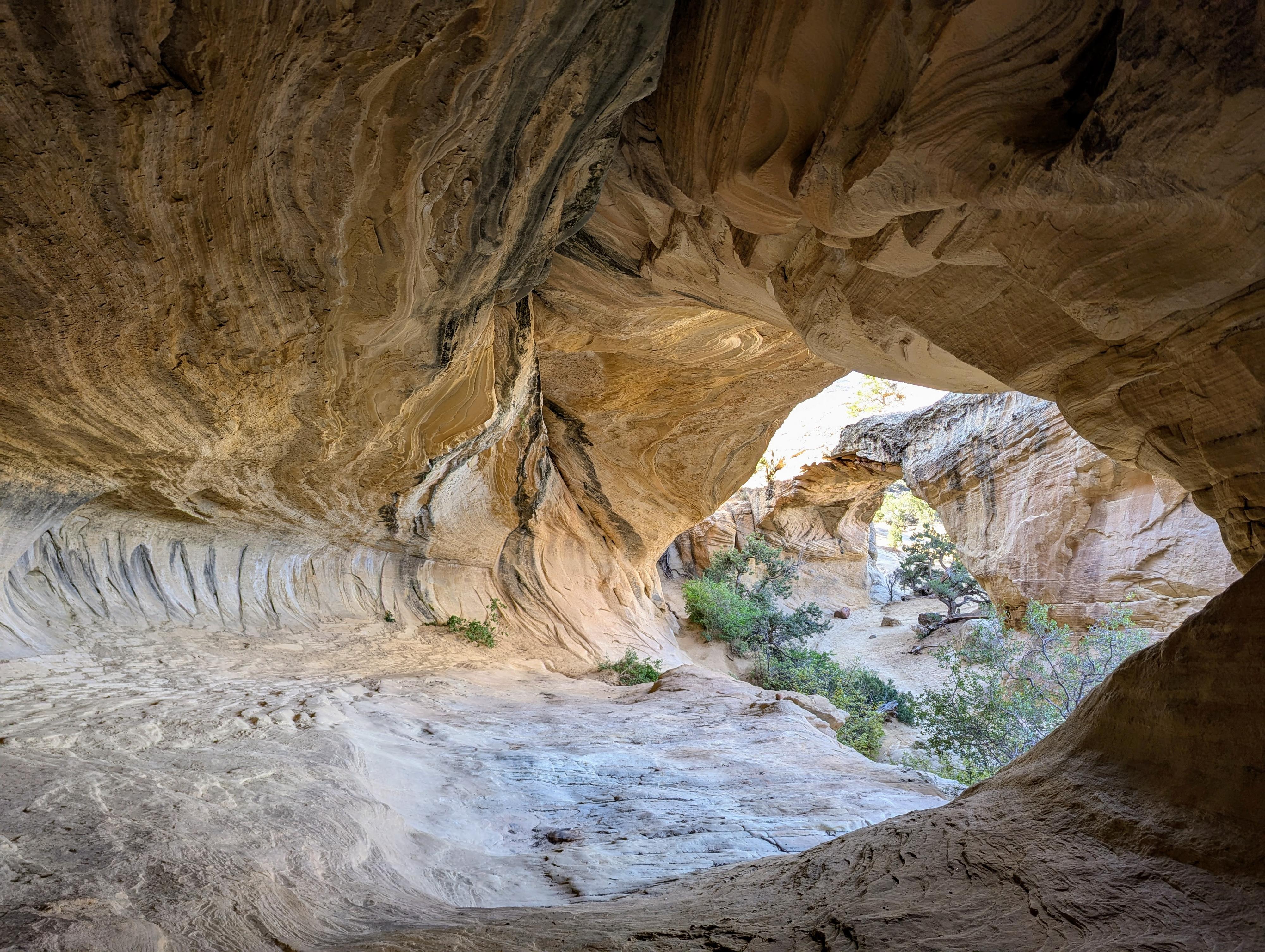
Moonshine Arch is one of the most popular hikes in the Vernal area that is outside of Dinosaur National Monument. The impressive arch spans a length of 85 feet and a height of 40 feet. It is a stunning and unique in the area.
The trail, since it is a multi-use trail, is easy to find and follow. The length and difficulty make this suitable for most. Our 7-year-old enjoyed the hike and arch equally. The arch is stunning. We visited in the early morning, and even though it was a summer weekend, had the area to ourselves until about 9AM.
The hike can be done anytime the roads are dry and snow free. If visiting in the summer, heat can be an issue. Start early and be sure to bring plenty of water. Furthermore, be aware that the hiking parking area is surrounded by private land and is adjacent to a fence and gate. Please respect the rights of the private landowner. Stay on the road in this area, pick up after yourself, and just generally be a good steward.
Getting There
Head north out of Vernal on US-191 N toward Steinaker Reservoir. Follow US-191 from downtown Vernal for about 7 miles to mile post 360.1 where a good dirt road leaves on the left (west) side of US-191.
Follow this dirt road, ignoring smaller side roads, for 1.1 miles to the hiker trailhead, which is a large parking area with a pit toilet. There is a gate at the end of the parking lot where the dirt road becomes rough and descends to a wash bottom.
Route Description
OHV Route: Most will want to start hiking at the hiker trailhead. If continuing by vehicle, go through the gate and down across a deep wash. The road here has some deep gullies. Stay left/straight past 2 side roads on the right after crossing the wash until a third road on the right is marked with a Moonshine Arch sign. (0.25 miles from the gate) Take this right as it doubles back toward the way you came. Stay left at junctions. There is a small parking area just before the road begins to climb and get rougher. Follow it to its end and the arch.
Hikers: Go through the gate and follow the road. It crosses a deep wash, then the road splits. Go right at this junction, which is signed for hikers. In just a minute another junction is encountered, go left here.
Finally, just about a 1/4 of a mile from the trailhead is the final junction. Go right here, as the road begins climbing and getting rougher. Follow the road all the way to the arch.
Return the same way.
Photos
Maps

12T 623832E 4490044N
40°33'07"N 109°32'15"W
12T 623469E 4489985N
40°33'05"N 109°32'30"W
12T 623734E 4489986N
40°33'05"N 109°32'19"W
12T 623549E 4489735N
40°32'57"N 109°32'27"W
12T 623100E 4490479N
40°33'21"N 109°32'46"W