 Hiking
Ryder and McPheters Lakes
Hiking
Ryder and McPheters Lakes
Western Uintas
Overview
Middle Basin, reached from the Christmas Meadows trailhead, is home to two major lakes, Ryder and McPheters. Unlike the other two basins that are reached from the Christmas Meadows trailhead, Amethyst and West Basin (which holds Kermsuh Lake), Middle Basin is less visited and offers much more solitude. Of the three basins, I would say Amethyst Basin is the most striking and spectacular, with Middle Bain and Ryder/McPheters lakes a close second.
If you are seeking to get away from the crowds, this can be a good choice. It is about 9 miles to the basin from Christmas Meadows, and makes an excellent 2+ day backpacking trip. The basin is surrounded by Hayden Peak and its impressive ridges. Like many hikes in the Uintas, much of the hike is in dense forest, with only fleeting glimpses of the mountains and ridges that line the valley. It isn't until near Ryder Lake that the trees subside a bit and big views come into focus.
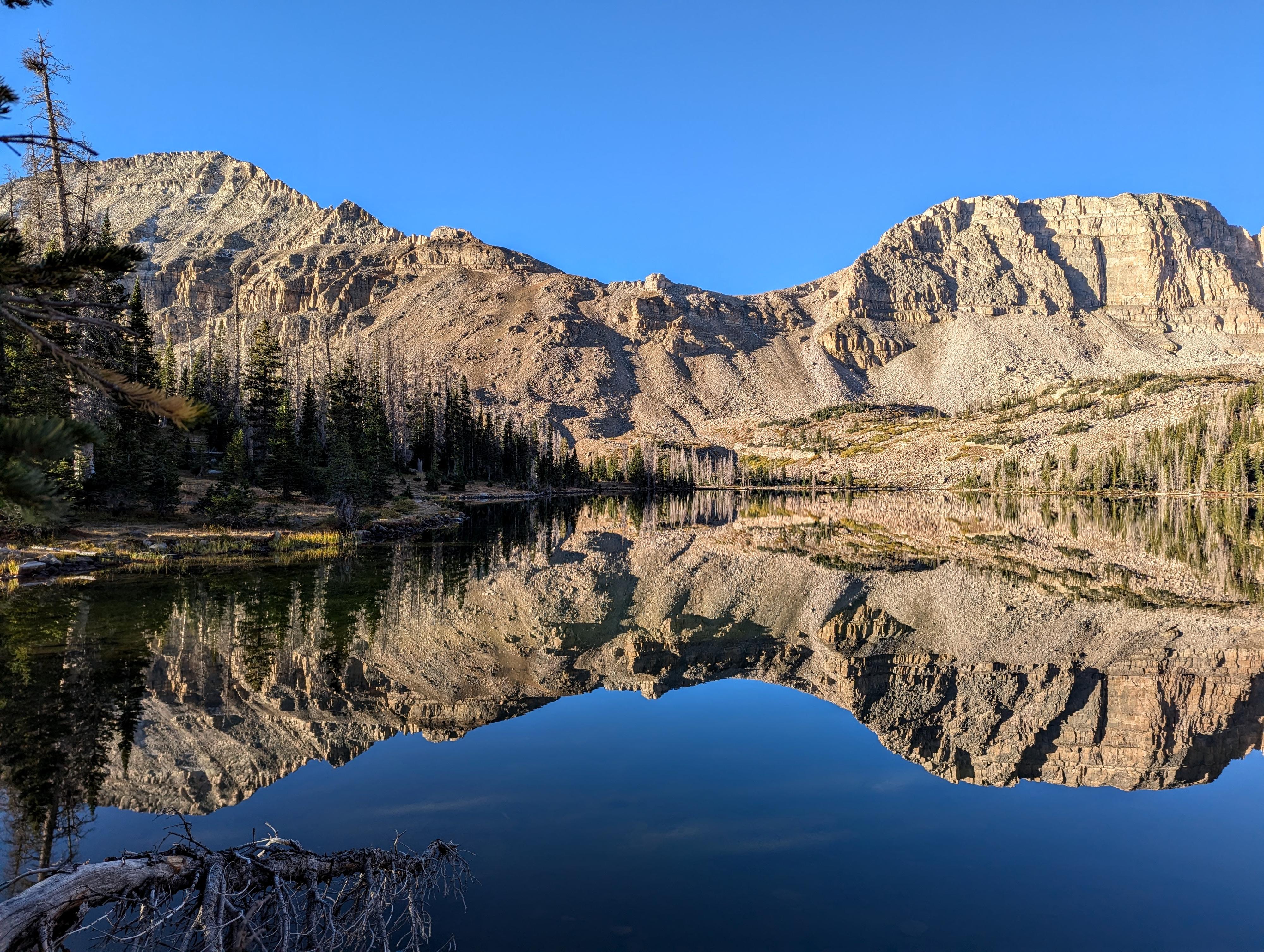
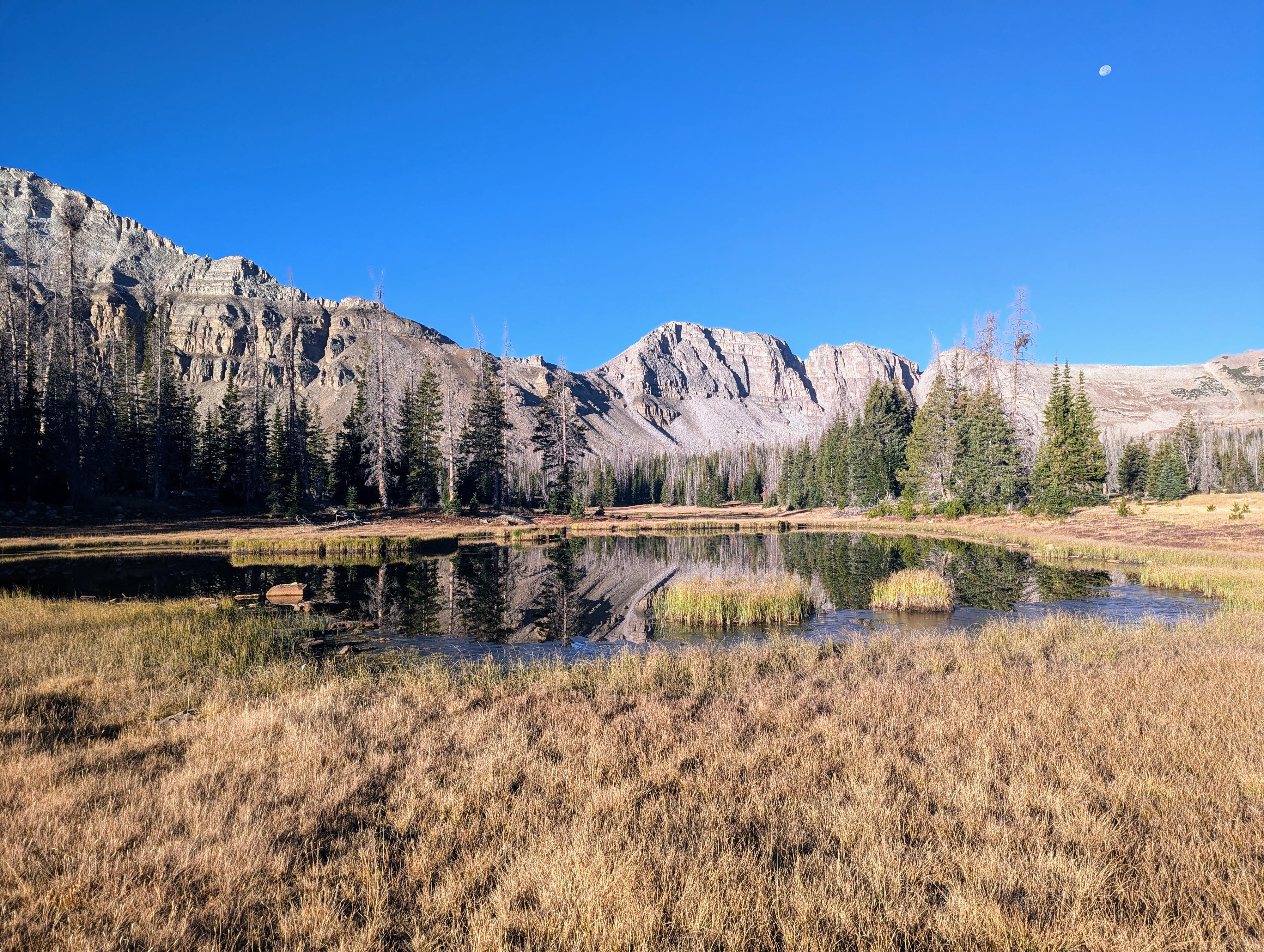
The two lakes, less than a half mile apart, are spectacular with different characters. Ryder has a very tree lined shore with nice campsites tucked among the trees. McPheters is above treeline and very open. Not great camping if there is wind or weather expected, but very spectacular. On my visit, the only visitors I saw in the basin were a couple of mountain goats. It made for a spectacular visit.
Ryder Lake was named in honor of Major William T. Ryder. Major Ryder was a significant figure associated with the U.S. Army Corps of Engineers, particularly during their work on early 20th-century surveys and mapping efforts of the Uinta Mountains.
The U.S. Geological Survey (USGS) and Army Corps of Engineers were heavily involved in exploring and mapping the remote Uinta range during this time. Naming geographical features like Ryder Lake was a common practice to honor individuals who contributed to exploration, military service, or public works projects in these rugged and less explored areas.
McPheters Lake was named in honor of Harry McPheters, a forest ranger who worked in the Uinta Mountains during the early 20th century. McPheters was known for his service in the U.S. Forest Service, where he played an important role in managing and preserving the forested areas of the Uinta Mountains.
Getting There
The trail starts at the Christmas Meadows trailhead in the Uintas. Travel south out of Evanston Wyoming on highway 150. Follow this for about 30 miles, crossing into Utah after about 20 miles.
Turn left at the signed Christmas Meadows road. This is milepost 45.9, not far past the Ranger Station.
Follow the Christmas Meadows road, staying on the main road, about 3 miles to the Christmas Meadows campground. The trailhead parking is signed just after the campground and has a pit toilet.
Route Description
To Amethyst Basin Junction (2.5 miles)
From Christmas Meadows Trailhead, navigation is quite straightforward. Head south on the Christmas Meadows Trail. It is well side, and easy to follow. The first bit has some open meadow sections, allowing for some views.
It is about 2.5 miles to where the Amethyst Basin trail leaves on the left and is an obvious junction with a large pile of rocks denoting it. This is the trail to Amethyst and Ostler Lakes. Stay straight here.
Amethyst Basin Junction to Kermsuh Lake Junction (2.3 miles)
The trail continues to amble up the valley from Amethyst Basin Junction. It is about 2.3 miles from the Amethyst Basin junction to where the trail to Kermsuh Lake and West Bain leaves on the right. Like Amethyst, it is denoted by a large pile of rocks and likely small wooden sign. Stray straight here to continue heading to Ryder and McPheters Lakes.
Kermsuh Lake Junction To Middle Basin (4.3 miles to Ryder)
The trail continues up the drainage in a similar rhythm. About 3 miles above Kermsuh Lake Junction, a lovely meadow area is reached. If you don't want to go all the way to Ryder Lake to camp, this area would be a lovely alternative. From the meadow, the trail begins heading a bit west and climbing more steeply into Middle Basin.
Once up in the basin, there are a few small ponds that are passed until reaching the large and distinct Ryder lake. There are some excellent campsites among the trees in the area of Ryder. Be sure to camp at least 100 feet away from lakes and streams.
To McPheters Lake (about 0.4 miles past Ryder)
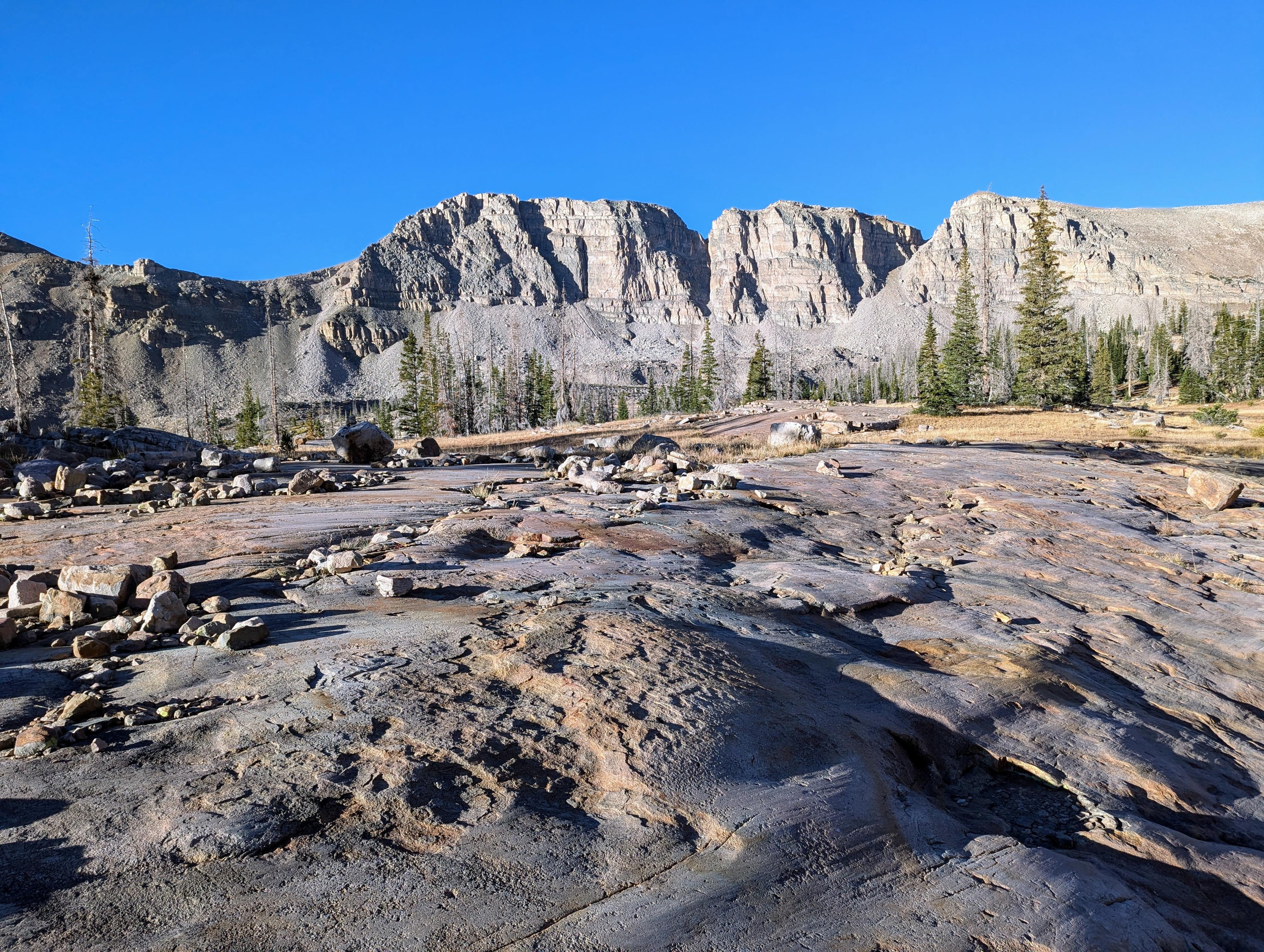
There isn't and offical trail from Ryder to McPheters, but there are a few social trails. From Ryder Lake, the easiest way I found on my return from McPheters, was to hike the north side of Ryder Lake to the west side of the lake, then hike uphill and north to McPheters. Once above Ryder Lake, there are a few short cliffs to find routes around, but the area is above tree line and route finding easy. I saw a few good campsites in some of the sparse groups of trees near McPheters. I thought the glacier-scared rock flats around McPheters were particularly pretty. It is a great spot to look for mountain goats on the slopes of Hayden Peak looming above the lake.
Photos
Maps

12T 516766E 4519054N
40°49'20"N 110°48'04"W
12T 517307E 4515513N
40°47'26"N 110°47'41"W
12T 517008E 4512386N
40°45'44"N 110°47'55"W
12T 514634E 4508435N
40°43'36"N 110°49'36"W
12T 514333E 4508914N
40°43'52"N 110°49'49"W