 Hiking
Iron Wash
Hiking
Iron Wash
Eastern Reef
Overview
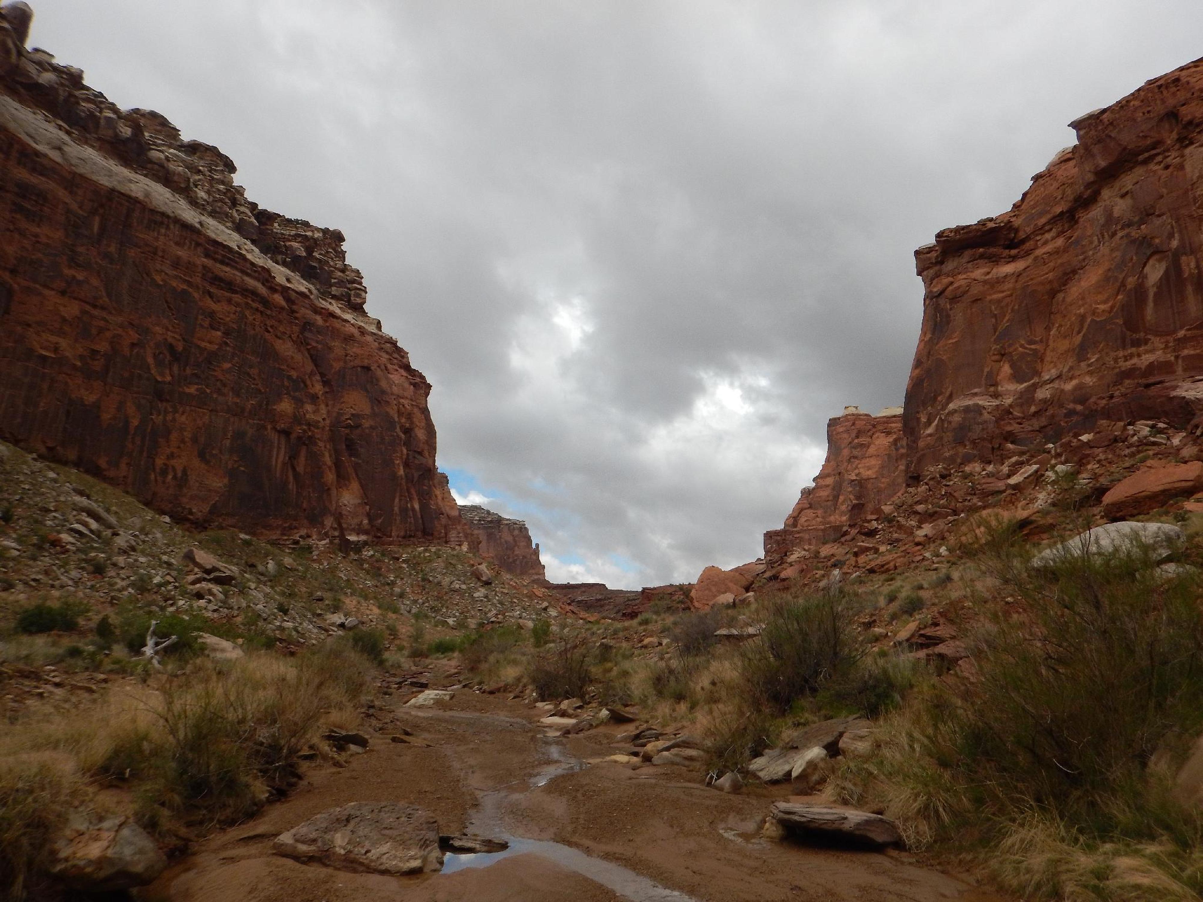
For a canyon so pretty, and with such easy access, Iron Wash seems to be infrequently trodden. Most will want to just visit the lower end where the canyon cuts through the reef. Visiting just Iron Wash is a casual romp and suitable for most. The hike starts in a pretty Navajo walled canyon then turns into a very pretty, deep, and wide Wingate walled canyon before it exits the west side of the reef.
For the very motivated, a loop can be made up Iron Wash, along Lone Man Draw, down Ernie canyon and back to the car. This makes for an excellent (albeit long) 16-mile loop hike. Water availability is a problem, so doing it as an overnight would be difficult unless after recent rains. A car shuttle can reduce this to a more manageable 12-13 mile hike.
Getting There
At mile marker 141.6 on highway 24, take the side road on the west side of the highway through the gate. This is about 26 miles north of Hanksville, or 18 miles south of I-70 if coming from Green River.
Route Description
Rock art and historic sites are fragile, non-renewable cultural resources that, once damaged, can never be replaced. To ensure they are protected, please:
- Avoid Touching the Petroglyphs: Look and observe, BUT DO NOT TOUCH!
- Stay on the Trails: Stay on the most used trails when visiting sites, and don't create new trails or trample vegetation.
- Photography and Sketching is Allowed: Do not introduce any foreign substance to enhance the carved and pecked images for photographic or drawing purposes. Altering, defacing, or damaging the petroglyphs is against the law -- even if the damage is unintentional.
- Pets: Keep pets on a leash and clean up after them.
- Artifacts: If you happen to come across sherds (broken pottery) or lithics (flakes of stone tools), leave them where you see them. Once they are moved or removed, a piece of the past is forever lost.
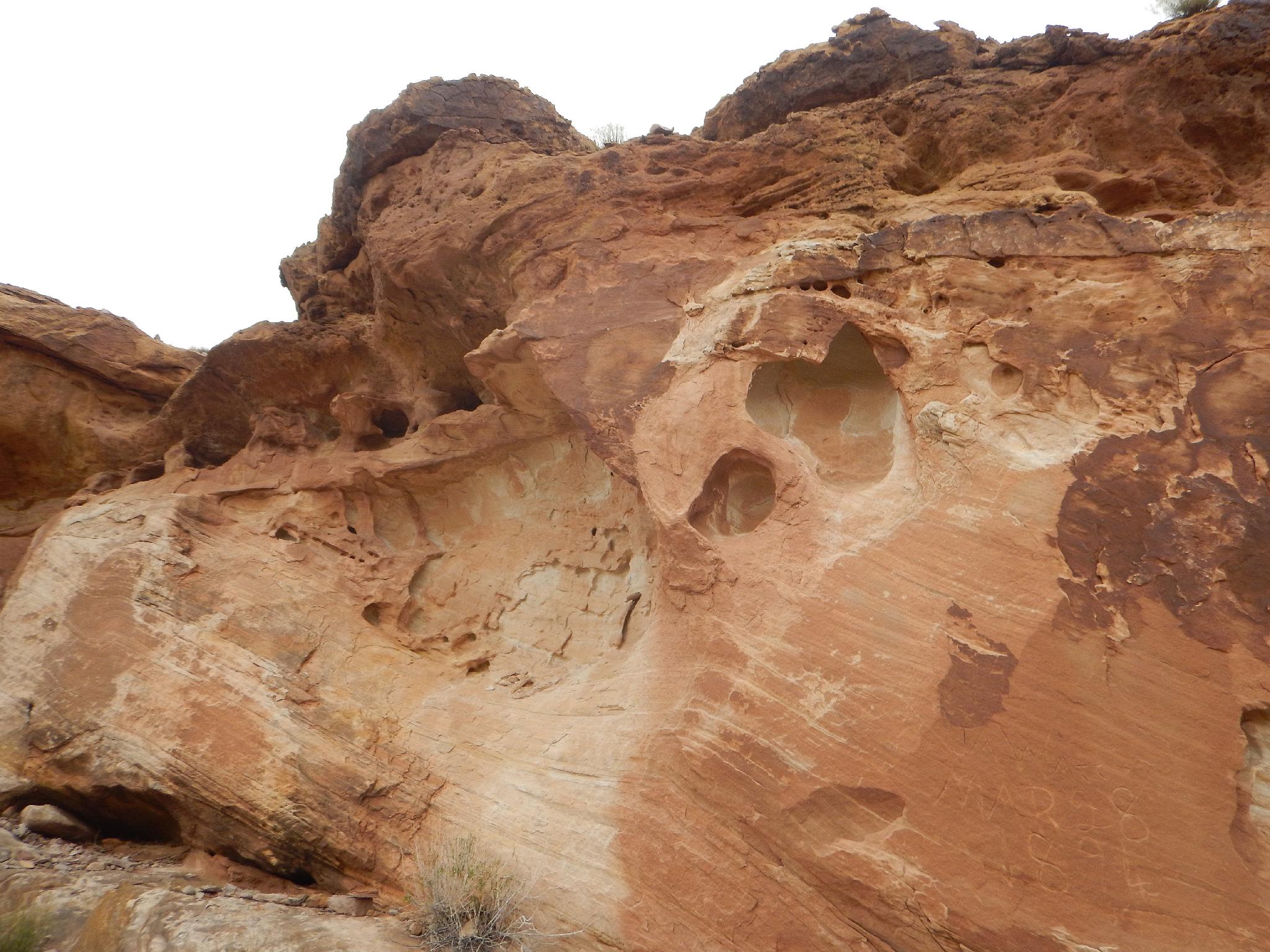
Pictograph Side Trip (30 minutes)
If you are interested in visiting rock art, there is an excellent small pictograph panel just east (downstream) from the trailhead. From the trailhead, head east down Iron Wash, this is away from the reef. It is wide, sandy, and open.
In less than 1,000 feet, just before the wash bends to the right, look for a small overhang on the left at the base of the cliff. There is a small rock art panel under the overhang. Though small, I think it is fascinating and a unique spot to find rock art.
To Lone Man Draw (3.6 miles / 1-1.5 hours)
From the trailhead, follow the sandy wash and cross the log fence indicating the canyon is closed to vehicles. Just past the fence, on the right, is a cave and old signature. The cave shows smoke on the ceiling and was likely used for millennia as shelter by ancient people.
The canyon begins in Navajo sandstone and soon deepens. The towering walls become red Wingate as the canyon winds deeper into the eastern reef. In 1-1.5 hours the canyon opens at the backside of the reef and a junction is reached where Lone Man Draw comes in on the right. Left continues up Iron Wash proper and ends in several large pools in 20 minutes or so. This is a nice destination.
For those up for the full loop, go right at the junction and start up Lone Man Draw.
Lone Man Draw (4.1 miles / 1.5 hours)
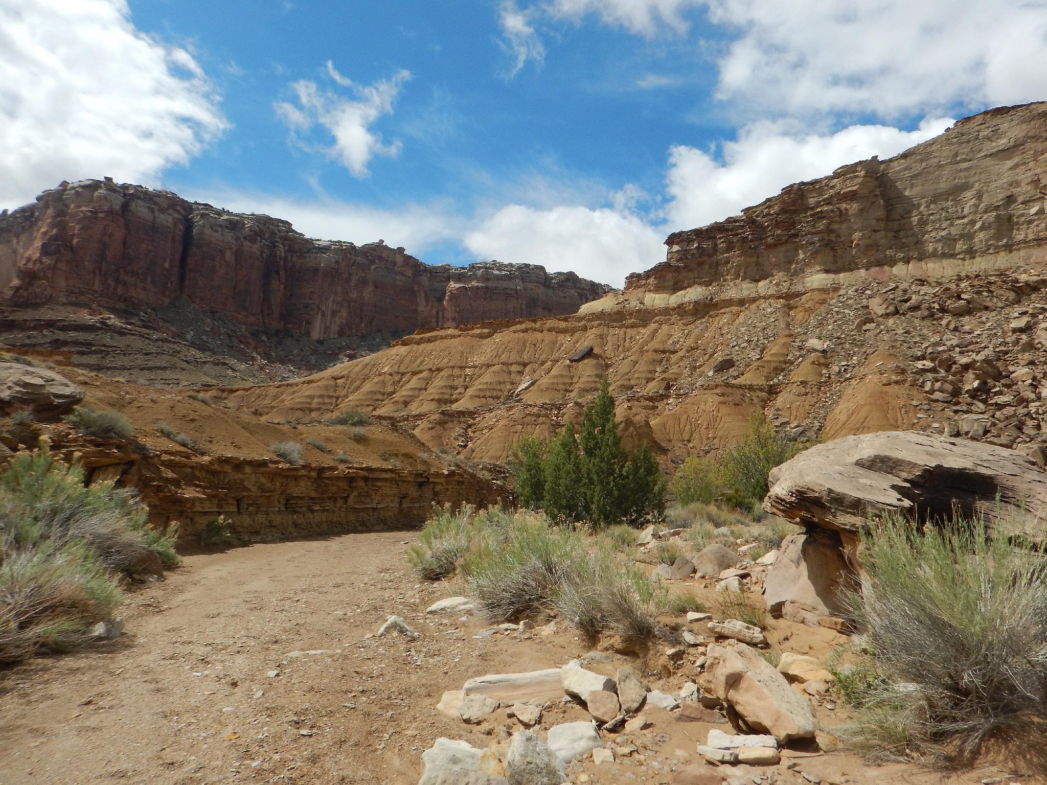
Lone Man Draw is wide and shallow. Hike up it, keeping an eye on the Wingate wall to the right. Though not spectacular, Lone Man Draw does have a surprising number of trees and seasonal seeps in sections.
When past the Wingate wall on the right, Lone Man Draw begins heading due north and away from the reef. A junction here with a prominent side wash makes a good spot to leave Lone Man Draw. Work up the side wash, passing a few minor obstacles until reaching the ridge. The ridge provides a good view down into Ernie Canyon. From the ridge, find and follow and an old trail that casually meanders down to the bottom of Ernie. This was likely either a motorcycle trail or bicycle trail at one point.
Ernie (3.9 miles)
Hiking down Ernie Canyon, the canyon quickly deepens as it enters the reef. An old mining road on the left is a good landmark. Just past it on the next bend are the remains of an old mining cabin on the right. Look up high on the north (left) side of the canyon from the ruins to see an arch.
Continuing down the canyon, it passes through Wingate and into the more shallow Navajo before exiting the reef and reaching a log fence.
Back to Iron Wash via the Dirt Road (4 miles)
After the log fence, follow the road a short distance down the wash. Continue on the road as it leaves the wash and begins heading back to the Iron Wash trailhead. Take a right at the junction just after leaving the wash, then again 2 miles later. It is about 4 miles from the log fence in Ernie back to the trailhead at Iron Wash.
Photos
Maps

12S 538844E 4283223N
38°41'48"N 110°33'12"W
12S 539021E 4283156N
38°41'46"N 110°33'05"W
12S 538510E 4283430N
38°41'55"N 110°33'26"W
12S 538508E 4283457N
38°41'56"N 110°33'26"W
12S 535697E 4285634N
38°43'07"N 110°35'22"W
12S 535424E 4288234N
38°44'31"N 110°35'33"W
12S 535552E 4289060N
38°44'58"N 110°35'27"W
12S 536891E 4288835N
38°44'51"N 110°34'32"W
12S 537943E 4288061N
38°44'26"N 110°33'48"W
12S 538092E 4288144N
38°44'28"N 110°33'42"W
12S 540529E 4286890N
38°43'47"N 110°32'01"W
12S 541006E 4286752N
38°43'43"N 110°31'42"W