 Hiking Long Dong Silver Spire
Hanksville
Overview
|
Sat 60 | 30 |
Sun 69 | 32 |
Mon 75 | 38 |
Tue 76 | 41 |
Wed 79 | 43 |
| View Full Weather Details | ||||
|
Sat 60 | 30 |
Sun 69 | 32 |
Mon 75 | 38 |
Tue 76 | 41 |
Wed 79 | 43 |
| View Full Weather Details | ||||
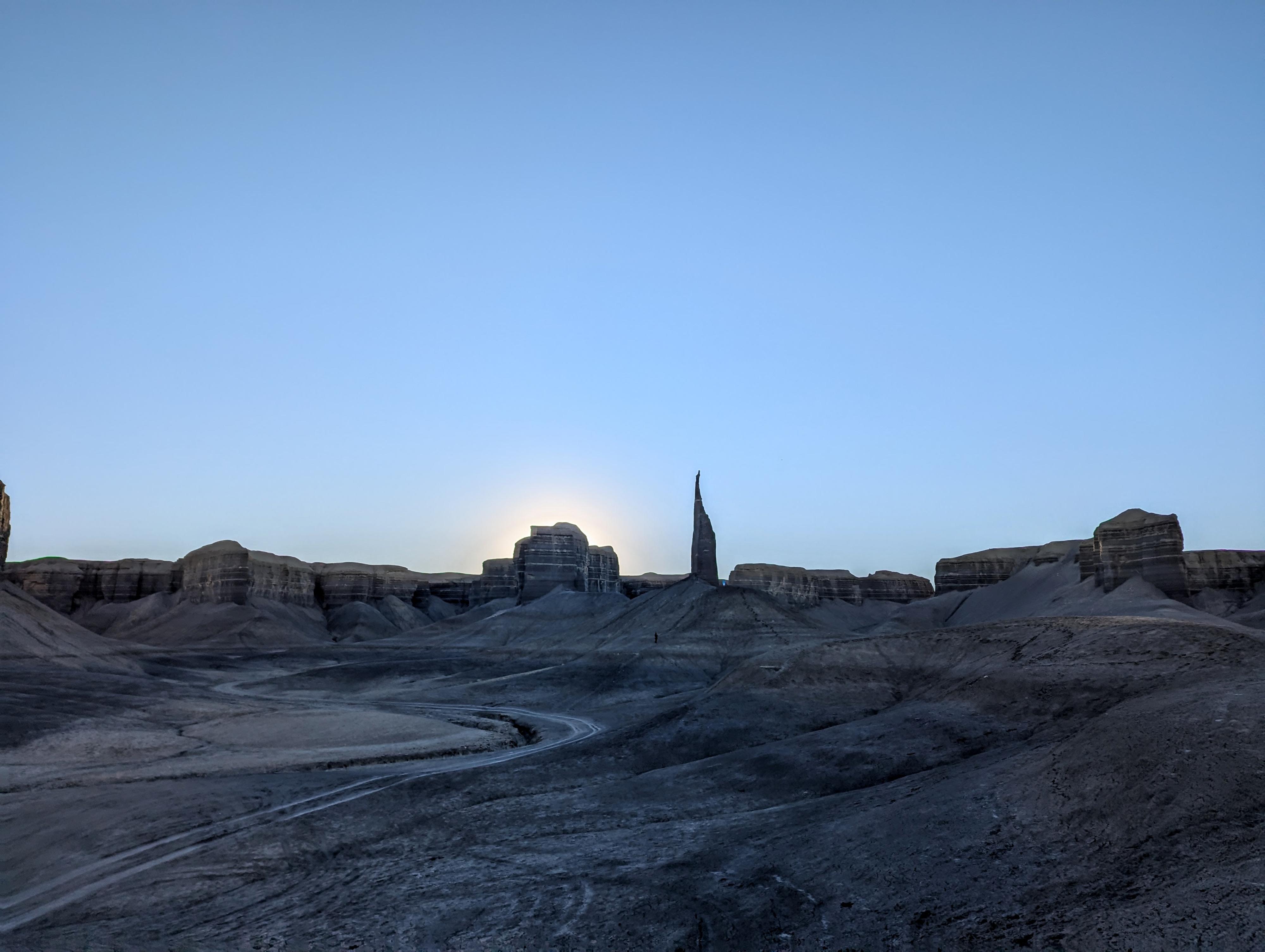
Long Dong Silver at Sunrise
Known as Long Dong Silver, Black Spire, Silver Tower, Lone Tower, and many other names, this area near Hanksville has exploded in popularity recently. The valley is a moonscape scene, with a couple of dramatic towers punctuating the views. It is a unique and otherworldly place to visit.
Access Notes
Reaching the trailhead requires driving 1.3 miles on a dirt road. The road is accessible by medium clearance vehicles, except when wet. Do NOT try to visit when wet, as you will definitely tear up the road and likely get stuck!
Moreover, the map shows the route from highway 24. Please try to stay on the route shown on the map. People are driving just about everywhere and trampling the flats. The path marked on the map is the official road.
The BLM has closed the road before entering the valley proper, so to visit will require a short hike of about 2 miles roundtrip. The valley, compared to my first visit years ago, has been trampled by vehicles. Please respect the closure and hike from the closure sign.
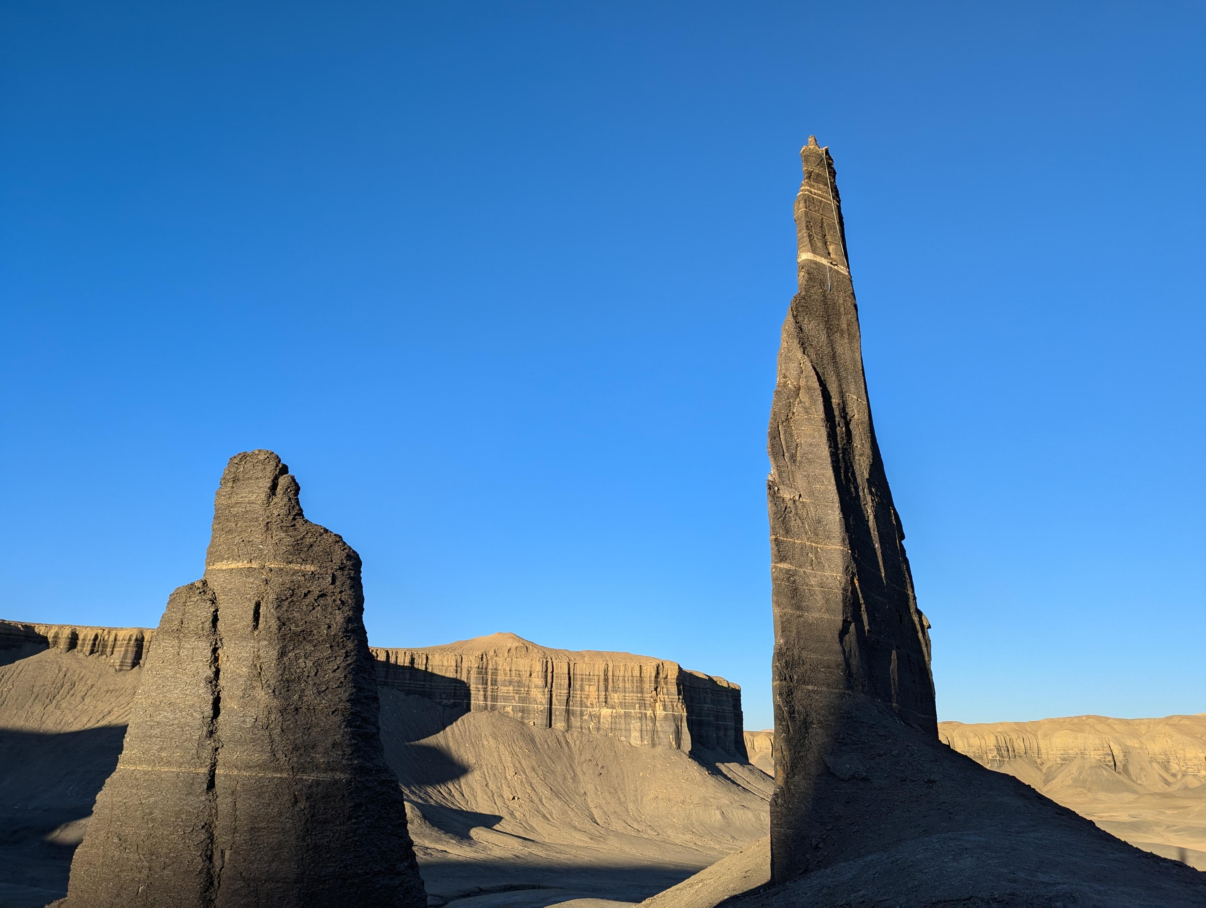
Long Dong Silver Spire
Getting There
Head west on UT-24 from Hanksville for about 7 miles to mile post 109.35. There is a dirt road leaving UT-24 hear on the right (north) side of the highway. Reset your odometer as you turn off the highway.
Follow the dirt road north. At about 0.5 miles it curves left which a lesser used track continues north. Go left staying on the main road. The road heads west, then curves north ending 1.2 miles from the highway at a road closure sign. This is the trailhead.
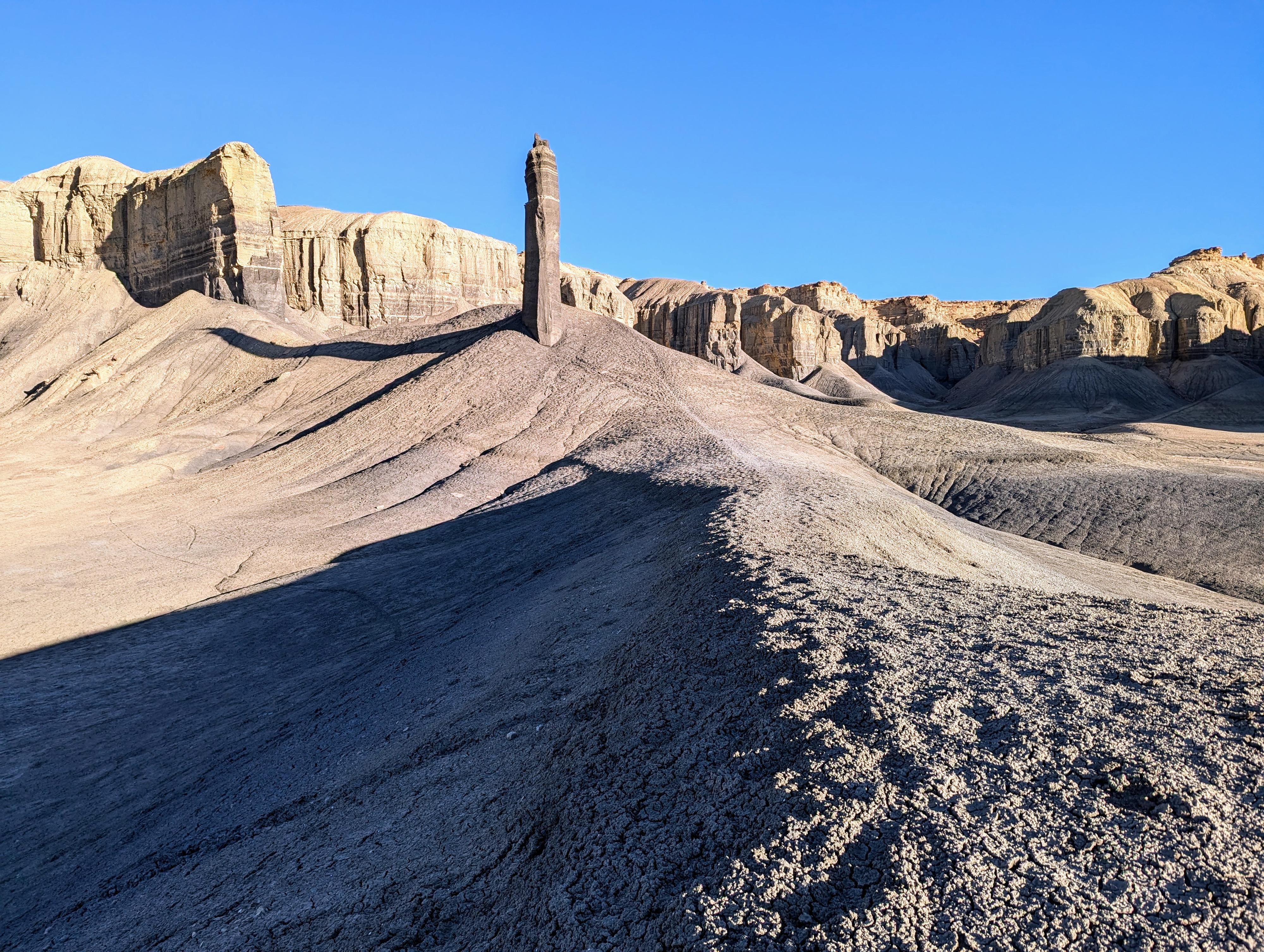
The first spire on the hike in.
Route
From the trailhead, follow the now closed road north into the valley. An impressive tower in on the left, a short distance from the trailhead, and I think worth the side trip to visit up-close.
Stay on the old road, it crosses the wash, then rounds a corner to where Long Dong Silver comes into view straight ahead. Social trails go up to and around the tower. A dramatic tower.
Return the way you came.
Photos

Maps

| MP109.35 |
12S 514680mE 4246818mN N38° 22' 10" W110° 49' 55" |
| Trailhead |
12S 514153mE 4248228mN N38° 22' 56" W110° 50' 17" |
| First Tower |
12S 514018mE 4249091mN N38° 23' 24" W110° 50' 22" |
| Long Dong Silver Tower |
12S 514659mE 4249528mN N38° 23' 38" W110° 49' 56" |