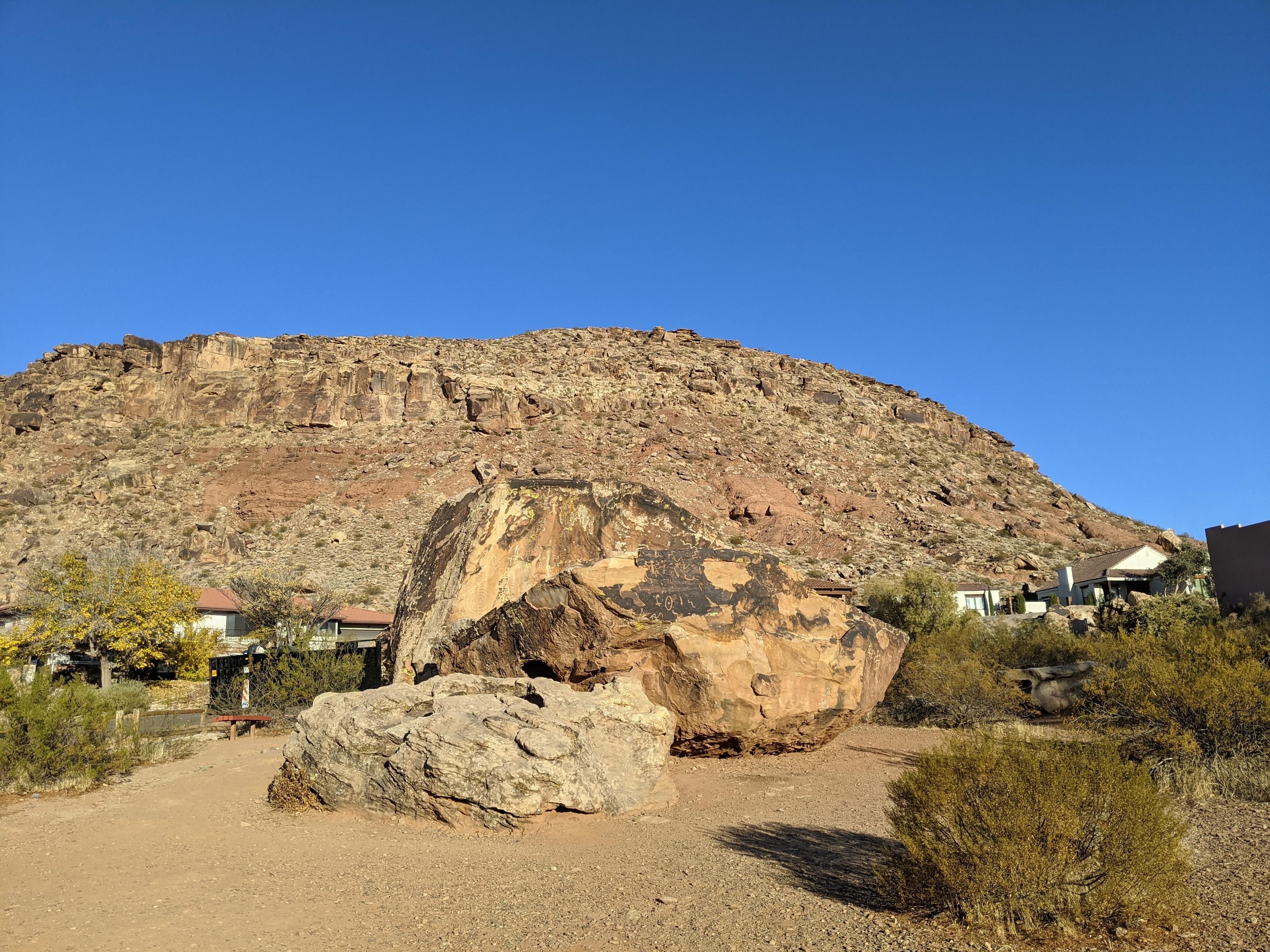
 Roadside Attraction Bloomington Petroglyph Park
St. George
Overview
|
Fri 62 | 46 |
Sat 70 | 41 |
Sun 78 | 44 |
Mon 84 | 49 |
Tue 87 | 52 |
| View Full Weather Details | ||||
|
Fri 62 | 46 |
Sat 70 | 41 |
Sun 78 | 44 |
Mon 84 | 49 |
Tue 87 | 52 |
| View Full Weather Details | ||||
Bloomington was settled in 1870 when William Carpenter founded the town. The town, with its location near the Virgin River and warm climate must have seemed like an idyllic spot to settle. Native Americans had also visited and likely settled in the area, long before 1870. On the west side of town, at the base of Bloomington Hill, there is an area of boulders with petroglyphs left by the pre-1870 occupants of the area. The Bloomington Petroglyph Park is a small park meant to preserve the rock art. It is an interesting contrast to have a petroglyph park in the middle of an ordinary neighborhood.
Easy access makes this a must visit for anyone passing through, and excellent place for a family picnic. The rock art on the boulders is fascinating. Some areas appear to be wearing off with the ravages of time, but the many glyphs are still very visible.
Getting There
From I-15, take exit 2 (Southern Parkway) and head west. This is left if you are heading south on I-15. Just off the highway, turn right on Pioneer Road.
Follow Pioneer Road for 1.0 mile and turn left on Sugar Leo Rd.
Follow Sugar Leo Rd for about 0.9 miles and turn left on Man O War Rd and follow it for 0.4 miles. Man O War road crosses the Virgin River.
Once over the Virgin River, turn left on Bloomington Drive. Follow Bloomington Drive for 1.4 miles as it winds through the neighborhood. Turn left on Navajo Drive, with the Petroglyph Park being 0.1 miles down Navajo Drive.
Route
Rock art and historic sites are fragile, non-renewable cultural resources that, once damaged, can never be replaced. To ensure they are protected, please:
- Avoid Touching the Petroglyphs: Look and observe, BUT DO NOT TOUCH!
- Stay on the Trails: Stay on the most used trails when visiting sites, and don't create new trails or trample vegetation.
- Photography and Sketching is Allowed: Do not introduce any foreign substance to enhance the carved and pecked images for photographic or drawing purposes. Altering, defacing, or damaging the petroglyphs is against the law -- even if the damage is unintentional.
- Pets: Keep pets on a leash and clean up after them.
- Artifacts: If you happen to come across sherds (broken pottery) or lithics (flakes of stone tools), leave them where you see them. Once they are moved or removed, a piece of the past is forever lost.
Once at the park, it is a small place to wander. Be sure to check the backsides of the boulders as well, as there are many glyphs on all side of the boulders.


