 Hiking Cinder Cone Trail
St. George
Overview
|
Mon 71 | 48 |
Tue 75 | 51 |
Wed 75 | 53 |
Thu 74 | 53 |
Fri 74 | 54 |
| View Full Weather Details | ||||
|
Mon 71 | 48 |
Tue 75 | 51 |
Wed 75 | 53 |
Thu 74 | 53 |
Fri 74 | 54 |
| View Full Weather Details | ||||
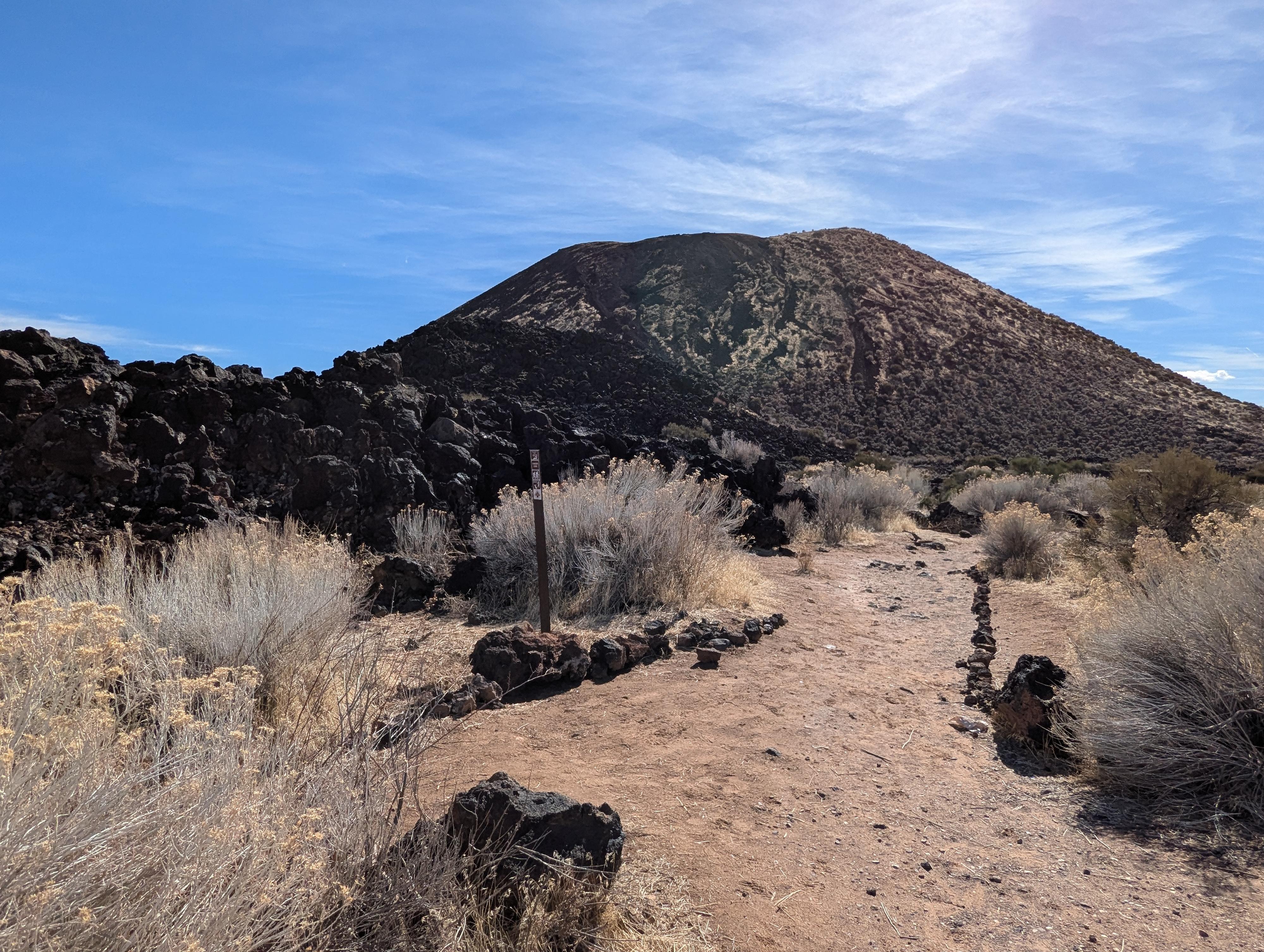
View of the cinder cone from the start of the trail
Snow Canyon State Park is a beautiful park filled with many interesting hikes, but it can also be very crowded. However, I found that the Cinder Cone Trail was not particularly busy even though I was there on a holiday weekend. The cinder cone is generally referred to as the Diamond Valley Cinder Cone.
You can see black basalt rock throughout Snow Canyon, some of which originated from volcanic eruptions that started 3 million years ago. The formation of the two cinder cones on the northern end of the park are from more recent eruptions, perhaps tens of thousands of years ago. Cinder cones are small, relatively symmetrical volcanoes. They form when liquid magma forcibly erupts from the earth’s crust into the air, where it then solidifies and accumulates around the vent, gradually building up the cone. Lava from these cinder cones and nearby vents created the basalt that you can now see along the main road through the park. The Utah Geological Survey has publications that describe the geology of Snow Canyon and explain cinder cones in more detail.
The Cinder Cone trail takes you around and up to the top of the features and then around the lip of the cone. This route is listed as difficult by the park, but I would rate it moderate due to the short distance and only a few very steep sections.
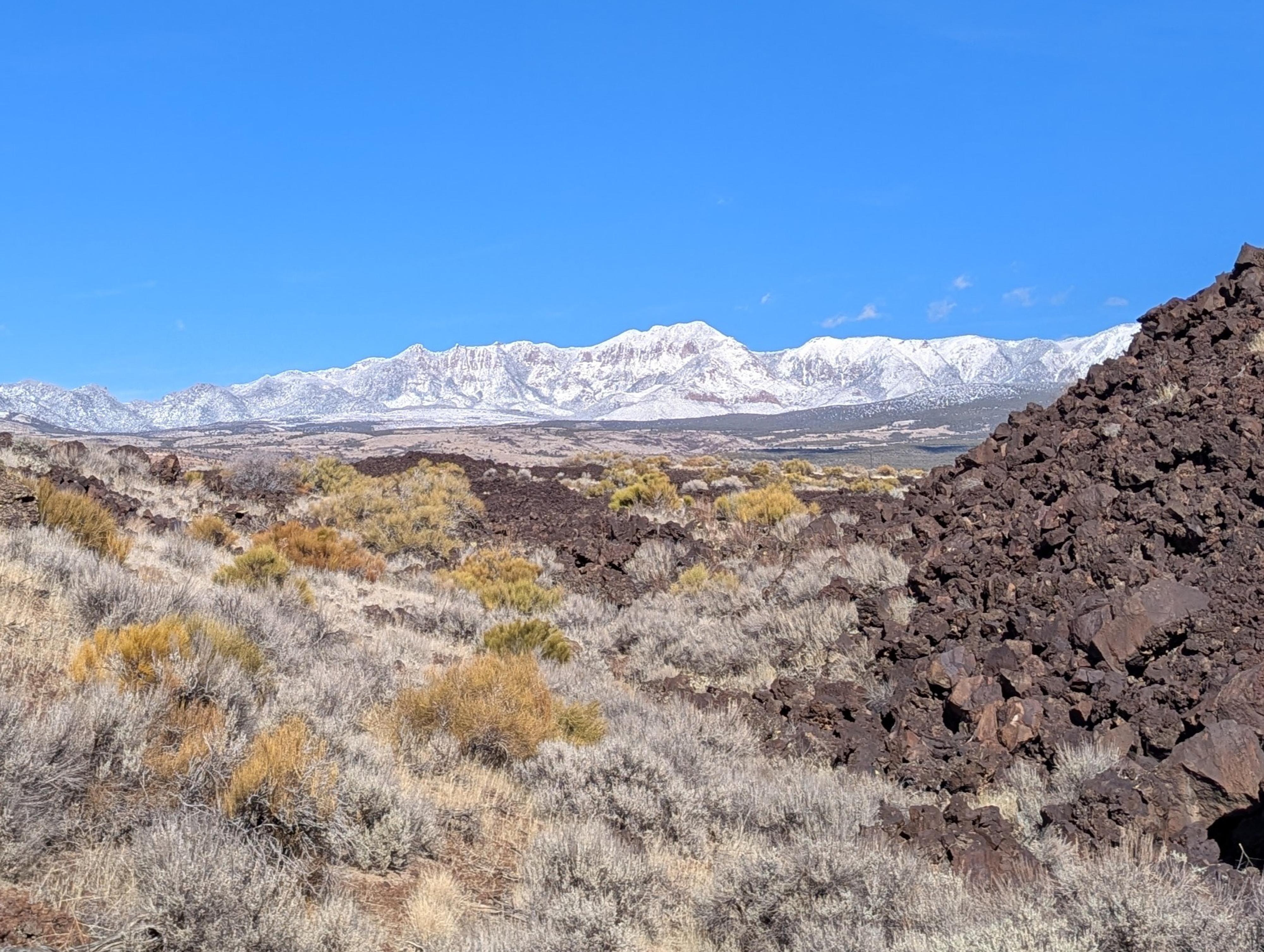
The snowy Pine Valley Mountains
Getting There
The trailhead is at mile 12.5 on UT-18. If you are coming out of the north entrance of Snow Canyon State park, turn left, and drive about 1.3 miles.
If coming from St. George, take UT-18 north toward Veyon/Dammeron Valley for 12.5 miles.
There is a wide area at mile 12.5 that offers parking for a handful of vehicles. If full, or if you would rather not park next to such a busy road, take the right just after the bend. There is a large parking area available there, with a trail that meets with the parking on the bend.
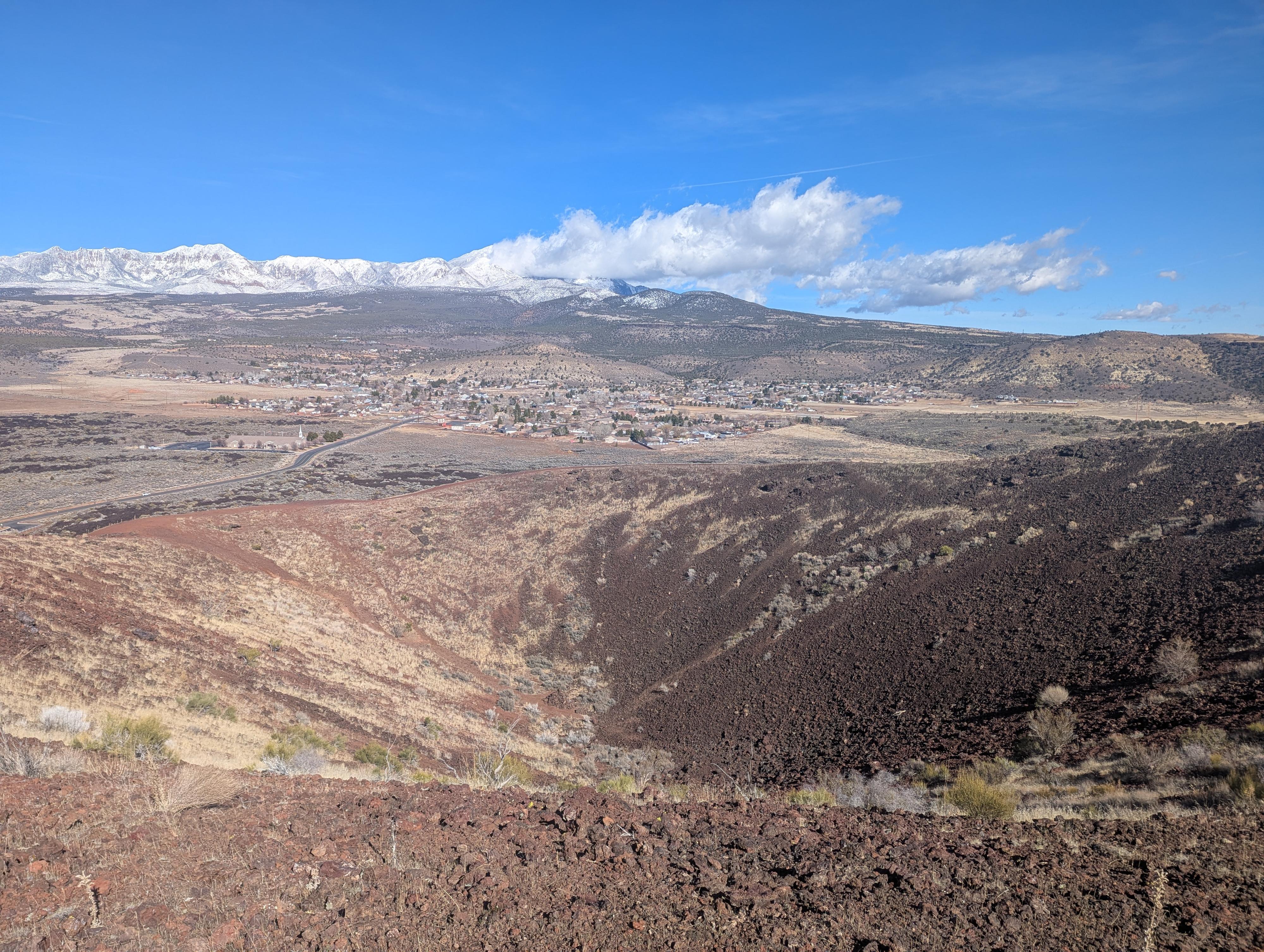
The inside of the cinder cone. Across the cone on the left of the photo you can see the loose track that people use to get to the bottom of the cone.
Route
From the trailhead, follow the trail across some lava flows to the base of the cone, which you will then start circumnavigating. You will soon reach a fence marking the boundary between the park and private land with signs warning about dangerous animals on the other side (bulls? rattlesnakes? dogs?). Here the trail follows the fenceline for a while and then curves towards the south side of the cone. While the trail is gradually uphill the whole way, the steepest section is at the final push to the top. Once there, you can walk the trail all along the lip of the cone. There is also a loose path down to the bottom which I didn’t hike on my visit there.
Enjoy the views to the north of Diamond Valley and the Pine Valley Mountains in the distance and to the south of Snow Canyon State Park and then return the way you came.
Photos
Maps

| Parking |
12S 266897mE 4125464mN N37° 14' 48" W113° 37' 41" |
| Bigger Trailhead |
12S 267023mE 4125574mN N37° 14' 51" W113° 37' 36" |
| Top Loop |
12S 266814mE 4124965mN N37° 14' 31" W113° 37' 44" |