 Hiking Sullivan Canyon
Virgin River Gorge
Overview
|
Mon 83 | 53 |
Tue 86 | 57 |
Wed 87 | 59 |
Thu 86 | 60 |
Fri 87 | 61 |
| View Full Weather Details | ||||
|
Mon 83 | 53 |
Tue 86 | 57 |
Wed 87 | 59 |
Thu 86 | 60 |
Fri 87 | 61 |
| View Full Weather Details | ||||
Hiking between the recreation area and Sullivan Canyon
Sullivans Canyon is a long side drainage of the Virgin River Gorge. From its mouth at the Virgin River, it can be hiked up almost 15 miles one way to Cougar Springs, near the top of Mount Bangs, gaining nearly 6,000' of elevation gain in the process. This is a remote, rough, and seldom visited area.
Most, I assume, don't make the full hike to Cougar Springs. I, personally, have only been from the Virgin River about 4 miles, then returned the same way. If you are looking for a winter hike in the Virgin River Gorge, this is a good one.
There are two options to start the hike. The first is to park off I-15 across the Virgin River from where Sullivan Canyon meets the river. This provides quick access to Sullivan Canyon.
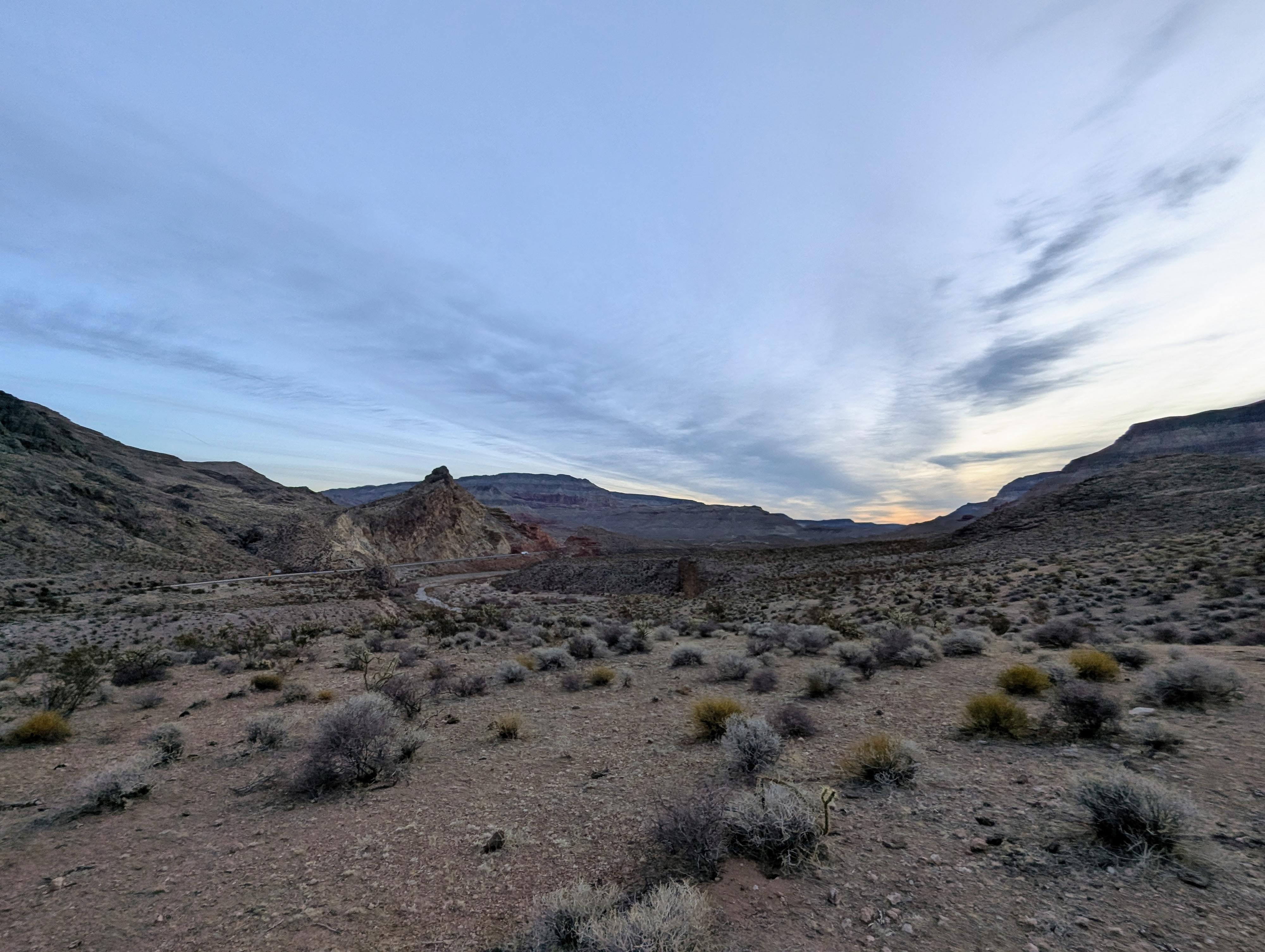
The second option is to start at the Virgin River Canyon Recreation Area. This was how I visited on my second trip, and I think a much better route. Though starting at the recreation area does have a lot more hiking with freeway noise, it follows along the Virgin River for a bit before reaching Sullivan, and I think is beautiful.
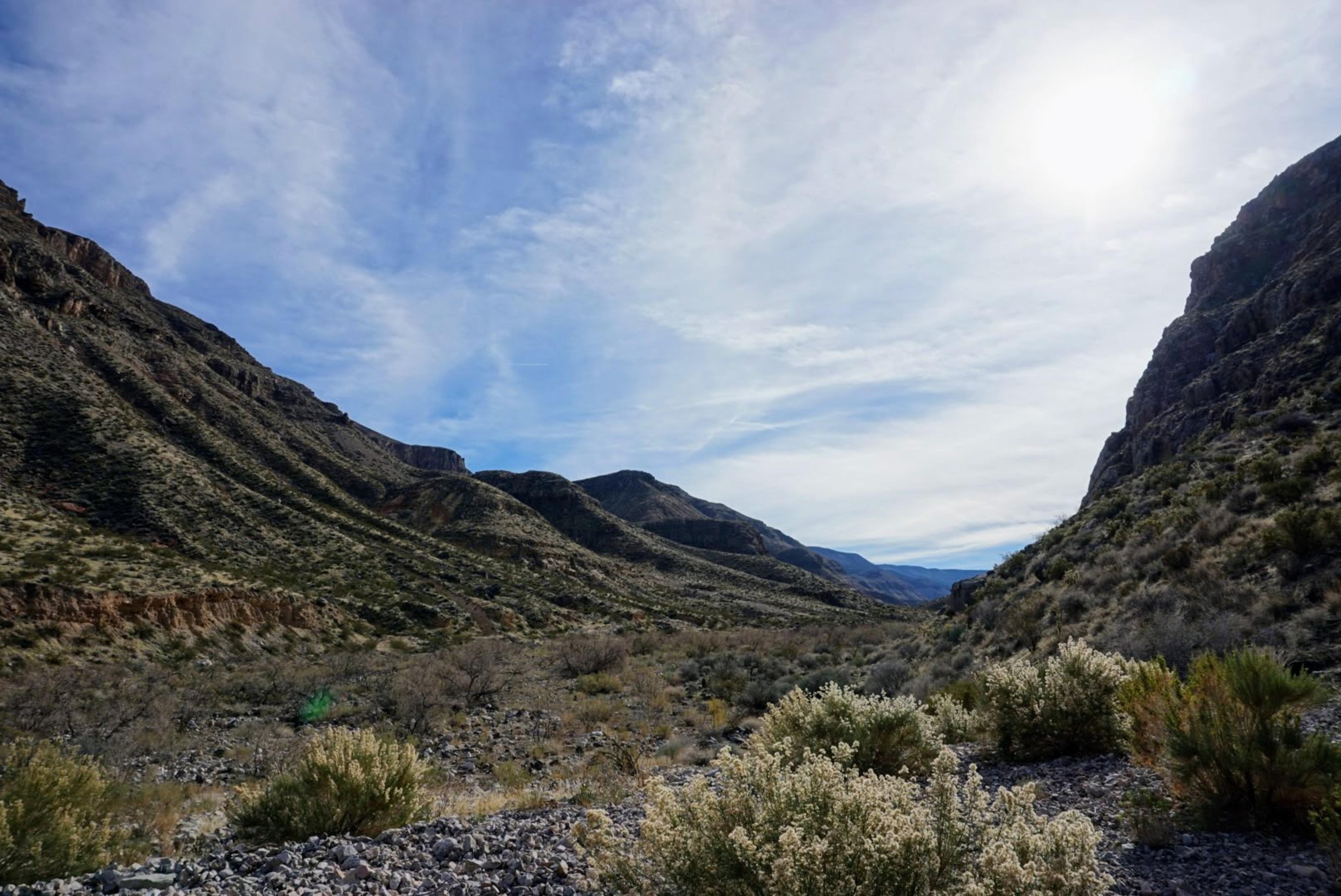
A few miles up Sullivan, typical scenery.
Getting There
Highway Trailhead
The trailhead is on eastbound I-15, in the Virgin River Gorge. Coming from the west (Littlefield, NV), follow the highway into the Virgin River Gorge. After entering Arizona and the Gorge, keep an eye out for milepost 16.8. There is a long dirt shoulder and parking here. This is the trailhead, across from the mouth of Sullivans Canyon.
Virgin River Canyon Recreation Trailhead
The recreation area is at exit18 on I-15, in the Virgin River Gorge. Coming from the west, this is about 10 miles east of Littlefield AZ. Coming from the east, this is about 19 miles from St. George.
Once off the freeway, go south into the recreation area. There is a fee for day use, as well as overnight camping. From the entrance pay kiosk, go right to go down to the lower loop of sites. The trailhead is just before site 92. Parking may be problematic if not camping. There are a few spots near the restroom, but otherwise all spots seem to be associated with campsites.

Nice cliffs along the Virgin River.
Route
From The Highway Trailhead
From the trailhead, cross the fence and work down to the river. At the river, find a shallow looking place to wade across, then head up Sullivans Canyon. The lower section of Sullivans has low cliff walls and is pretty. The going is sand and cobblestones. As you continue up Sullivans, the walls open more and more.
From Virgin River Canyon Recreation Area Trailhead
The trail starts just before campsite 92 on the lower loop. The start of the trail is signed with a BLM trail marker.
The trail drops from the campground to the flats, crosses the flats on a well-defined trail, then reaches the river crossing. The crossing, on my visit, was sandy bottomed. Once across the river, pick-up the trail on the other side.
After the crossing, the trail becomes narrower, but is still easy to follow for the most part. Keep an eye out for trail markers, but in general, the trail follows along the river.
About 1.1 miles into the trail, as you finish going around a bend in the river, and the river heads north toward the highway, be sure to keep an eye out for a trail marker on the left. The trail leaves the river bank here and climbs up a small hill. The trail climbs the hill, crosses a small flat area, then descends and climbs out of a side wash. One out of the side wash, it meanders along the hillside above the Virgin River. This section has great views of the Virgin River Canyon. As a reference point, there is a fence and gate to pass through in this section.
About 2 miles from the Virgin River Recreation Area, the trail descends into Sullivan Canyon. Make note of this spot to recognize it on the way back.
Both Routes
Once in Sullivan, there isn't an obvious trail, it is just hiking up the sand and cobblestone floor of the canyon. You can head up Sullivan as far as motivation allows.
Return the same way.
Photos
Maps

| Highway Trailhead |
12S 248874mE 4091985mN N36° 56' 26" W113° 49' 12" |
| Recreation Area Trailhead |
12S 250854mE 4092953mN N36° 56' 59" W113° 47' 53" |
| River Crossing |
12S 250599mE 4092817mN N36° 56' 54" W113° 48' 03" |
| Leave River |
12S 250158mE 4092211mN N36° 56' 34" W113° 48' 20" |
| Gate |
12S 249872mE 4092007mN N36° 56' 27" W113° 48' 31" |
| Sullivan Jct |
12S 249141mE 4091560mN N36° 56' 12" W113° 49' 00" |