 Hiking Devils Canyon Nature Trail
Blanding
Overview
|
Fri 66 | 43 |
Sat 67 | 41 |
Sun 58 | 42 |
Mon 56 | 33 |
Tue 61 | 38 |
| View Full Weather Details | ||||
|
Fri 66 | 43 |
Sat 67 | 41 |
Sun 58 | 42 |
Mon 56 | 33 |
Tue 61 | 38 |
| View Full Weather Details | ||||
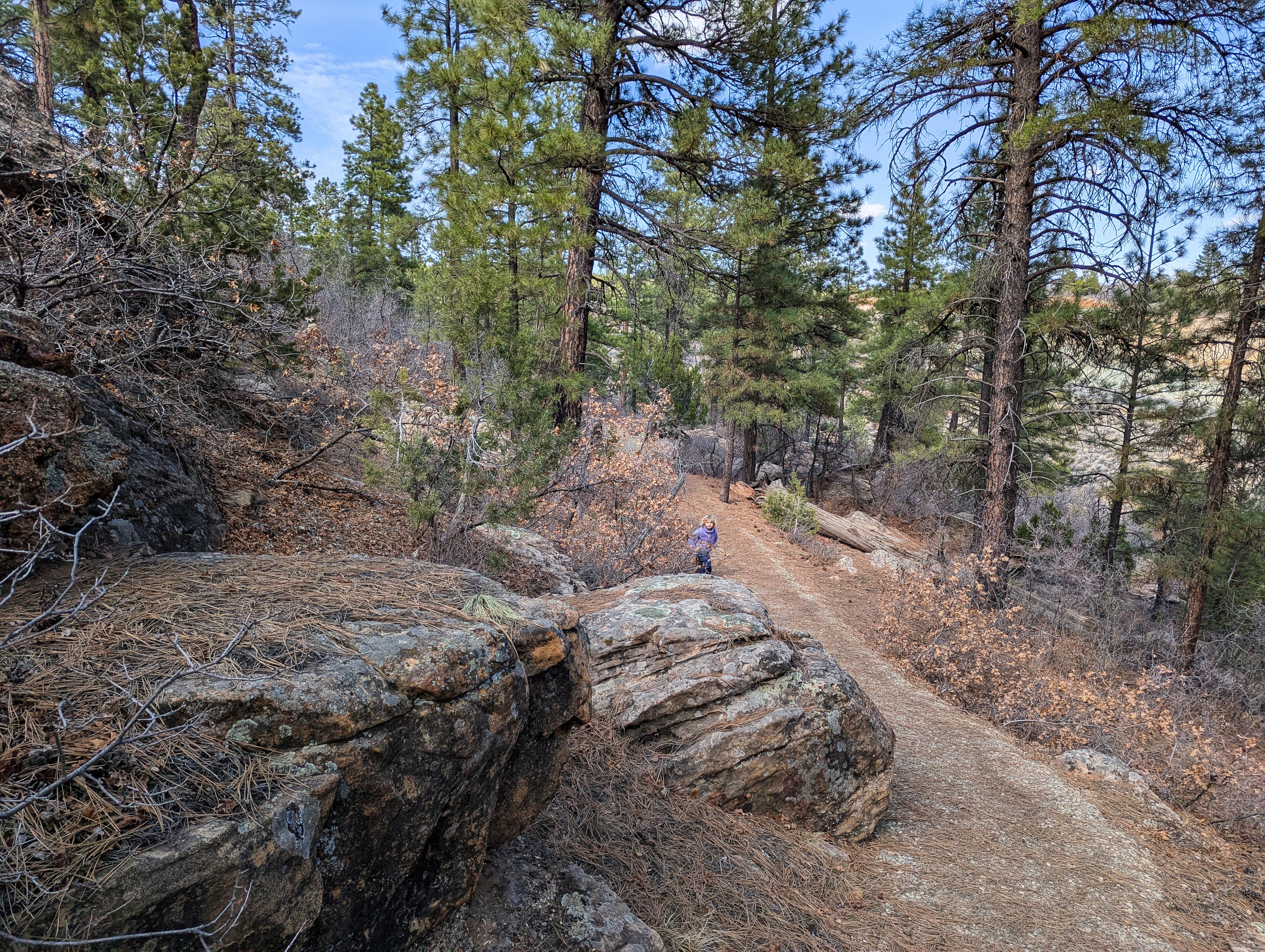
Getting started on the trail on a warm March day.
Devils Canyon Nature Trail is a short interpretive trail at the Devils Canyon Campground between Monticello and Blanding. This short trail makes a great "leg-stretcher" if passing through the area. The campground is also quite nice, if needing a place to camp for the night.
This short 0.4-mile hike has 15 markers with information about the area. On our visit, there was one very tattered brochure to use and return to the trailhead register when done with the hike. The points of interest are reproduced below in case the brochure is missing.
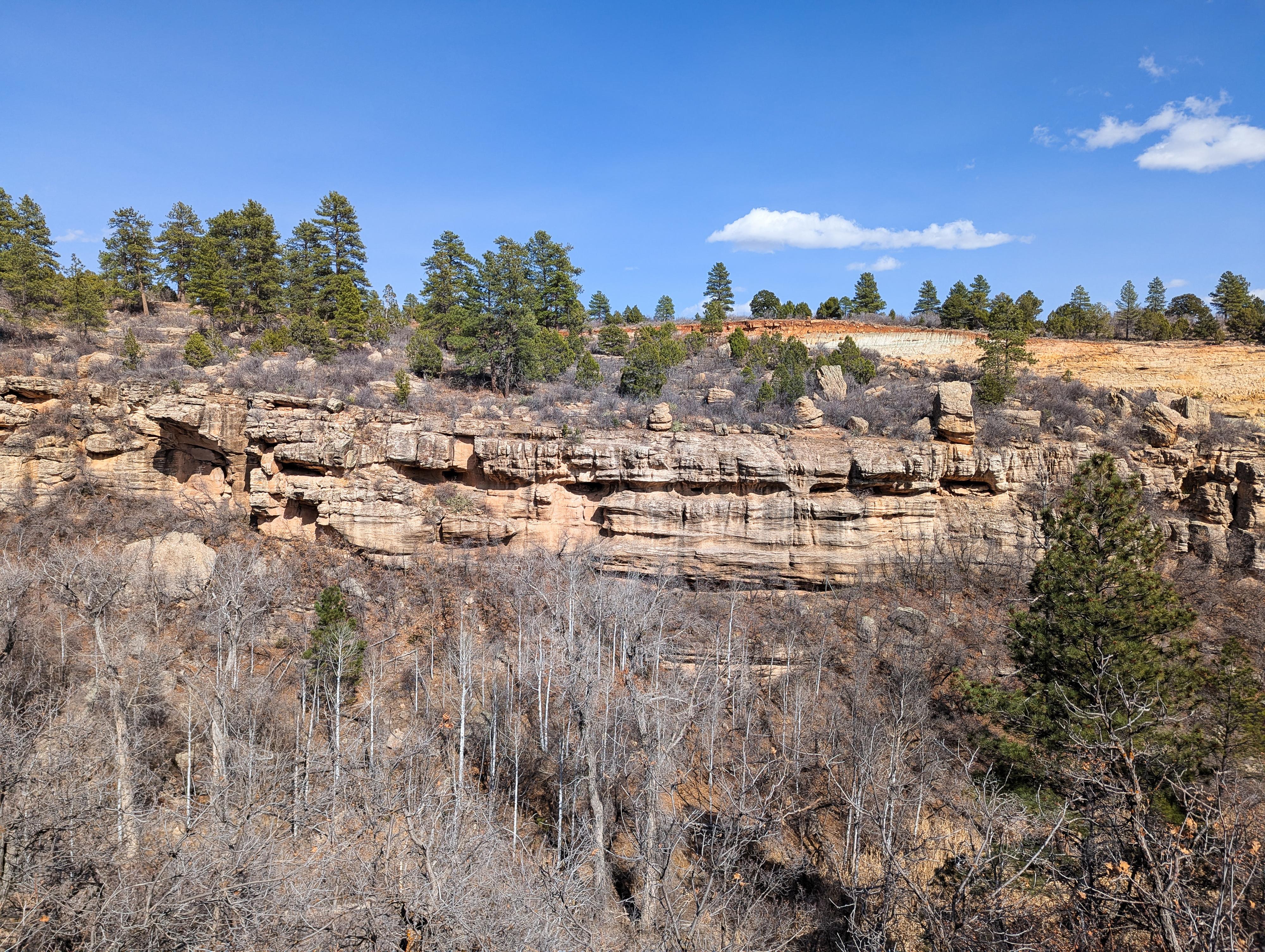
Center, in the shade, is a hard to photograph ruin across the canyon.
Getting There
Head north out of Blanding toward Monticello on US-191 for about 8 miles to the signed Devils Canyon Camground road on the left.
Turn off of US-191, and follow the Devils Canyon Campground road about 0.7 miles to Devils Canyon Campground on the right. Once in the campground, then left and follow the road to its end at the trailhead.
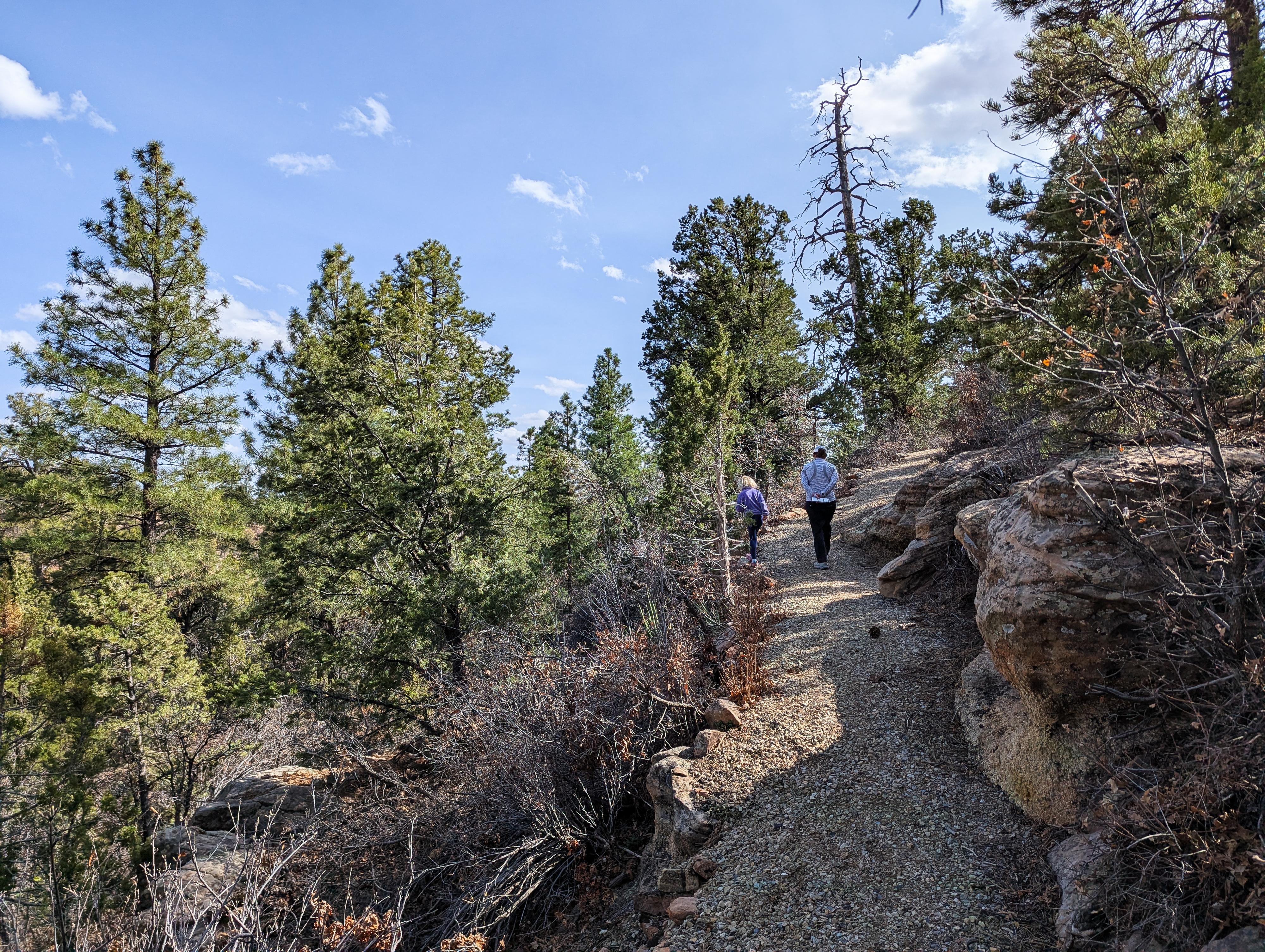
Nearing the end of the Devils Canyon Nature Trail
Route
From the trailhead, start on the trail in a counter-clockwise direction. Information from the brochure:
WELCOME!
As you walk this trail, you’ll see evidence of how people and the forest connect. These connections influence our uses of the present day. Match the numbered posts to the numbers below to learn more about how people have returned to nature.
1. PINYON PINE
Ancestral Puebloan’s diet included the seeds, or pine nuts, produced by pinyon or piñon pines (Pinus edulis). Have you eaten roasted pine nuts or pinyon nuts? It’s delicious, at least if the beetles think so. You might notice evidence of beetle damage and mortality across the surrounding forest.
2. NARROW LEAF YUCCA
Narrow leaf yucca (Yucca angustissima) may look unfriendly, but it is actually a one stop shop; every part of the plant can be used by people. Tribes weave the fibrous leaves into baskets, sandals, rope, and twine. People eat the stalks, blooms and buds. Even the roots can be made into yellow dye to color yarn, and even processed into soap.
3. PONDEROSA PINE
Need glue or waterproofing? Ponderosa pine (Pinus ponderosa) sap is just what you need! In addition to uses for the sap, tribes ground the seeds into flour. Give the tree’s orange bark a sniff. The bark contains vanilla, which gives the tree its distinctive sweet butterscotch smell!
4. GAMBEL OAK
Women’s and family use for Gambel oak (Quercus gambelii) was common across the Colorado Plateau. The acorns, a food rich in fat and protein, were roasted or ground into flour. In order to make the acorns palatable, people soaked or boiled them in several changes of water to remove the bitter tannins. The acorns can be stored for long periods and used throughout the year.
5. CAT FACE STUMP
This tree stump is a reminder. It was cut down by a human, but no commercial logging has occurred here. It may have been cut to build fire line, or for firewood. This triangular scar is from the base of the tree to the new bark which protects the wound, forming a lobe. If we lift up our shirts and show the scars from where we got injured, sometimes we see a new layer of flesh heals the edges of the wound, but behind a scar, called a cat face.
6. UTAH JUNIPER
How would you survive a drought? Utah junipers (Juniperus osteosperma) have some impressive adaptations to limited water. You might mistake the blue fleshy modified cones for berries. These are used by people for medicinal purposes. Tea and oil can also be made from its resin, fence posts from its wood, and firewood from its drought-resistant wood.
7. LIGHTNING STRIKE
A lightning strike caused the long scar on this tree, leaving it vulnerable to insect damage. Lightning was once feared. In the Western United States, Gambel oak, which often grows in dry soil and forest floor, would be struck material and ignited.
8. FOREST SUCCESSION
Over our lifespans we grow and change, often providing for new life to come behind us. A forest goes through a life cycle of birth and death. Wildfires ignite often vegetation along the way, driving off life and seen as killing everything. In fact, they are the start of life. Grasses, flowers and small shrubs sprout literally from the ashes. These plants introduce nitrogen into the soil from the fire as food. These first species, also called pioneer species, also hold and shield the soil from erosion. This lets the second growth of larger shrubs and small trees to sprout. They’ll eventually outgrow the first vegetation and will in turn be replaced by another succession of trees producing a mature forest. Finally, another wildfire returns the mature trees to soil nutrients and the cycle begins again. Climate change has altered the frequency of wildfires, reducing the forest’s ability to maintain a healthy succession of vegetation.
9. BEETLE KILL
Bark beetles found this pinyon pine to be delicious! Warm temperatures used to only occur in summer, but climate change has extended the period of warmth. Beetles can now reproduce multiple times before winter frosts make them go dormant or killing them off.
10. BITTER APPLE
Bitter apple (Peraphyllum ramosissimum) is the vitamin of the forest. The small red fruits are a source of vitamin C. Humans as well as elk, deer and birds all consume it for its nutritional properties. Raw, the fruits taste nothing like a sweet apple, but cooked they can become a delicious jam or jelly.
11. GRANARY
Look across the canyon, do you see your pantry? The rock structure built into the small alcove was built by Ancestral Puebloans, probably to store grains and corn. This and other archaeological evidence tells us the site of this granary is about 50–1300 common era (CE). Hunter-gatherer tribes became more stationary as they began to cultivate food in early agricultural societies. Around 1300 CE, the Ancestral Puebloans migrated from the area, but their descendants, the tribes such as Hopi, Zuni, and several different Ute tribes, as well as the Navajo and several different Ute tribes, still live and use the forest. Remember, all artifacts are protected by law. Please take only pictures and leave only footprints.
12. DEN TREE
Death is not the end of the story for many trees. This tree was killed by bark beetles, but it’s now excellent habitat for wildlife. The hollows and other cavities from the insect damage are perfect homes—high off the forest floor and away from predators—for many species of birds and small mammals.
13. BARBED WIRE FENCE
A fence type to match many desert plants. The barbed wire fence can indicate use by humans when grazing cattle. When the Forest Service was created in 1907, it was split into parcels and designated to prevent overgrazing, ensuring cattle stayed in one location and didn’t stray into vulnerable habitats. This barbed wire has been used for over 100 years to contain livestock animals and is still used today to control livestock movement.
14. TRASH
So, why did you come to visit the forest today? Did you come to find out how to survive like many of those who’ve passed here before? Probably not, but you’re one of the many new users of the forest, who have left evidence of your visit and that story will end up in this trash can. What kind of story does your trash tell? What evidence will future people find in your remains? The Forest encourages you to enjoy your public land, while packing out what you pack in and practicing Leave No Trace ethics. For more information visit www.lnt.org.
15. ACCESS
Imagine traveling to this spot by foot or by horse. Your journey would be a bit different than by the car you drove to get here. Still though, you can be a part of the same journey, by exploring on foot, while staying on trails, roads, respecting the boundaries of each campsite so that everyone may enjoy this campground. Please also follow campfire use and fire restrictions. Human use of this area may not change just as it has for thousands of years, but it is up to each of us to ensure the natural beauty and health of the forest remains for today and for tomorrow.
Photos
Maps

| Campground Gate |
12S 639981mE 4177800mN N37° 44' 12" W109° 24' 41" |
| Trailhead |
12S 640446mE 4178044mN N37° 44' 20" W109° 24' 22" |
| Devils Canyon Ruins |
12S 640573mE 4178207mN N37° 44' 25" W109° 24' 16" |