 Hiking
Lower Harris Wash
Hiking
Lower Harris Wash
Hole In The Rock
Overview
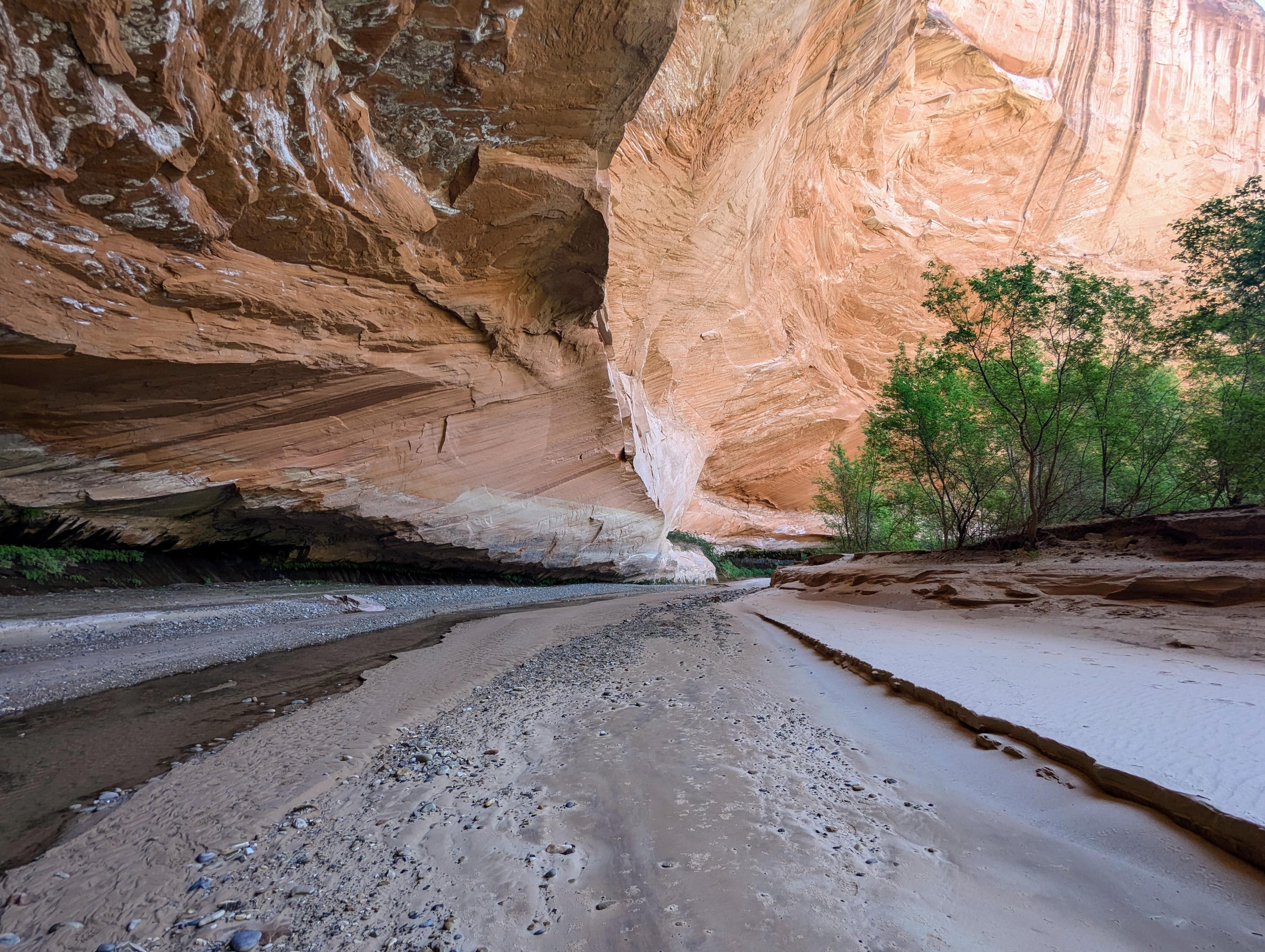
Lower Harris Wash used to be quite popular. The lower section of the canyon has an idyllic small stream meandering down to the Escalante river, cutting deep overhangs along the way. The overhangs are reminiscent of the very popular Coyote Gulch, but maybe not quite as dramatic. The canyon used to be one that ranchers ran cows in until the early 1990s when grazing was stopped.
Today, then canyon doesn't seem very popular. It is quite overgrown and the easiest path is generally to hike in the stream bed proper. A use trail, for the most part, doesn't exist. I suspect the removal of cattle, and the trails they made, has helped the canyon recover from over grazing but also made access a fair bit more difficult.
I found the canyon beautiful, but also physical and challenging. You will be walking in the stream bed or thrashing through overgrowth the whole way. The stream bed is easy walking until you sink thigh deep into quicksand. I'd have someone else in your group lead!
The out-and-back is a great intro to the area and can be done as a day hike or an easier backpack for hikers or backpackers of all abilities. Hiking down 4-5 miles and returning makes for a great day hike or short overnight backpack. Going all the way to the river and back is a bit over 22 miles by my track and a solid overnight backpack.
Going to the river, setting up base camp, and exploring the area is a good 3+ day trip. If wanting to explore along the Escalante River, be sure to time your trip to avoid spring runoff, when crossing the river can be difficult. Early spring, summer, or fall would be good seasons. Peak run-off is generally mid-April to mid-May but varies each year.
Doing the full loop is long, strenuous, and not for the inexperienced. Experienced desert backpackers only! You will need to time your trip to avoid spring runoff (usually mid-April to mid-May, but varies each year). The loop can be done in either direction, but either way will have a strenuous 9-mile overland section with no water and little shade. I tracked the route at over 30 miles, but it will vary depending on how you cut corners, side trips, etc... Most groups will likely want 3-4 days for the trip. I found it quite strenuous, and a beautiful and rewarding section of the Escalante River to visit.
Getting There
Head east out of the town of Escalante about 5 miles on highway 12 until the well signed Hole in the Rock road on the south side of highway 12. Reset the odometer as you turn onto this road.
Route Description
To The Escalante River (11.25 miles / 3.5-5 hours)
From the trailhead, follow the road north a minute to where it crosses the wide Harris Wash. Go right and start heading down Harish Wash. It is wide and dry in the upper section. In just over a mile, the canyon walls will begin to rise. It is about 3.25 miles (1-1.5 hours) to the Glen Canyon boundary. On my trip, good water started flowing a bit above this boundary and was plentiful and would be easy to pump at the boundary. There used to be a jeep road running down Harris Wash through this section, but it has mostly become overgrown. Once it becomes more difficult to bushwhack cutting the corners than to stay in the stream bed, I would recommend just staying in the stream.
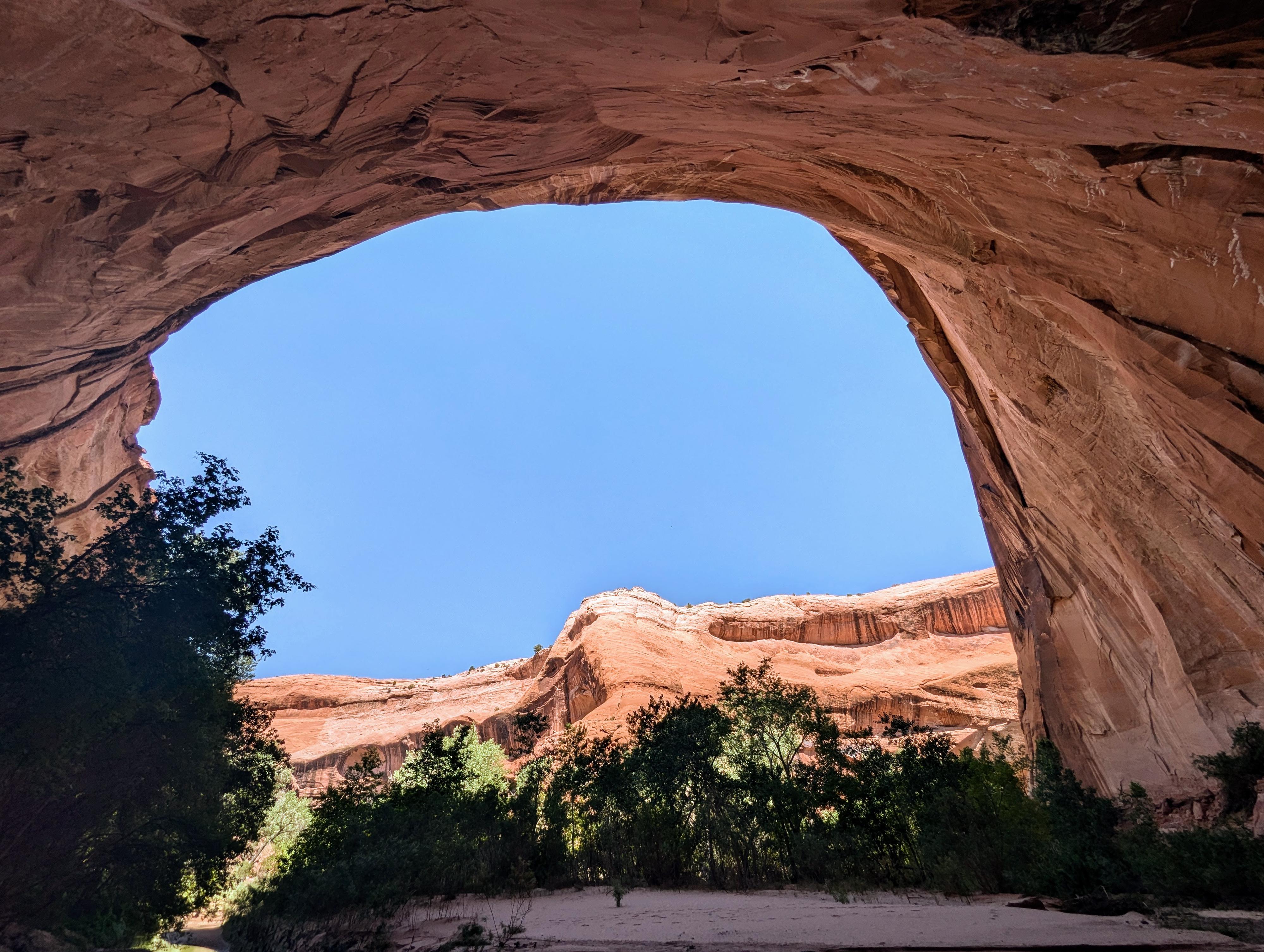
Continue down, the canyon and alcoves get deeper with each turn. Floods have washed out a deep sediment layer, making the alcoves inaccessible to hikers, though there are said to be small granary ruins in some of the lower and bigger alcoves. It is a bit over 11 miles to where Harris Wash meets the Escalante River. There is good camping just up from the Escalante River on the right side (looking down canyon) of Harris Wash. It would make a great base camp for exploring up or down the Escalante River. If not doing the full loop, return the way you came.
Up the Escalante To Lower Sand Slide (2.5 miles)
Head up the Escalante River! It is quite overgrown. The best strategy I found during my hike was to bushwhack to the river, cross it at places with wide benches on the other side, cut the corner to the next bushwhack and crossing. It can be tiring, especially with a backpack.
About an hour or so, there is a huge sand hill on the left (west/south) side of the river. It would be hard to miss. This is known as the Lower Sand Slide and can be used to hike out of the Escalante River canyon. It is a steep sand hill to a short scramble at the top.
Lower Sand Slide to Old Sheffield Cabin (3.5 miles)
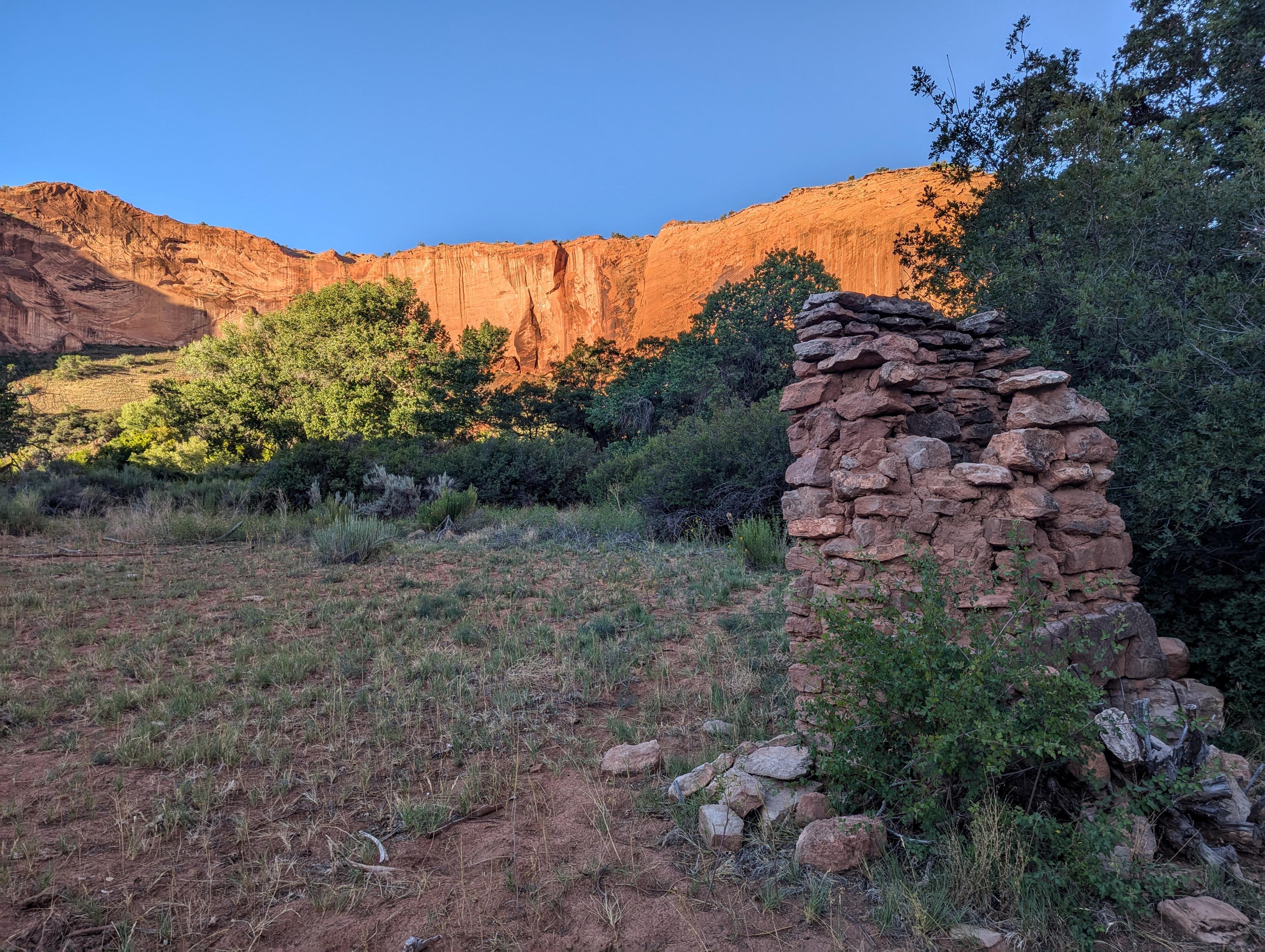
Continue up the river with more of the same. Stunning high walls, but brushy crossings. Keep an eye on the map. The Old Sheffield cabin is on the left (looking up river) about 6 bends up from the Lower Sand Slide, where a couple of deep alcoves are on the left (south) side of the river. This is the site of the Old Sheffield Cabin.
The cabin was built in the late 1800's, but not much other history is known. All that is currently there is the old chimney. This bend makes a nice camping area. The two deep alcoves downstream of the cabin have very worn moki steps between them. There is also an old granary just upstream from the old chimney on the same side of the canyon as the chimney. It is about 1/3 of the way up the cliff face. There doesn't appear to be much left of it.
Old Sheffield to Upper Sand Slide (1.3 miles)
Continuing upstream, it is only about 30-45 minutes and a couple of bends before the Upper Sand Slide is clearly visible on the left (looking upstream) side of the river. If doing the loop hike, this is the exit to the cross-country section.
Side Hike to Horse Canyon (3 miles roundtrip)
If time and energy allow, it is about 1.5 miles up river to Horse Canyon. Just before Horse Canyon, there is a small arch high on the skyline on the right (looking up stream). On your return downstream, after the arch, stay along the right side (looking DOWNSTREAM). The river goes around a peninsula, with a big sandy area along the river. As you head downstream and the river bends back to the base of the cliffs on the right (again looking DOWNSTREAM), look for an interesting pictograph a bit up on the cliff face. Just below the pictograph another minute or so is the inscription of "J A Burr 1891".
Upper Sand Slide to Trailhead (about 9 miles)
Slog up the sand hill, starting on the upstream side of an abandoned meander. There is a bit of a shallow drainage to follow up at times. It is steep and sandy. As you near the cliff band, there are some cowboy glyphs on the left where the old trail used to come down. The drainage here goes right just below the cliff band and the direction to go after visiting the glyphs. Follow the base of the cliff northwest up to the sand's apex, where a little easy scrambling gains the rim.
The terrain ahead is convoluted and void of many landmarks or trails. Head southwest. It is about 2.8 miles from the river, up the sand hill, and across the open terrain to the V Road, a jeep road that is still in use today. As long as you head southwest, you should hit it. Once on it, go right and follow it. The V Road heads southwest and crosses a deep section of sand. Just after the sandy section is a sign warning of "Deep Sand". This is the trailhead to the Volcano.
Continue along the V Road. From where you intersect it to the Harris Wash Trailhead is about 6 miles depending on where exactly you intersect the road after the cross-country section.
Photos
Maps


12S 469894E 4165264N
37°38'02"N 111°20'28"W
12S 472658E 4165973N
37°38'26"N 111°18'36"W
12S 473566E 4165937N
37°38'25"N 111°17'59"W
12S 480984E 4168484N
37°39'48"N 111°12'56"W
12S 479123E 4169878N
37°40'33"N 111°14'12"W
12S 479287E 4170545N
37°40'55"N 111°14'06"W
12S 477501E 4172139N
37°41'46"N 111°15'19"W
12S 477269E 4172046N
37°41'43"N 111°15'28"W
12S 477605E 4172316N
37°41'52"N 111°15'15"W
12S 476750E 4172892N
37°42'11"N 111°15'49"W
12S 476606E 4173016N
37°42'15"N 111°15'55"W
12S 476428E 4174195N
37°42'53"N 111°16'03"W
12S 476441E 4174220N
37°42'54"N 111°16'02"W
12S 476909E 4174457N
37°43'01"N 111°15'43"W
12S 471716E 4169370N
37°40'16"N 111°19'15"W
12S 472164E 4170672N
37°40'58"N 111°18'56"W
12S 474903E 4170966N
37°41'08"N 111°17'05"W
12S 471558E 4169299N
37°40'14"N 111°19'21"W