 Hiking The Volcano / Cosmic Ashtray
Harris Wash
Overview
|
Thu 67 | 46 |
Fri 48 | 39 |
Sat 52 | 33 |
Sun 66 | 33 |
Mon 70 | 39 |
| View Full Weather Details | ||||
|
Thu 67 | 46 |
Fri 48 | 39 |
Sat 52 | 33 |
Sun 66 | 33 |
Mon 70 | 39 |
| View Full Weather Details | ||||
The view inside of the Volcano
The Volcano, Cosmic Ashtray, or one of many other names, used to be a hidden gem. It seems to have gained internet fame recently, and has become quite popular. The dome itself is hollow with an island in the middle. Size is difficult to grasp from pictures. Imagine a pothole 25 m ( 83 ft. ) deep, maybe 30 m ( 99 ft. ) + across, with a 10 m ( 33 ft. ) tall island in the middle. The bottom filled with dunes. Wild! If you're adventurous, the bottom of the dome can be visited, but beginners beware, or you could end up stuck in the bottom!
This route approaches from the Harris Wash/Hole-in-the-rock area and is shorter than the approach from the Old Sheffield Road road. Though this route is shorter, I think it is a bit less scenic than the longer route from the Old Sheffield Road road. Coming from Harris Wash also requires more dirt road and a bit rougher dirt road. Medium to high clearance required, and there are a few short spots of deep sand. If you are doing other things off the Harris Wash area or are looking for the shortest possible route, I recommend this route. Otherwise, I prefer the longer route from Old Sheffield road because it seems more scenic to my eye.
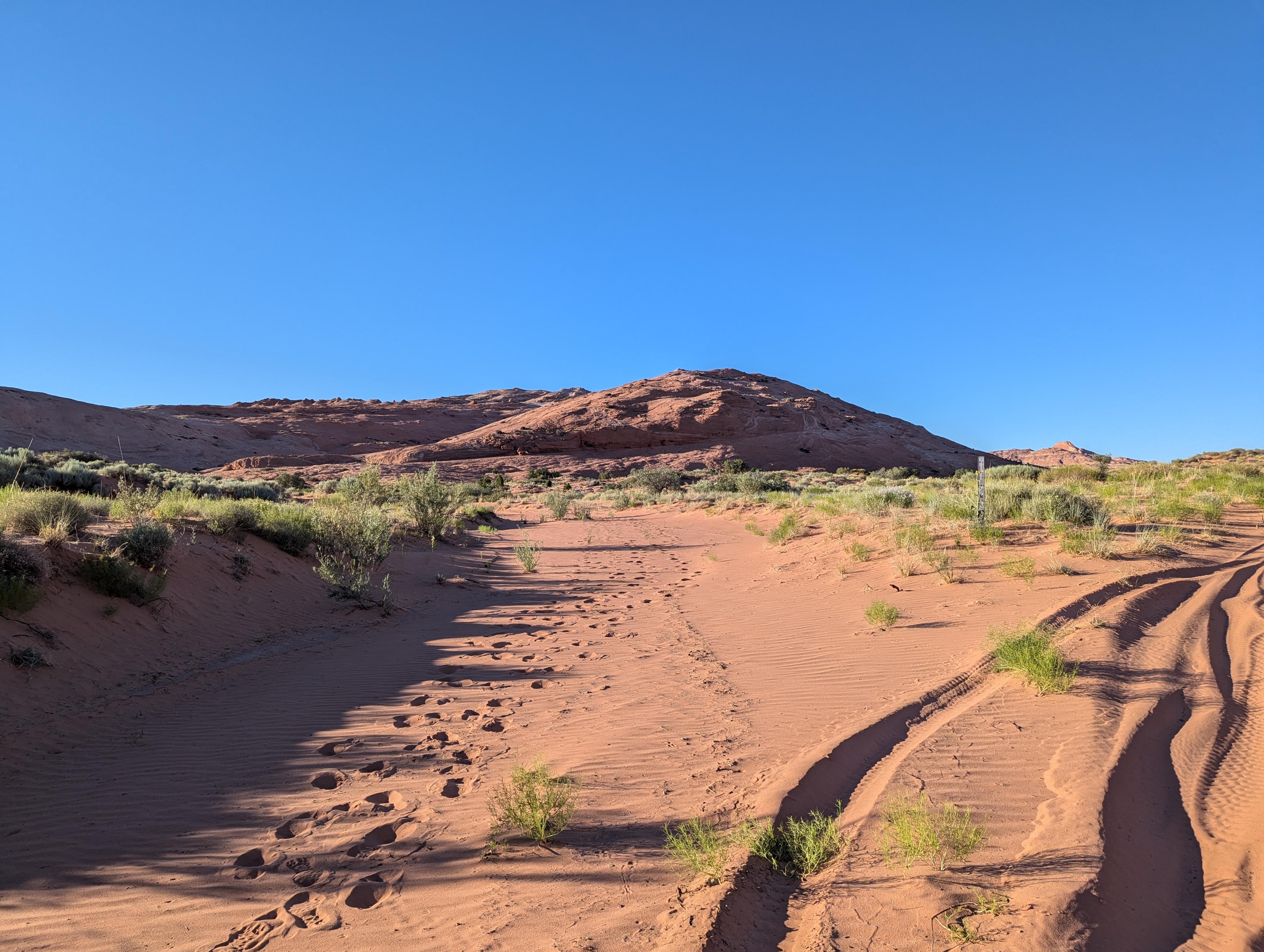
The wash where you leave the road. DEEP SAND!
Getting There
Head east out of the town of Escalante about 5 miles on highway 12 until the well signed Hole in the Rock road on the south side of highway 12. Reset the odometer as you turn onto this road.
- Mile 0 - Hole-In-The-Rock Road Turnoff ( 12S 453167mE 4175716mN / N37° 43' 39" W111° 31' 53" )
- 8.0 miles - Parking area after a cattle guard. This is the Zebra/Tunnel trailhead. ( 12S 460681mE 4165896mN / N37° 38' 22" W111° 26' 44" )
- 10.6 miles - Harris Wash side road on the left. Turn onto this side road and reset your odometer. ( 12S 462224mE 4162235mN / N37° 36' 23" W111° 25' 41" )
- Harris Wash Side Road - 6.1 miles - Harris Wash Trailhead. The road gets a bit rougher beyond. ( 12S 469880mE 4165271mN / N37° 38' 03" W111° 20' 29" )
- Harris Wash Side Road - 9.7 miles - Volcano Trailhead. There is likely a sign that says "Caution Deep Sand" and very deep sand just ahead. Note: The road gets very sandy about 0.15 miles before the trailhead. If in doubt, stop short and walk the last little bit. ( 12S 471716mE 4169370mN / N37° 40' 16" W111° 19' 15" )
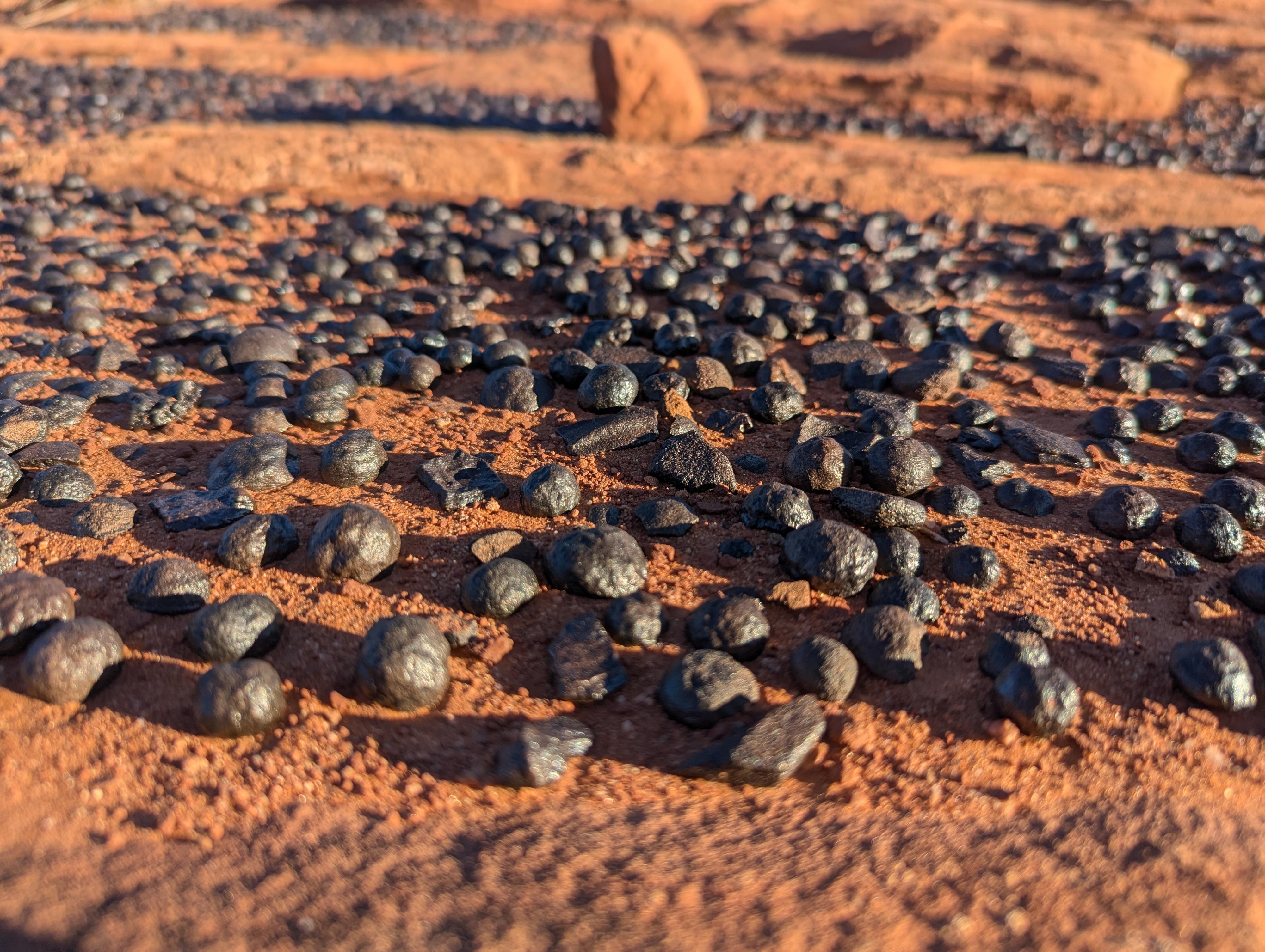
Moki marbles near the trailhead. You are not allowed to collect rocks in the national monument.
Route
Approach (about 1.1 miles, but may take 30-45 minutes with route finding)
From the parking area, walk the road for just a minute or so in very deep sand to where a wash comes in on the left. Leave the road and head north up the wash. The wash quickly enters sandstone. Stay in the drainage.
The shallow drainage passes through an area of white slickrock. Just after the white section, climb a bit on the left to avoid a dryfall ahead. Looking north and a touch east is a large white slickrock peak. The Volcano is on the right. Head toward the peak on the easiest path, staying low enough to avoid steep slickrock and aiming for the east side of the peak. Once on the east side of the peak, the Volcano is up in the white layer. It is a bit difficult to spot from below, GPS helpful, but a little searching on the east side should be all that is needed if you don't have a GPS.
Return the same way.
Photos
Maps

| Volcano Trailhead |
12S 471716mE 4169370mN N37° 40' 16" W111° 19' 15" |
| Volcano |
12S 472164mE 4170672mN N37° 40' 58" W111° 18' 56" |
| Long Deep Sand |
12S 471558mE 4169299mN N37° 40' 14" W111° 19' 21" |