 Hiking Cuberant Lake
Western Uintas
Overview
|
Sat 29 | 7 |
Sun 35 | 16 |
Mon 36 | 23 |
Tue 39 | 22 |
Wed 43 | 26 |
| View Full Weather Details | ||||
|
Sat 29 | 7 |
Sun 35 | 16 |
Mon 36 | 23 |
Tue 39 | 22 |
Wed 43 | 26 |
| View Full Weather Details | ||||
Cuberant Lake - Western Uintas
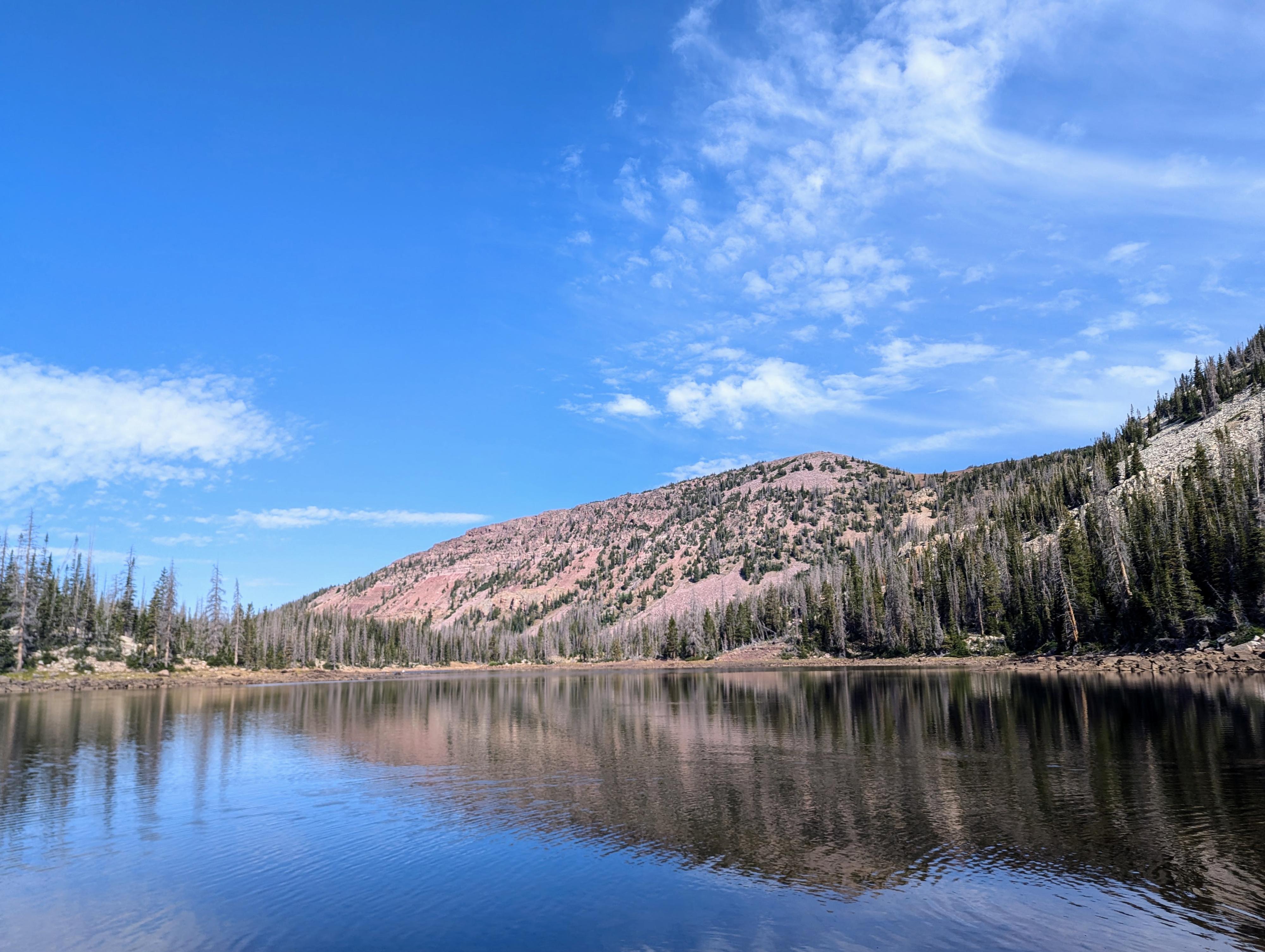
Cuberant Lake, near Bald Mountain off the Mirror Lake Highway, is one of my favorites. It doesn't seem to get quite the visitation some nearby lakes do. The hike, about 6 miles, is quite lovely. With Bald Mountain and Reid's Peak dominating the views during much of the hike, then the lake itself being tucked up against the base of Mount Marsell, there are a lot of big, dramatic views and great alpine scenery.
It makes an excellent day hike, but for those looking for a short overnight backpack, this is one worth considering. Cuberant Lake is the largest in the basin, but there are several smaller unnamed lakes in the area as well that are less visited and can offer nice campsites off the more well-travelled areas.
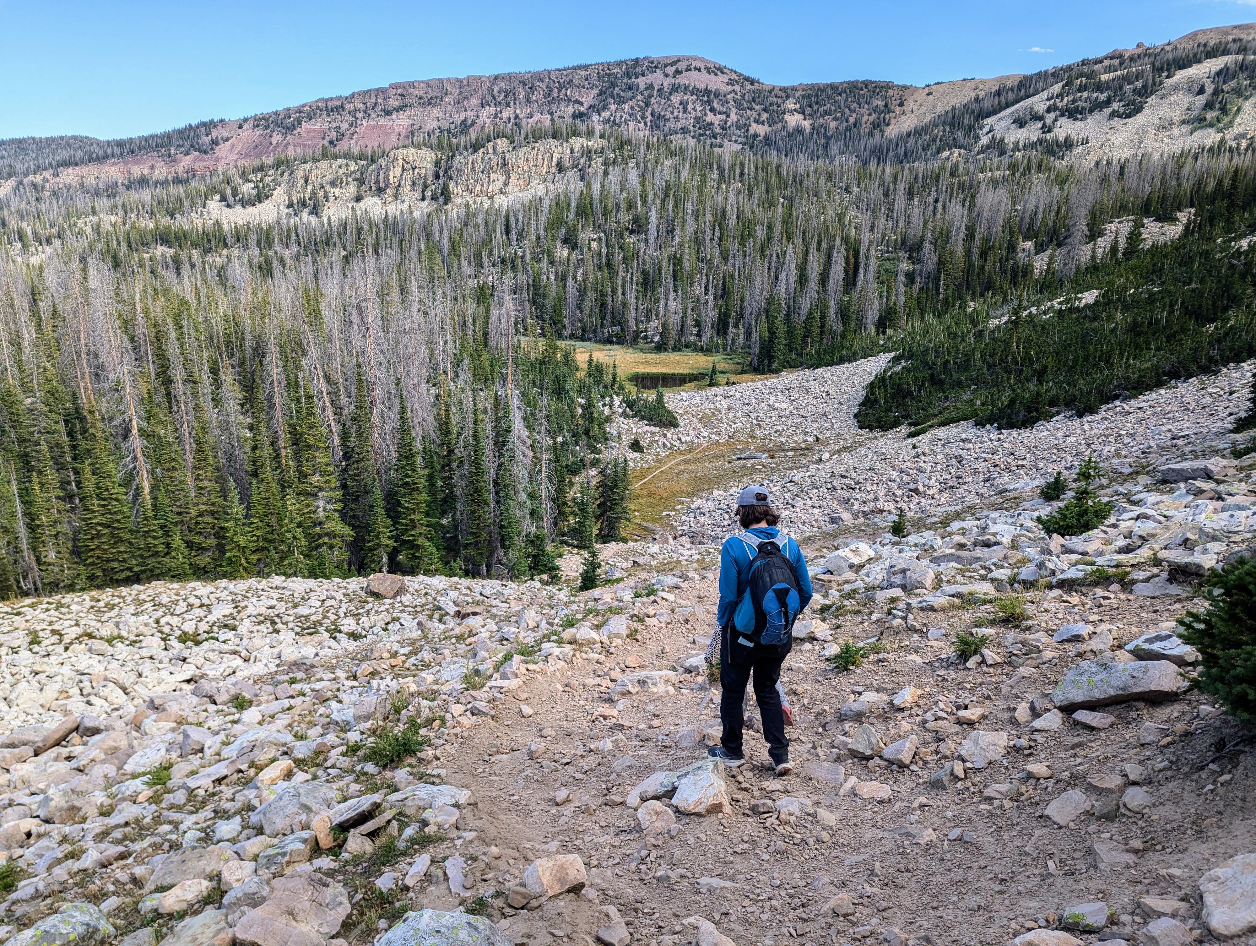
Descending down before one final climb up to Cuberant Lake
Getting There
The trailhead is the Pass Lake Trailhead off the Mirror Lake highway. This is at mile post 32.1, which is 32.1 miles from Kamas Utah on highway 150, or about 45 miles south of Evanston Wyoming on highway 150. The trail will likely be very snowy until late June in most years.
The trailhead has a pit toilet and a large parking area a short distance off the Mirror Lake Highway. If full, there is overflow parking along the highway.
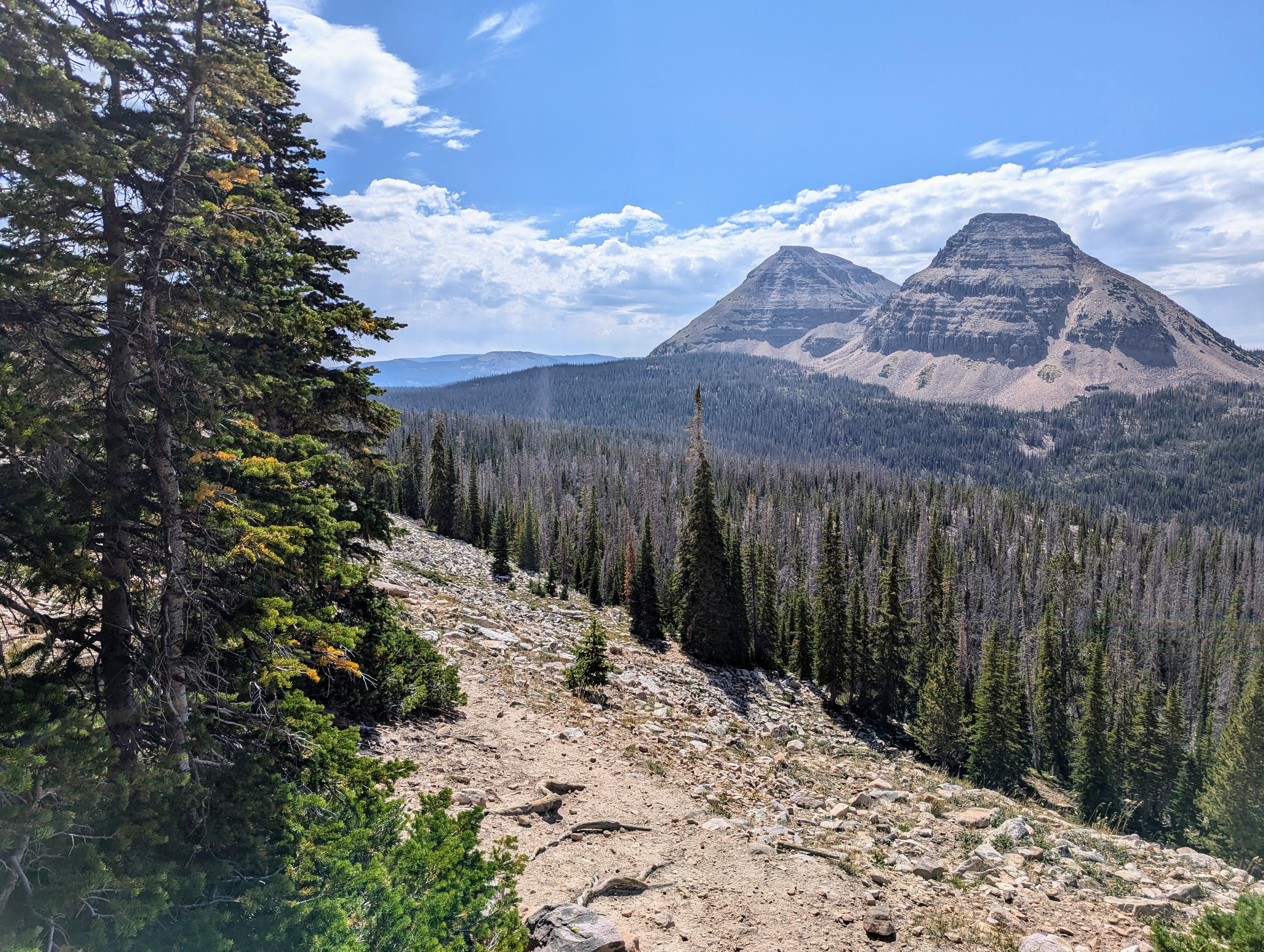
Reids Peak and Bald Mountain in the distance.
Route
There are two trails that leave the Pass Lake trailhead. Make sure you take the one that starts on the west side of the parking area.
Just a few minutes down the trail is a minor junction where left goes to Pass Lake and the highway. Stay right.
About 0.4 miles from the trailhead (10 minutes), another junction is reached. Go right again, left is the Main Fork of the Weber Trail.
The trail ambles down and near a lovely meadow area with nice views of Bald Mountain and Reids Peak. After about 1.6 miles and a bit of elevation gain, the junction to Kamas/Lofty Lakes and Cuberant Lake is reached. Go left here.
The trail follows along the base of Mount Marsell with a small climb and descent before reaching the basin with Cuberant and several unnamed lakes. An unnamed lake is reached first, then a short climb reaches Cuberant Lake proper. We enjoyed the smaller unnamed lake better than Cuberant Lake. There are quite a few campsites along Cuberant Lake. Be sure to practice low-impact camping.
Return the same way, or, with good map and compass skills or a GPS, visit the other small lakes nearby.
Photos
Maps

| Trailhead |
12T 509056mE 4507021mN N40° 42' 51" W110° 53' 34" |
| Main Fork Of Weber - Go Right |
12T 508510mE 4506866mN N40° 42' 46" W110° 53' 57" |
| Kamas Lake Jct - Left |
12T 507680mE 4508098mN N40° 43' 26" W110° 54' 33" |
| Cuberant Lake |
12T 507291mE 4509593mN N40° 44' 14" W110° 54' 49" |