 Hiking Stewart Falls
Mount Timpanogos
Overview
|
Fri 61 | 38 |
Sat 62 | 38 |
Sun 51 | 37 |
Mon 45 | 33 |
Tue 54 | 31 |
| View Full Weather Details | ||||
|
Fri 61 | 38 |
Sat 62 | 38 |
Sun 51 | 37 |
Mon 45 | 33 |
Tue 54 | 31 |
| View Full Weather Details | ||||
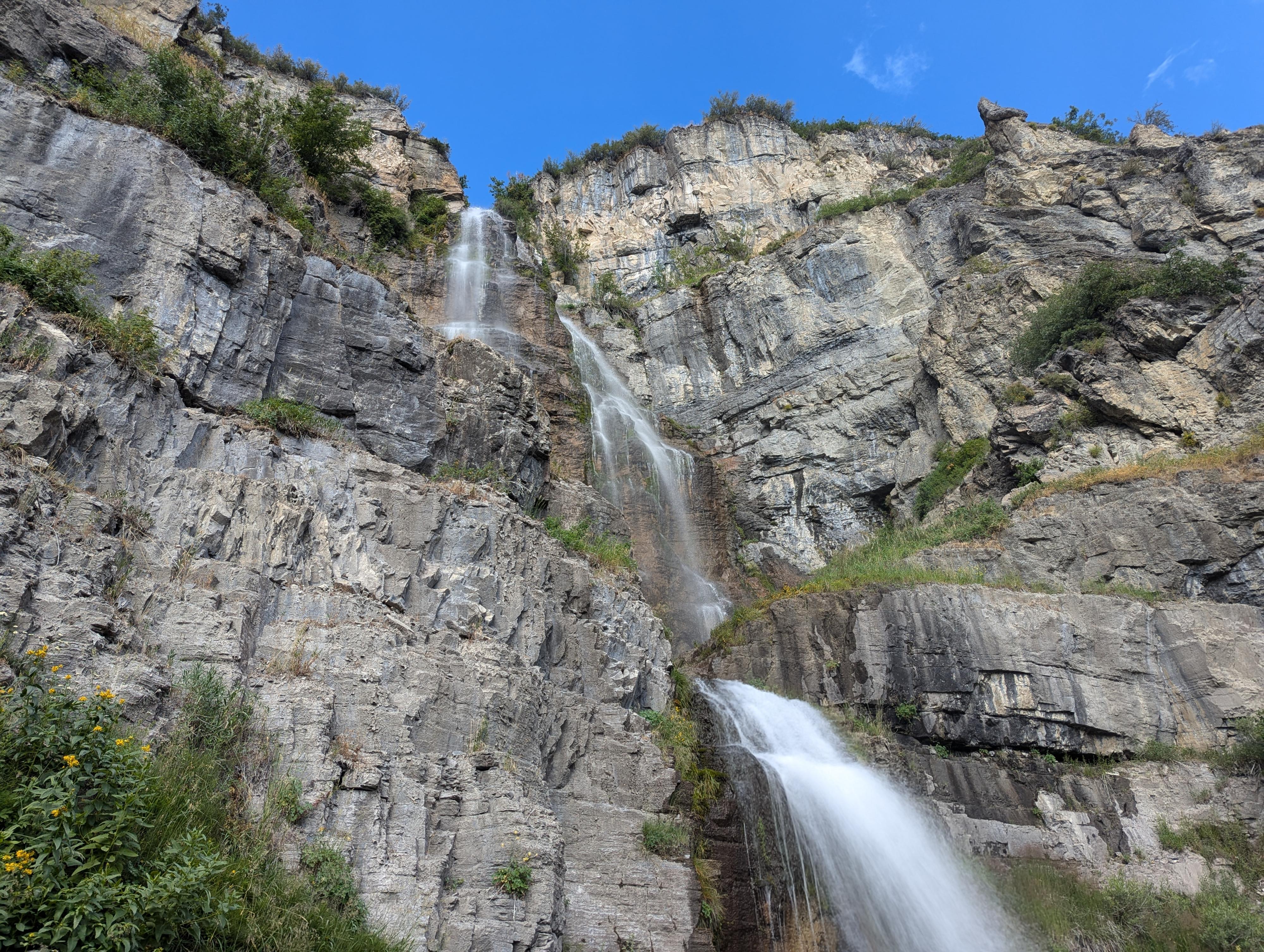
Stewart Falls on Mount Timpanogos
One of the most popular and I would say dramatic hikes in the Provo Canyon area, Stewart Falls is a must-do. The falls are over 200 feet high and absolutely stunning!
The hike meanders through forest before reaching the falls and is dramatic in any season. Summer brings wildflowers, fall brings vibrant leaf colors, and winter brings a snow-covered wonderland. Spring can be a mixed bag of snow, ice, and/or mud, but also dramatic views of the snow capped peaks along the hike!
A few things to know for the hike:
My watch clocked it about 3.9 miles and 800 feet of gain and 800 feet of loss round-trip. The trail is heavily used and easy to follow. I call this suitable for most as long as you are determined! We saw 3-year-olds hiking it (mostly) on their own, all the way up to octogenarians, and many families with kids of all ages.
Trail conditions can play a big role in your day. Summers can be hot, bring plenty of water and start early. Spring and winter can be slippery and require good traction shoes.
A few special notes about winter hiking: The trail is frequently hiked in the winter, and generally packed down within a few days of storms. That being said, be sure to check avalanche danger, the weather forecast, and make sure you are comfortable with the conditions and risk. In the winter, I would recommend traction devices like Yak-Trax. The hike is much less family friendly in winter conditions and, again, avalanches can happen in the area as well as white-out blizzards. Don't take the trail lightly if visiting in the winter!
Finally, dogs are allowed, but please pick up after them. On one winter visit, we were amazed at the tremendous amount of dog poop on and along the trail. Please clean up after your pet, so the area continues to be open to pets. On other visits, we have not noticed this problem.
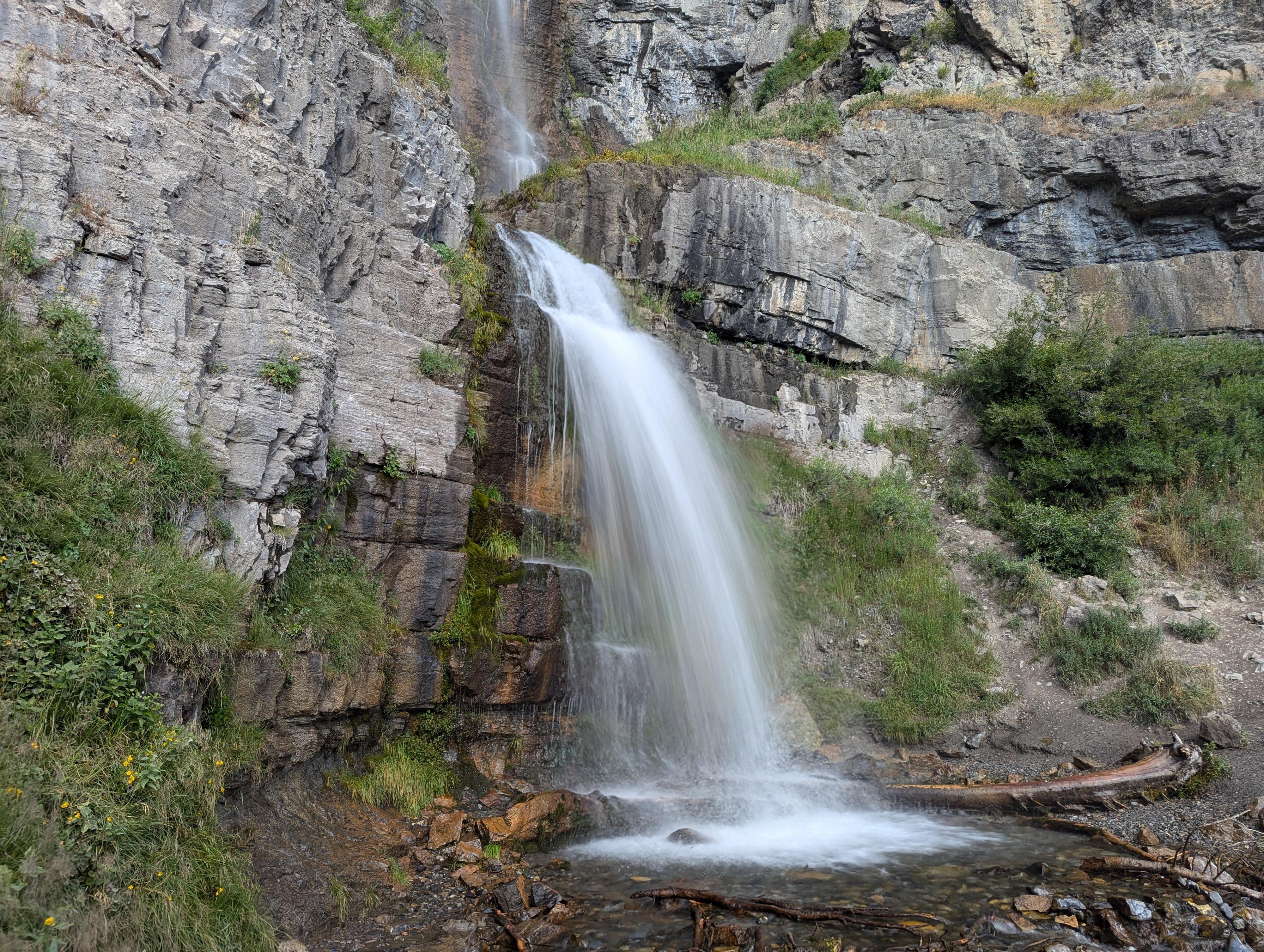
The very bottom of Stewart Falls
Getting There
From Provo, take US-189 up Provo Canyon toward Heber Utah. From the mouth of Provo Canyon, travel up the canyon about 7 miles. After about 7 miles, turn left off of US-189 on the Alpine Loop Road/Sundance Resort. Follow the Alipe Loop Road for 4.8 miles to the trailhead on the left just after passing the forest service fee booth.
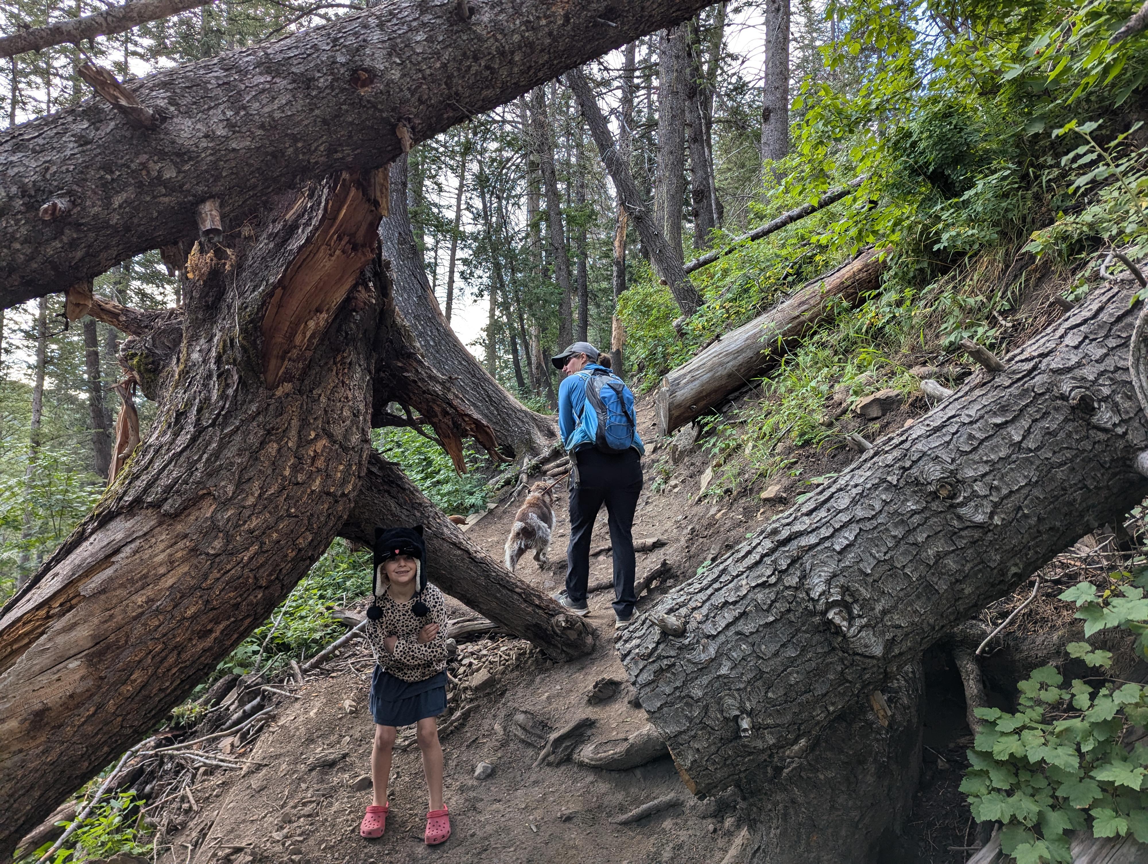
Early on during the hike. Some serious trees have fallen!
Route
The first step of the hike is the most important. Be sure you are on the correct trail! The Stewart Falls trail starts on the south side of the Aspen Grove Trailhead parking lot. This is near the pit toilet. The Mount Timpanogos trail also leaves from this trailhead, closer to the main road, and it NOT the one you want!
Follow the Stewart Falls trail. It meanders for just a couple of minutes before heading east and climbing the hillside. The trail climbs for a bit, then meanders a bit up and down. There are a couple of minor side trails that leave the main trail. Stay on the main trail the entire way. This section has Aspen trails and would be lovely in the fall. This is also a section of trail that shows some evidence of avalanches. The trail begins descending to Stewart Falls. The descent is steeper and longer than you may expect. At about 2 miles from the trailhead is a rocky outcrop that makes an excellent vantage point for the falls.
From the outcrop, the trail continues down a short distance to the stream bed and base of the falls. Magnificent! Return the same way.
Photos
Maps

| Trailhead |
12T 448631mE 4472805mN N40° 24' 15" W111° 36' 19" |
| Overlook |
12T 448705mE 4470831mN N40° 23' 11" W111° 36' 16" |
| Bottom of Falls |
12T 448700mE 4470804mN N40° 23' 11" W111° 36' 16" |