 Hiking
Granddaddy Basin
Hiking
Granddaddy Basin
South Slope Uinta Mountains
Overview
The road to the trailhead is a bit rocky and rough. Medium clearance highly recommended, though there were a couple of low clearance sedans at the trailhead on our visit, I would not recommend it!
Grandaddy Basin is named after Granddaddy Lake, the largest natural lake in the Uinta mountains at about 260 acres. The basin is dotted with over a dozen named lakes, and numerous smaller ponds. Trails crisscross the basin, with many options for visiting different lakes and making different loops. The basin is in the trees, but I was surprised when we visited at how stunning the views from the lakes of the alpine ridges around the basin are.
This is one of the most popular backpacking areas in the Uinta mountains. Granddaddy and Betsy Lakes, the initial lakes the trail reaches, see the most use and are about 4 miles from the trailhead. This makes a very reasonable day hike for those not wanting to carry backpacking gear. If you are looking for solitude, I would recommend going further into the basin. On our loop to Pine Island and Palisade Lakes, we didn't see anyone beyond Betsy Lake. There are many excellent camping sites around the lakes, just be sure to obey the distance rule for camping 200 feet or more from a water source.
The description below is the almost 15 miles loop we did in the basin. There are many other options and side trails to additional lakes as well. Most trail junctions are marked, but be sure to pay attention to where you are on the map when you reach a junction. There are many trails and it would be easy to take a wrong turn at a junction.
Getting There
To reach the Grandview Trailhead, used for this hike, head south out of Kamas on UT-32 toward Francis.
After 2.2 miles, turn left on UT-35 toward Woodland/Hanna/Tabiona.
Follow UT-35 for about 32 miles to the North Fork Road / FR 144. Turn left onto the North Fork Road. It is initially paved. Follow it for 6.5 miles and turn right onto FR 315/Grandview Trailhead Rd/Hades Canyon Rd.
Once on FR 315, the road climbs steeply and get more washboard and rocky. It is just under 6 miles to the roads end at the trailhead. The parking area has a pit toilet and large parking area. There is a small spur road about 1.5 miles before the trailhead that has a some primitive camping, but there aren't a lof of spots off FR 315. If camping in the area, you may want to consider one of the campgrounds on the North Fork Road.
Route Description
To Hades Pass (2.5 miles)
From the trailhead, it is about 2.4 miles to Hades Pass. This is not particularly steep, but can feel like a bit of a long slog, especially if you are carrying a heavy pack. Hades Pass and Hades Canyon were named because of the ruggedness and difficulty of coming up the canyon.
To Betsy Lake Jct from Hades Pass (1.7 miles)
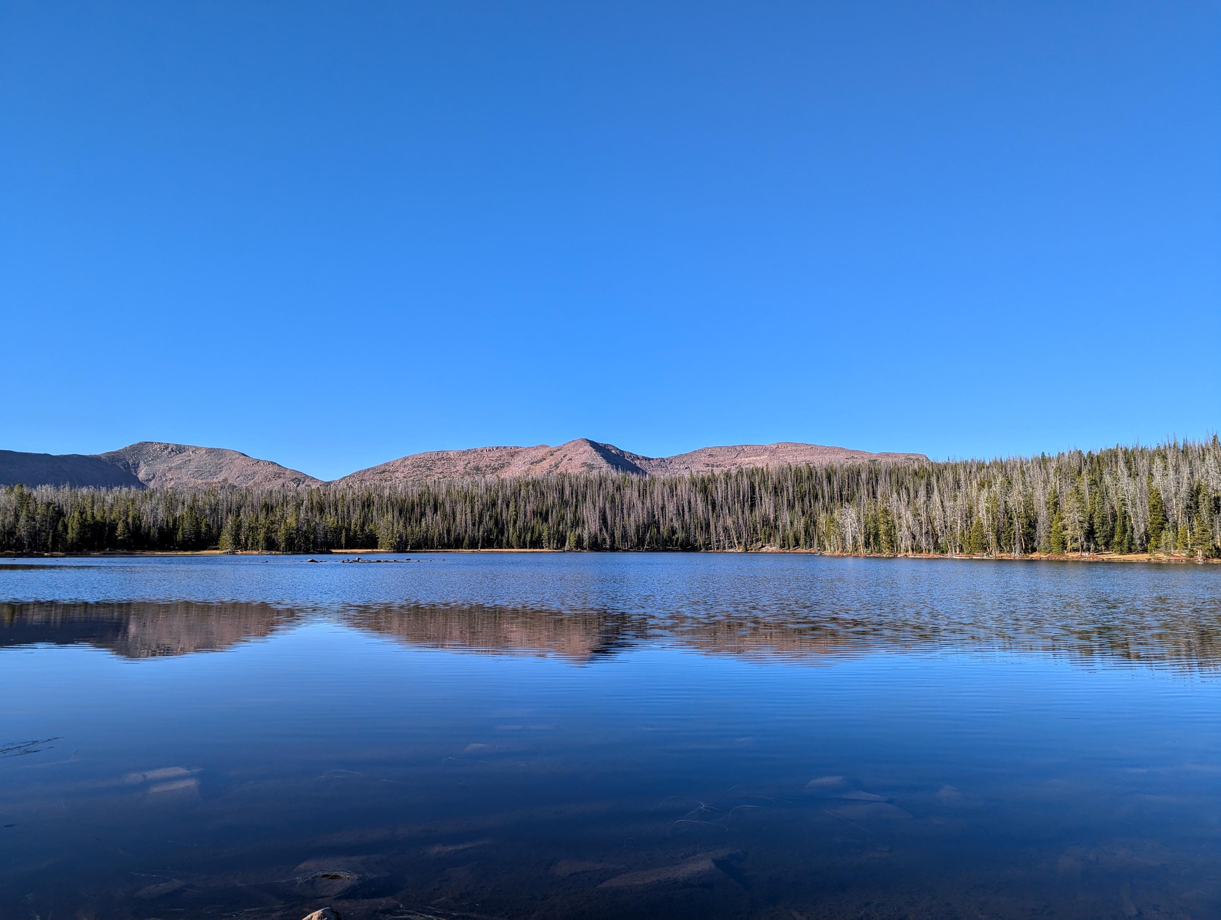
From Hades Pass, the views open of Granddaddy Basin and the ridgeline of the Uinta Mountains in the distance. The scale of the area is immense! The trail descends from Hades Pass with the small Heart Lake on the right a short distance off the trail. Continue down to Granddaddy Lake. There is a junction just after reaching Granddaddy Lake to Lodgepole Lake. For this loop, stay left toward Betsy Lake.
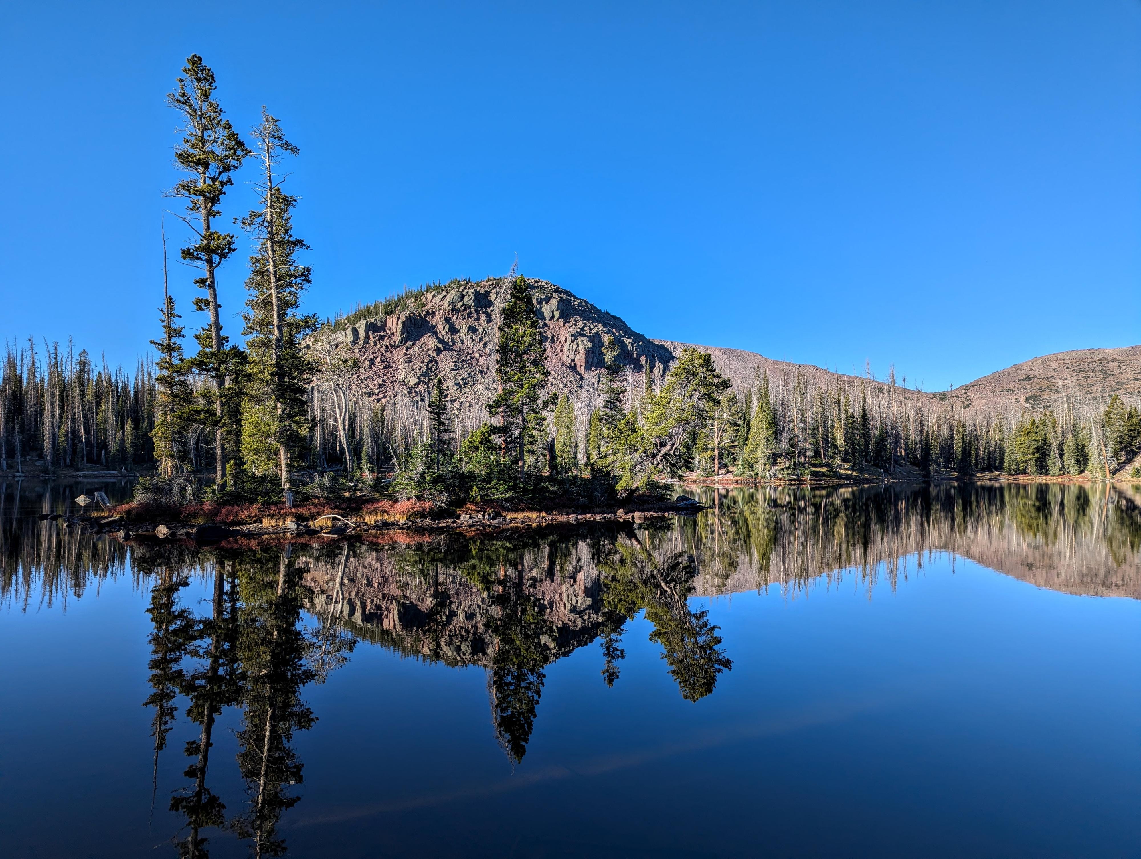
Betsy Lake is a short distance and a bit of elevation above Granddaddy. It has dramatic views of West Granddaddy Mountain to its west and south, as well as many campsites surrounding it.
Part way along Betsy Lake is a trail junction signed Fish Hatchery Lake and Rainbow Lake. For this loop, I recommend going left first, though the end of the loop will come back to this junction.
Betsy Lake To Fish Hatchery Lake (1.3 miles)
On the north end of Betsy Lake, the Mohawk Lake trail leaves on the left and goes about 1/2 mile one way to Mohawk Lake. Stay straight to go to Fish Hatchery Lake. The trail settles into a rhythm of some minor ups and down, but most just an easy amble. Fish Hatchery Lake is pretty, with a small island or two.
Fish Hatchery Lake to Pine Island Lake (1.4 miles)
The trail climbs a bit from Fish Hatchery Lake to reach Pine Island Lake. Pine Island Lake was one of my favorites. Large, with islands and a dramatic backdrop, it is quite stunning to my eye.
Pine Island Lake to Palisade Lake (1.2 miles)
From Pine Island Lake, continue on the trail for about 3/4 of a mile to the Palisade Lake Jct. Go right here to go to Palisade Lake. This trail was quite a bit less used, but still easy to find and follow. It is about 1.2 miles from Pine Island Lake to Palisade Lake. There are some good camping spots between the junction and the lake.
Palisade Lake to Betsy Lake (2.4)
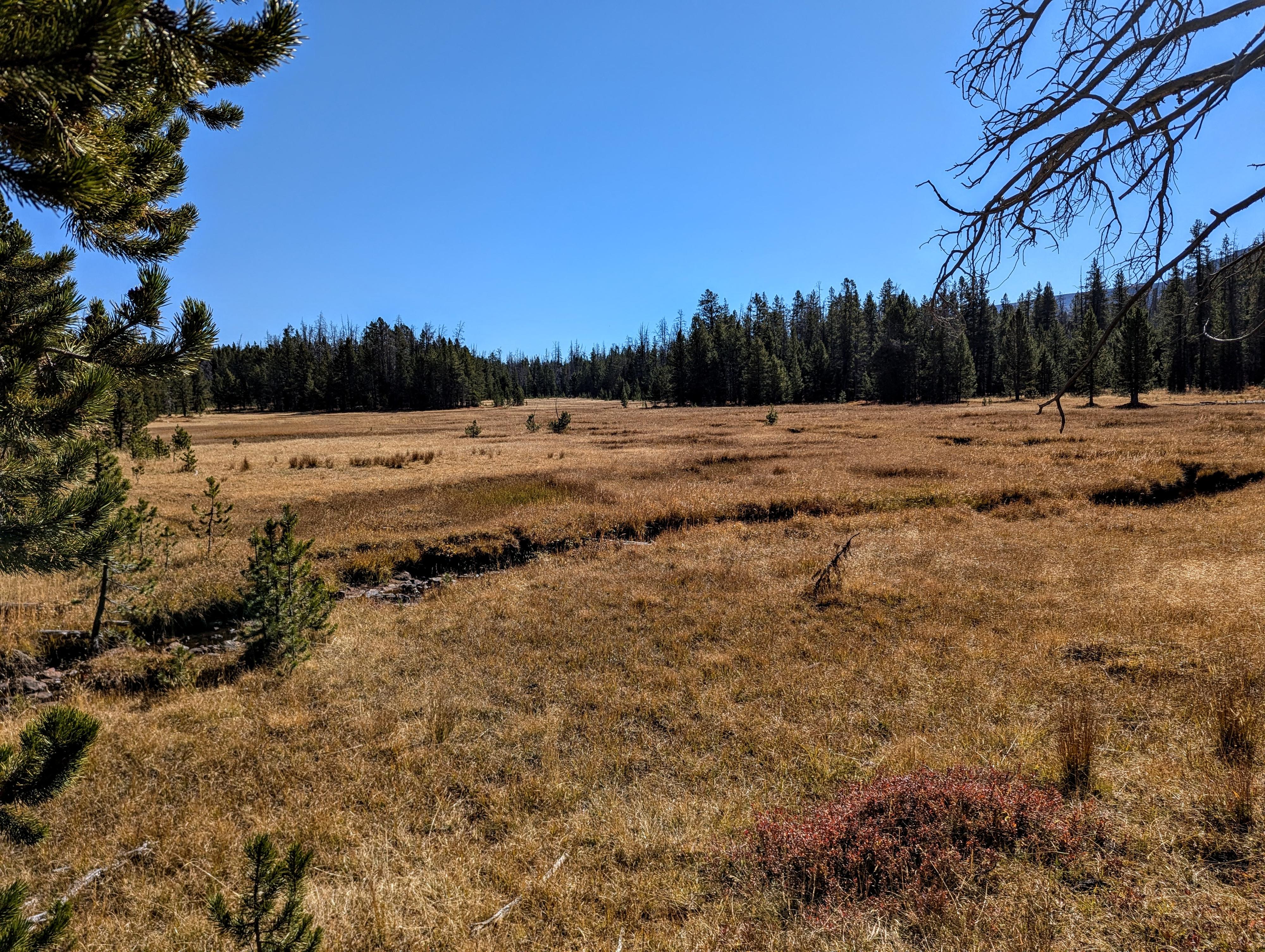
From Palisade Lake, it is about 1.1 miles to Brinton Meadow. Howard Brinton was a rancher that ran livestock in the meadow in the late 1800s and early 1900s. It is a pretty meadow, and we found it a great place to bird watch. At the south end of the meadow is a trail junction. Go right here to head back toward Betsy and Granddaddy Lakes.
The trail gains a bit in this next section, but from Brinton Meadow, it is about 1.3 miles back to Betsy Lake.
Return to Trailhead from Betsy Lake (4.2 miles)
From Betsy Lake, return the way you came into the basin via Granddaddy Lake and over Hades Pass to the trailhead.
Photos
Maps

12T 514762E 4490741N
40°34'02"N 110°49'32"W
12T 515638E 4493665N
40°35'37"N 110°48'55"W
12T 516104E 4495094N
40°36'23"N 110°48'35"W
12T 515931E 4495567N
40°36'39"N 110°48'42"W
12T 515655E 4495725N
40°36'44"N 110°48'54"W
12T 516374E 4498724N
40°38'21"N 110°48'23"W
12T 516169E 4496970N
40°37'24"N 110°48'32"W