 Roadside Attraction
Cedar Pocket Sinkhole
Roadside Attraction
Cedar Pocket Sinkhole
Cedar Pocket
Overview
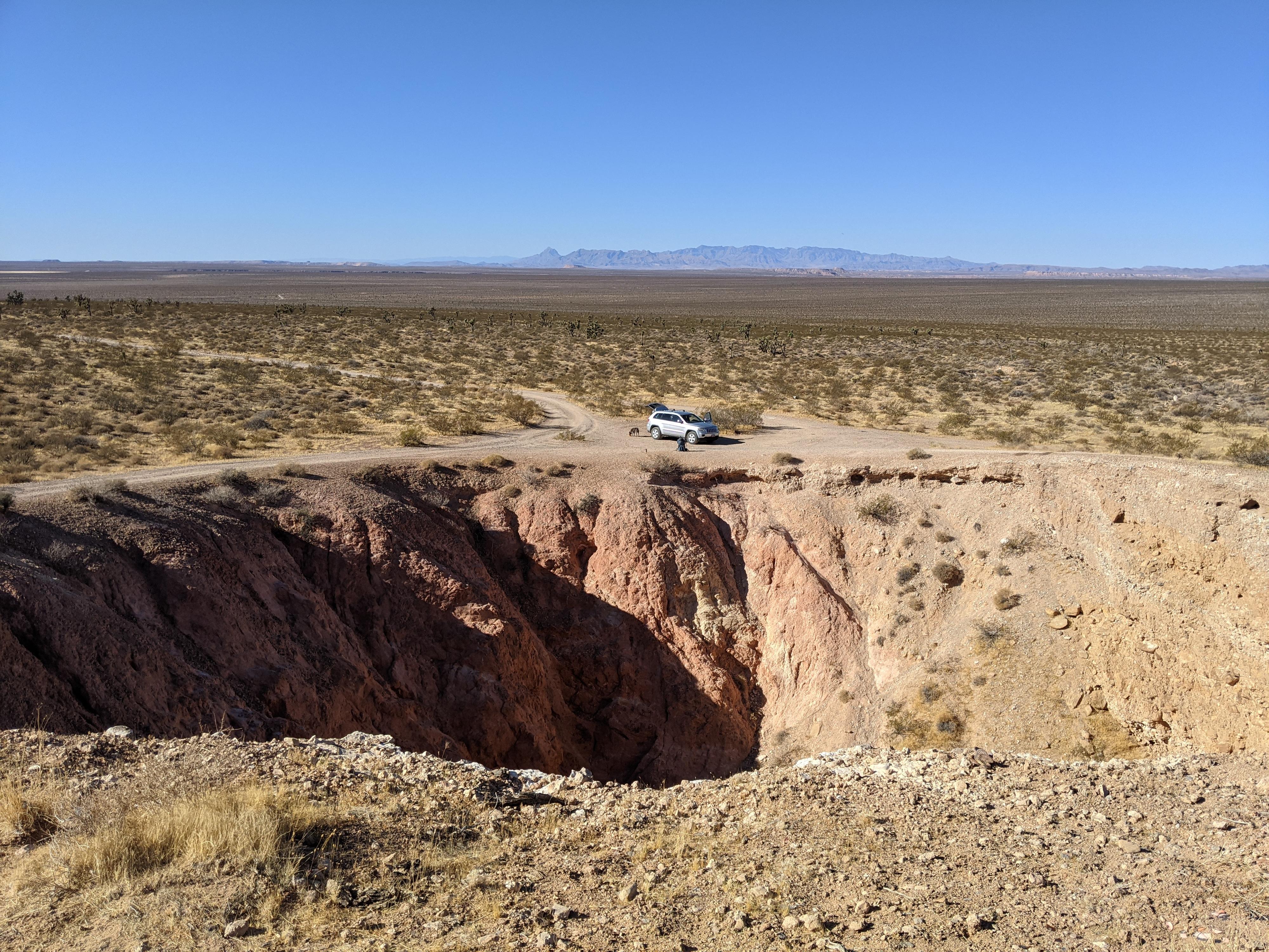
Not far from the main Cedar Pocket road that connects I-15 to AZ-91 is a large sinkhole. Being a bit off the main dirt road and on a small hill, I passed this sinkhole a few times over the years before finally visiting. We weren’t disappointed, it is massive in both diameter and depth!
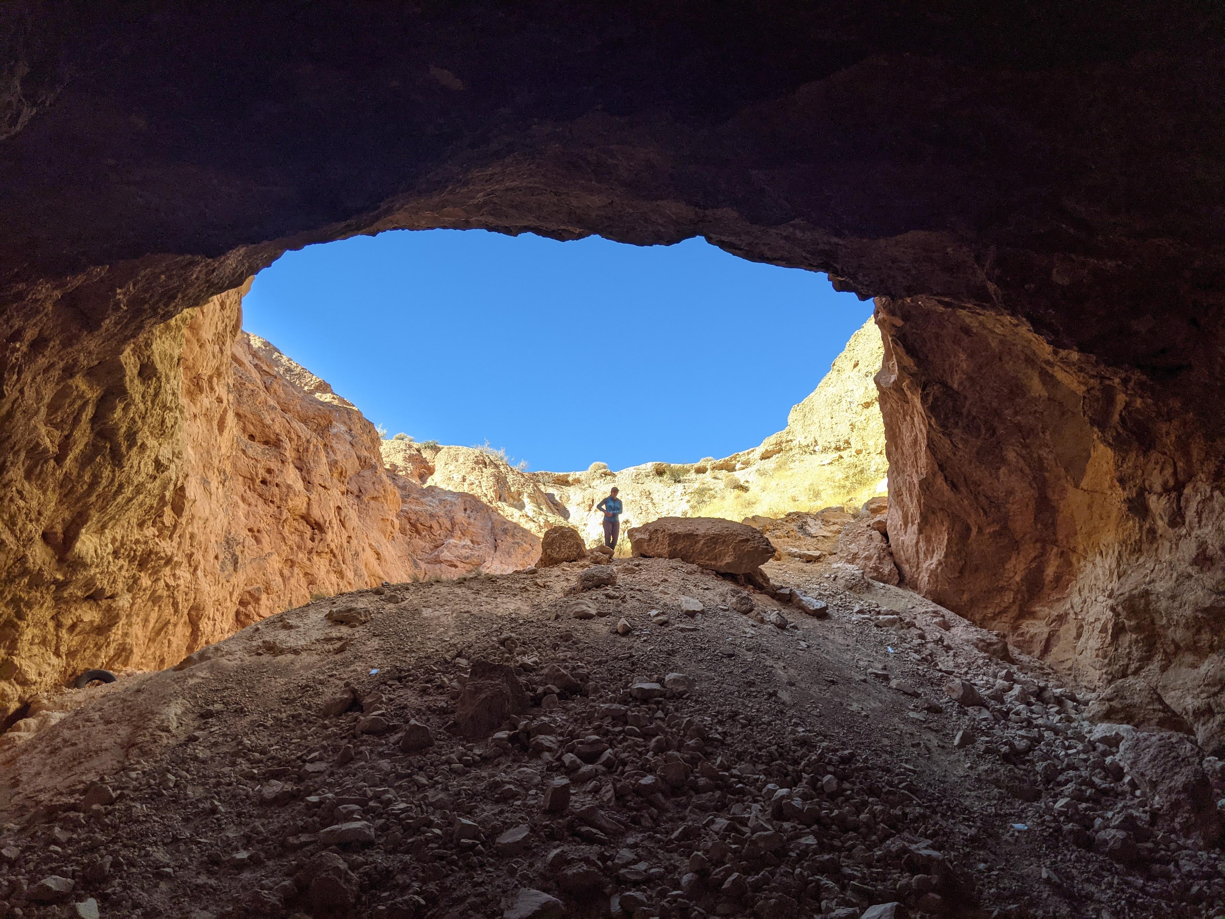
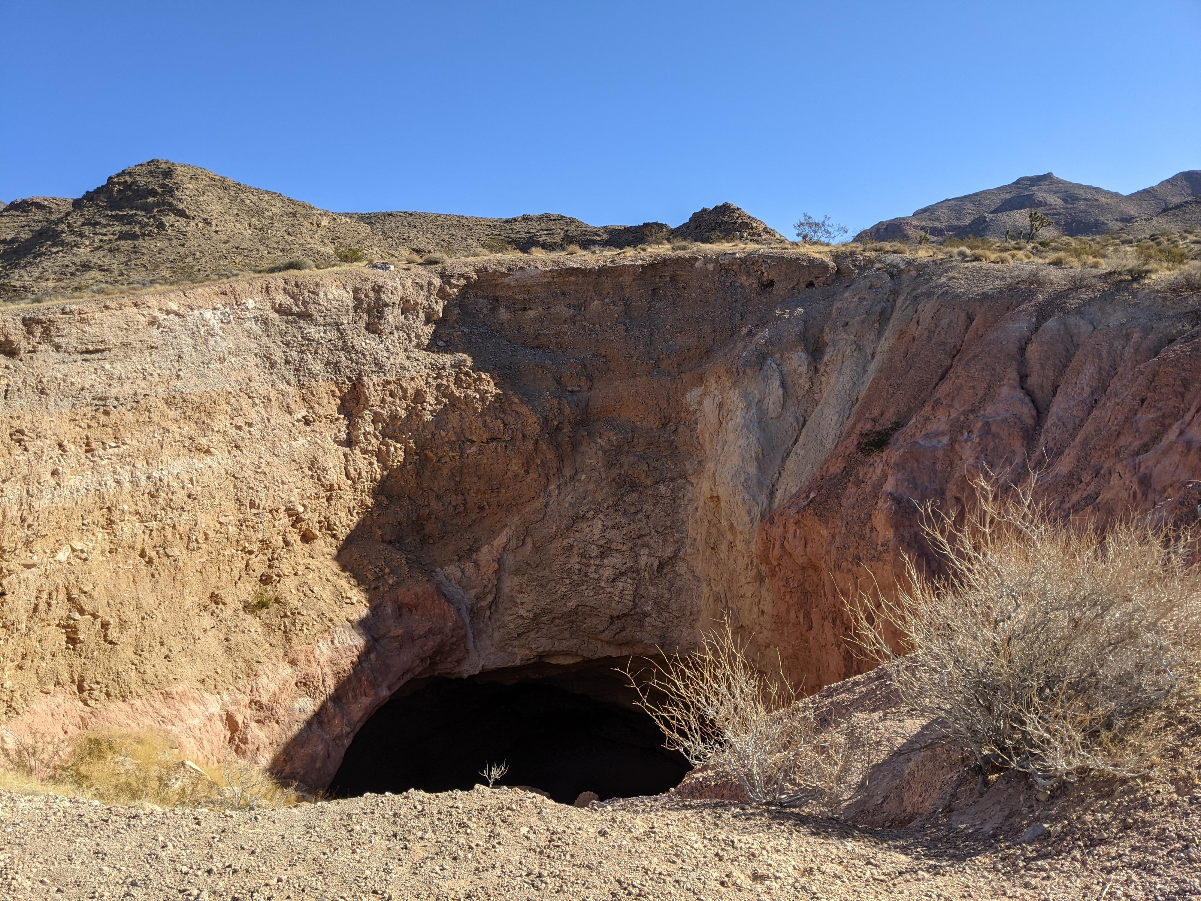
Unlike many sinkholes, Cedar Pocket Sinkhole has a collapsed side allowing for adventurous souls to descend to the bottom of the sinkhole. This is a short side trip that I thought was very worthwhile when passing through the area. The sinkhole was created when gypsum underground was dissolved by ground water. This created instability, and when water levels dropped, the ground collapsed creating the sinkhole.
Getting There
The trailhead is off the Cedar Pockets road in the Virgin River Gorge. This is exit 18 from I-15 about 17 miles west of St. George or 20 miles east of Mesquite NV. This is the same exit for the Virgin River Gorge Campground,
Route Description
The trailhead is right on the edge of the sinkhole.
Maps

12S 244469E 4095467N
36°58'14"N 113°52'14"W
12S 244198E 4095748N
36°58'23"N 113°52'25"W