
 Fossil Canyon
Arizona Strip
Overview
|
Sun 75 | 46 |
Mon 79 | 50 |
Tue 82 | 54 |
Wed 81 | 55 |
Thu 79 | 55 |
| View Full Weather Details | ||||
|
Sun 75 | 46 |
Mon 79 | 50 |
Tue 82 | 54 |
Wed 81 | 55 |
Thu 79 | 55 |
| View Full Weather Details | ||||
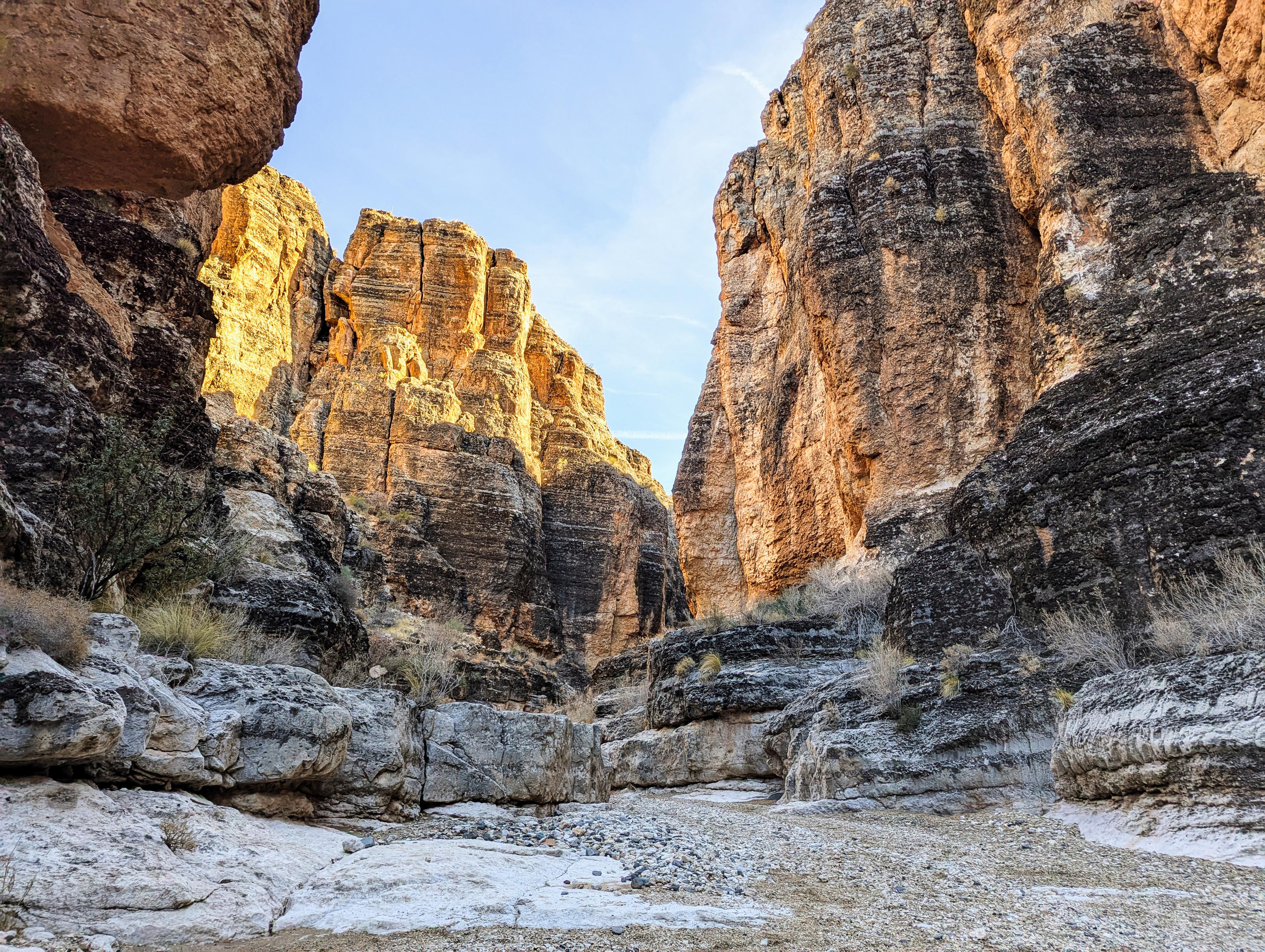
Near the bottom of Fossil Canyon
Fossil Canyon (Quail Canyon) is a gem of a canyon, not too far from St. George. Unlike many of the more popular sandstone canyons in the area, this one is limestone. It has an entirely unique look and feel!
The canyon, carved in limestone, has a handful of obstacles that make for a more challenging hike. We did the hike with a couple of 7-year-olds and a couple of dogs in tow. The kids absolutely loved the challenges and finding a way up, around, or through the challenges. The dogs, though patient with being lifted, seemed to tire of the ordeal. I would rate this as family friendly if you are comfortable giving people a boost if needed. It is dog-friendly if your dog is used to being boosted up and down obstacles.
The hike, for most, ends at about a 7 m dry fall that often has a fixed rope in place. I would recommend most turn around here. If you continue, the canyon opens up in just a minute or two above the rope. Turning around at the bottom of the rope sees the best part of the canyon.
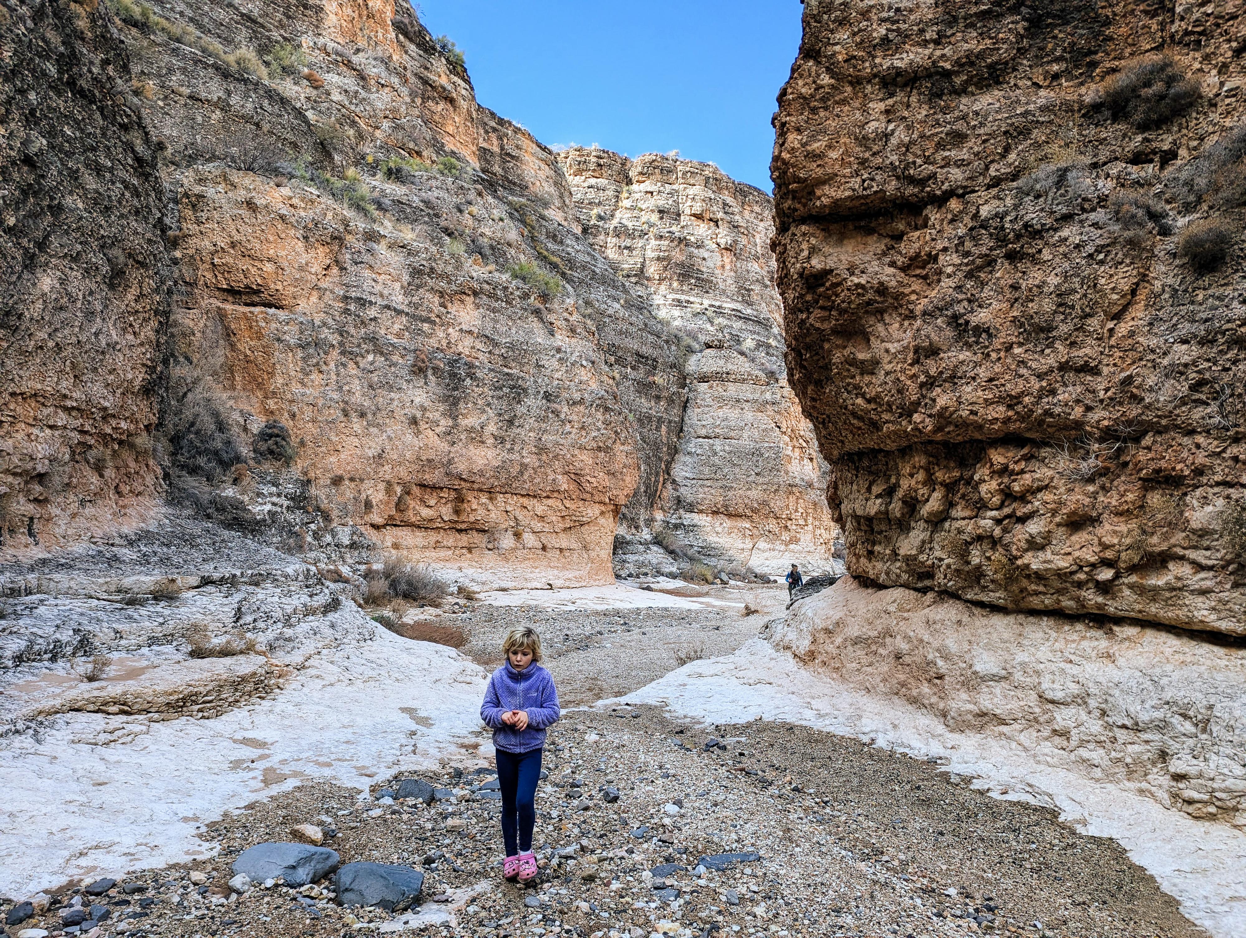
In the upper section not far below the dry fall.
Getting There
Head south on I-15 from St. George, and take Exit 2 for UT-7. Go east on UT-7 toward the St. George Airport.
Stay on UT-7 for about 3 miles to exit 3 (River Road). Once off UT-7, reset your odometer and head south.
The dirt road, generally, has tons of campers on spur sites. Stay on the main dirt road (CR-5, BLM 1069) avoiding the many smaller side roads.
7.8 miles from UT-7 is a spur road on the right that goes down hill. This is the lower trailhead. Park either along the main dirt road, or go down the side road 100 feet or so to a gate where there is a small parking area for a handful of cars.
Upper Trailhead
To reach the upper trailhead, continue on the main dirt road another 1.5 miles to 9.3 miles for UT-7, where a side road leaves on the right. Take this side road. It branches almost immediately, go right. 0.6 miles from the main dirt road, this side road crosses a wash. Just after crossing this wash is a junction. Go right. It goes a short distance and ends. This is the trailhead.
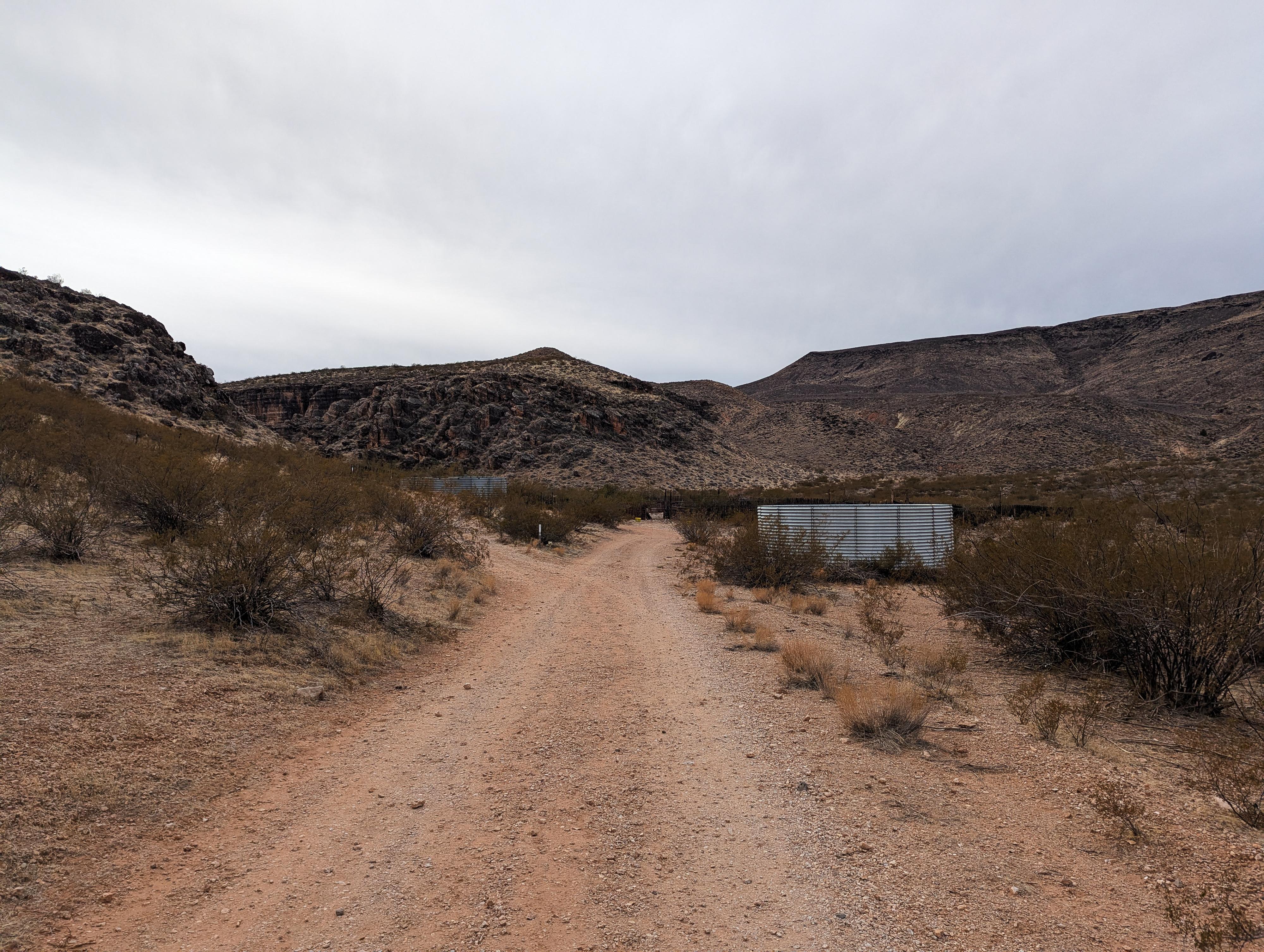
The water tank and corral.
Route
From the trailhead, follow either the road, or the social trail that cuts down directly from the gate to the road at the bottom of the hill, shortening the hike a tiny bit. Follow the dirt road to the corrals and water tank. The trail leaves on the left here and goes through a gate in the fence. It is singed and easy to find. Once through the gate, the trail goes back down to the wash bottom and heads up canyon.
Heading up the canyon bottom, the canyon slowly narrows. There are a few boulder piles as you head up the canyon. All are fairly easy to surmount, but may require some looking around to find the best path. The canyon never becomes a slot, but has some beautiful narrow sections.
The canyon ends at a 7 m dry fall. Generally, there is a fixed rope here, but I always advise caution using someone else's rope and anchor. Once above the dry fall, the canyon opens soon.
Optional Upper Trailhead Exit
Above the dry fall, continue up the canyon a few minutes to a split. Go left here, for another 2-3 minutes to where the upper trailhead is on the right. If you happen to miss it, you will intersect the dirt road to the upper trailhead a few minutes later.
Photos
Maps

| Lower Trailhead |
12S 271594mE 4087217mN N36° 54' 12" W113° 33' 49" |
| Corral |
12S 270731mE 4086775mN N36° 53' 57" W113° 34' 23" |
| Gate |
12S 270782mE 4086746mN N36° 53' 56" W113° 34' 21" |
| Dry Fall |
12S 270772mE 4085699mN N36° 53' 22" W113° 34' 20" |
| Upper Trailhead |
12S 270913mE 4085441mN N36° 53' 14" W113° 34' 14" |