 Roadside Attraction Glitter Mountain
Arizona Strip
Overview
|
Mon 80 | 50 |
Tue 84 | 53 |
Wed 84 | 56 |
Thu 84 | 56 |
Fri 84 | 57 |
| View Full Weather Details | ||||
|
Mon 80 | 50 |
Tue 84 | 53 |
Wed 84 | 56 |
Thu 84 | 56 |
Fri 84 | 57 |
| View Full Weather Details | ||||
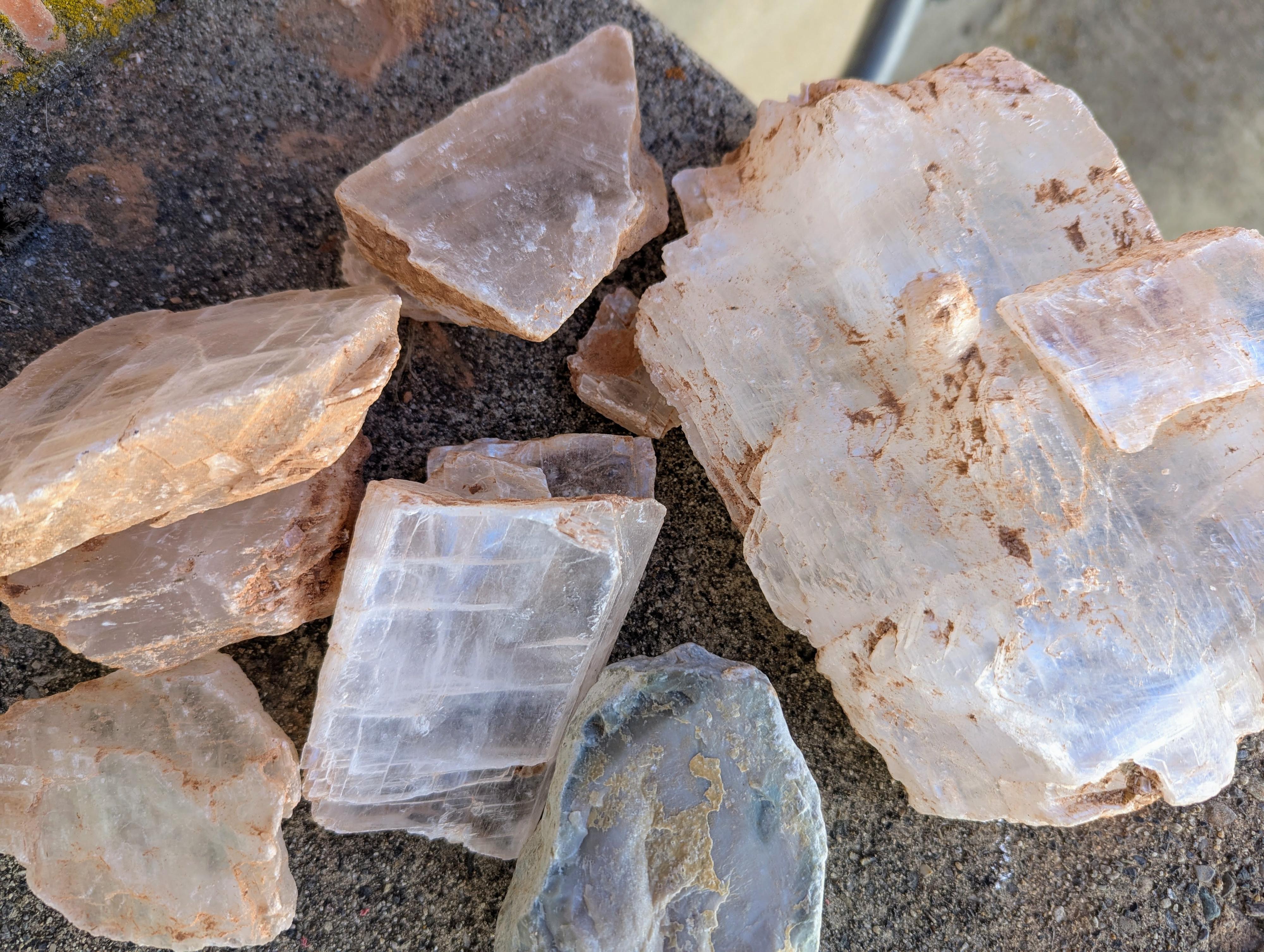
Examples of the rocks we brought home.
Glitter Mountain, also known as the Old Gypsum Crystal Mine, is a popular spot near St. George, Utah, known for its sparkling gypsum crystals. It's an old mining site where gypsum was extracted, and now visitors can explore and collect some of the naturally occurring crystals.
Blm Site Information
Please Respect This Active Mining Claim
History of the Glitter Mine
The “Glitter Mine” is an active mining claim issued by the Bureau of Land Management (BLM) governed by the General Mining Act of 1872, as amended. Feller Stone holds the claim and has the exclusive rights to remove selenite for the purposes of commercial sales. Feller Stone in Veyo, Utah, sells this selenite as “Utah Ice.”
What is Selenite?
This mine contains a deposit of transparent, crystalline gypsum called selenite (CaSO₄ · 2H₂O).
All varieties of gypsum are very soft minerals. In fact, the most important identifying characteristic of gypsum is its softness. If you find a clear mineral, try scratching it with your fingernail.
Gypsum has a hardness of 2 on the Mohs Hardness Scale, which is softer than your fingernail. Other transparent minerals, such as quartz and varieties of mica, are harder than a fingernail and will not be scratched.
How Does Gypsum Form?
Gypsum is commonly formed in highly evaporative environments, such as closed-basin lakes. In these lakes, a water source terminates in the lake basin, bringing dissolved ions with it.
As water evaporates, minerals precipitate out of the water and form solid salts, including calcite, gypsum, and halite (table salt). An example of this type of environment is the Great Salt Lake.
This selenite was deposited as part of the Moenkopi Formation during the early Triassic period, about 240 million years ago. At this time, a large basin covered the southern portion of Utah and northern Arizona.
Guidelines for Visiting
Digging and mining tools are prohibited. This includes hammers, picks, shovels, machinery, etc.
For your safety, do not go near or in the mine’s pit.
Please help keep the site free of trash.
For your safety and the safety of others, do not shoot near the mine.
They ask for a fee for rocks taken, payable (in 2025) via Venmo. Please support the owner of the claim by paying for rocks you take home.
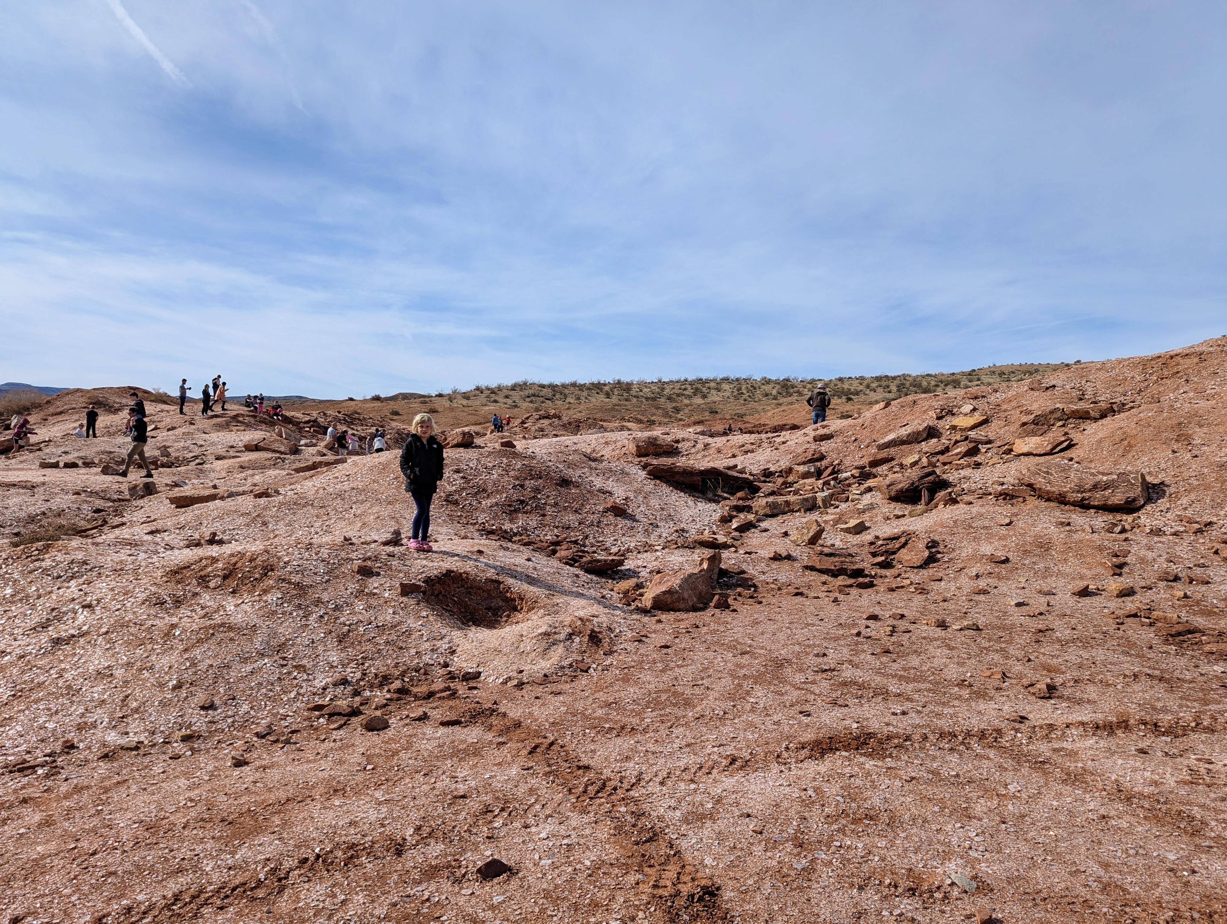
A glittering field of rocks and people!
Getting There
Take exit 2 from I-15, south of St. George, and head east on UT-7. Follow UT-7 for 10 miles to the Warner Valley Road exit.
Once off UT-7, reset your odometer and turn right, then almost immediately (0.1 miles) right again on the dirt road paralleling UT-7 heading south. Stay on the main dirt road, ignoring lesser side roads, unless noted.
At 3.3 miles, turn left, then right at 4.3. The road heads southeast, then south.
Turn left at 5.1 miles, and continue another mile to 6.1 miles. Glitter Mountain is on the right here. Take the spur road a short distance to the parking area and informational sign.
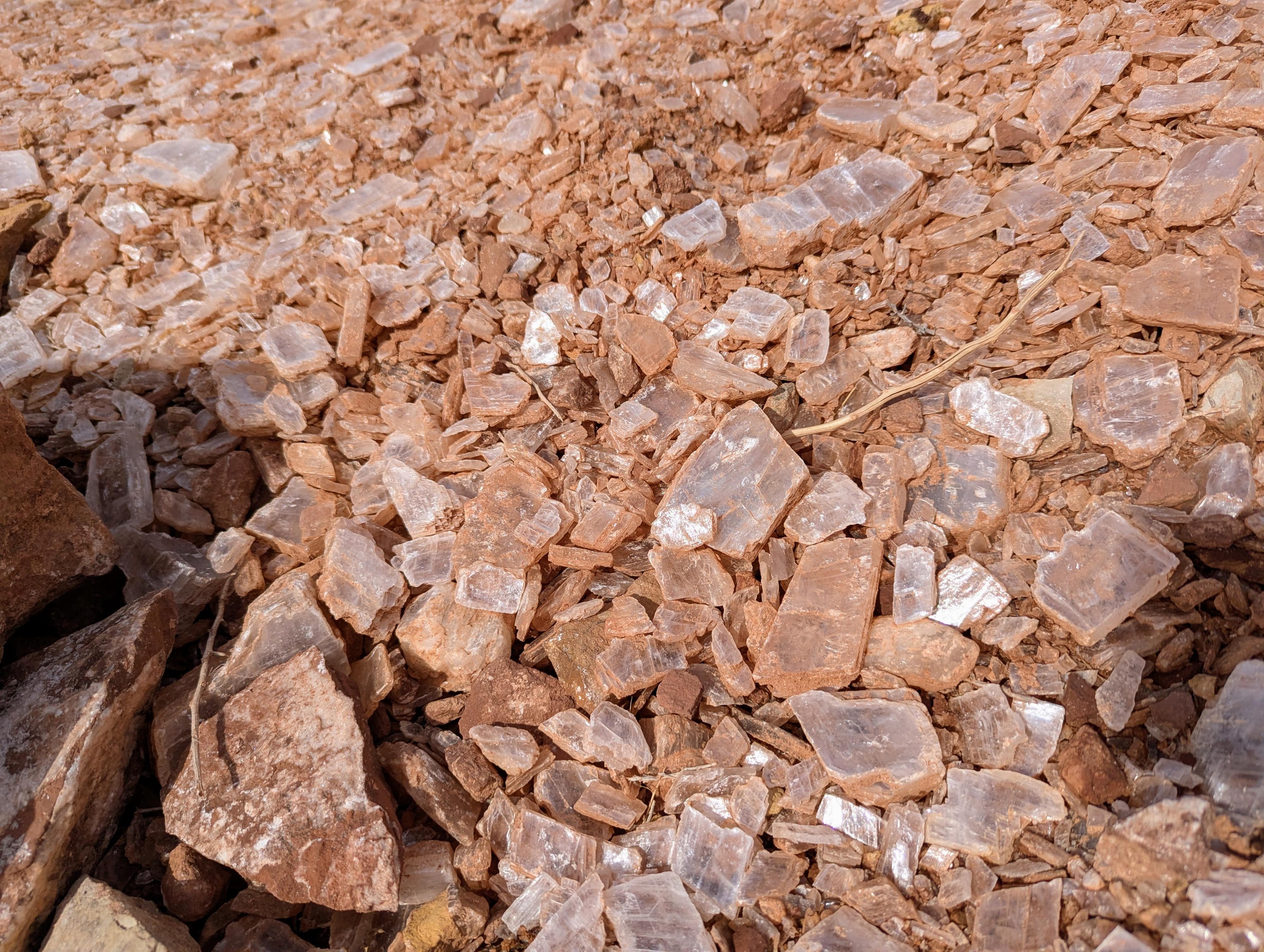
A close-up of the ground at the site. It is easy to find good specimens.
Route
The mine is right at the trailhead. On our visit, we found some areas had bigger specimens than others, so poke around a bit.
Photos
Maps
| Glitter Mountain |
12S 280681mE 4095344mN N36° 58' 43" W113° 27' 50" |