 Hiking Lava Tubes
Snow Canyon State Park
Overview
|
Tue 78 | 47 |
Wed 80 | 53 |
Thu 80 | 54 |
Fri 83 | 55 |
Sat 80 | 56 |
| View Full Weather Details | ||||
|
Tue 78 | 47 |
Wed 80 | 53 |
Thu 80 | 54 |
Fri 83 | 55 |
Sat 80 | 56 |
| View Full Weather Details | ||||
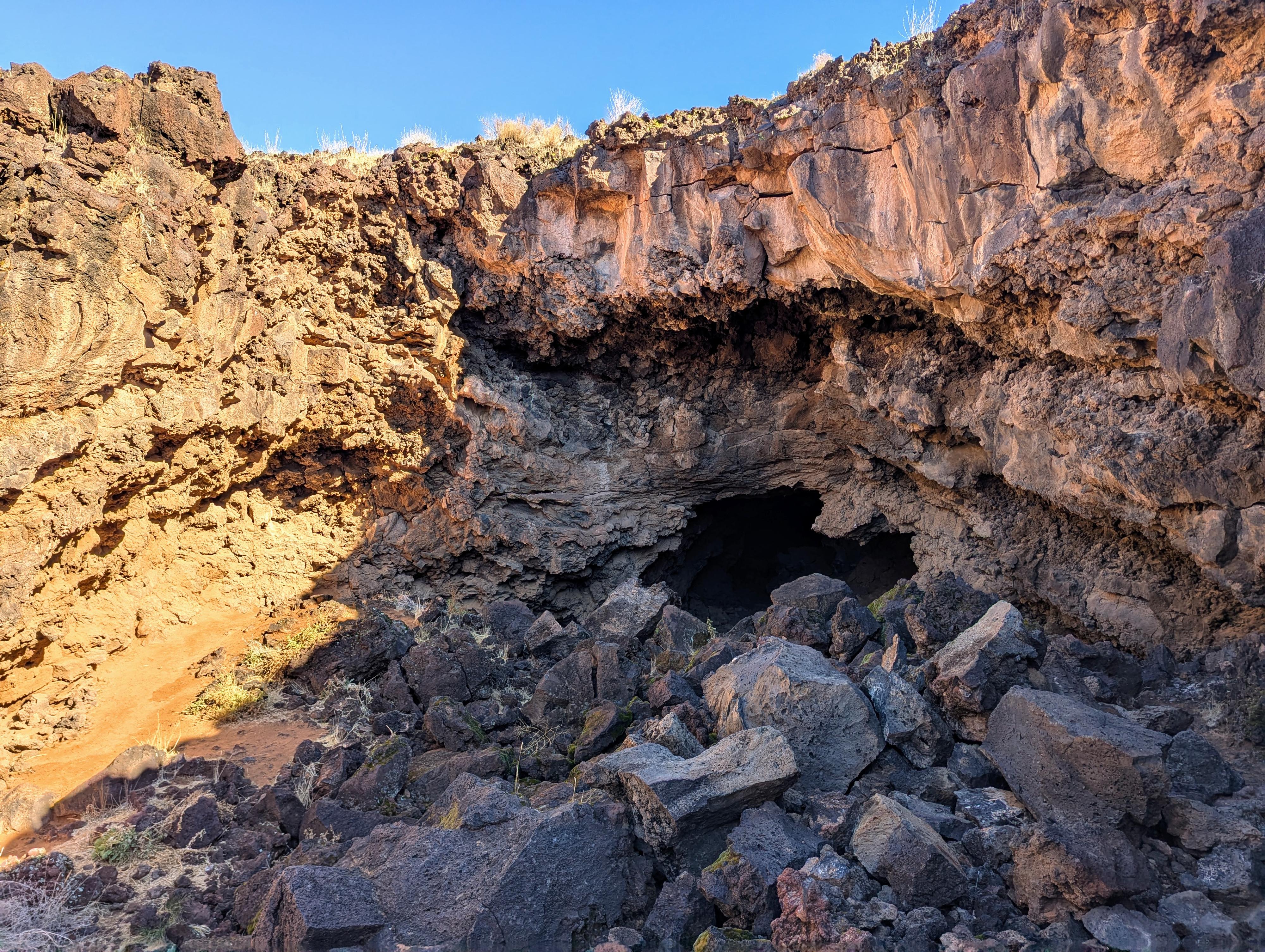
The South Lava Tube after the first minor downclimb to the big entrance.
Nestled within the red rock landscapes of Snow Canyon State Park in Utah, the lava tubes are a unique and adventurous hiking experience. Formed by ancient volcanic activity, these underground tunnels were created as molten lava flowed through the area, leaving behind hollowed-out passageways once the outer layers cooled and hardened. Today, hikers can explore these fascinating geological formations, scrambling over rugged basalt rock and descending into the cool, shadowy depths of the caves.
The hike to the lava tubes is a mix of sandy trails, rocky terrain, and uneven lava fields. Suitable for most, though avoid it during hot times of the year. There is very little shade until you get to the lava tubes. Getting into the south lava tube is straightforward, but the north lava tube has two tricky entrances, both of which require an intermediate level of skill. I would recommend starting with the South Tube first.
From the State Park:
Basic Safety and Etiquette:
Glow sticks, chalk, spray paint and human waste can destroy tubes -- their use to mark or deface tube walls and floors is prohibited.
Always let someone know where you're going and when you will return
Never go alone -- there should be at least three in your group.
Individuals need their own flashlight always have two additional light sources and extra batteries.
Proceed cautiously and watch your step, rock-strewn floors make walking difficult. In low places, watch that ceiling!
Remember, cell phones don't work underground!
Bring your first aid kit.
If you carry it carry it out! Please explore resonsibly so others can enjoy their visit too.
Your Safety is Your Responsibility
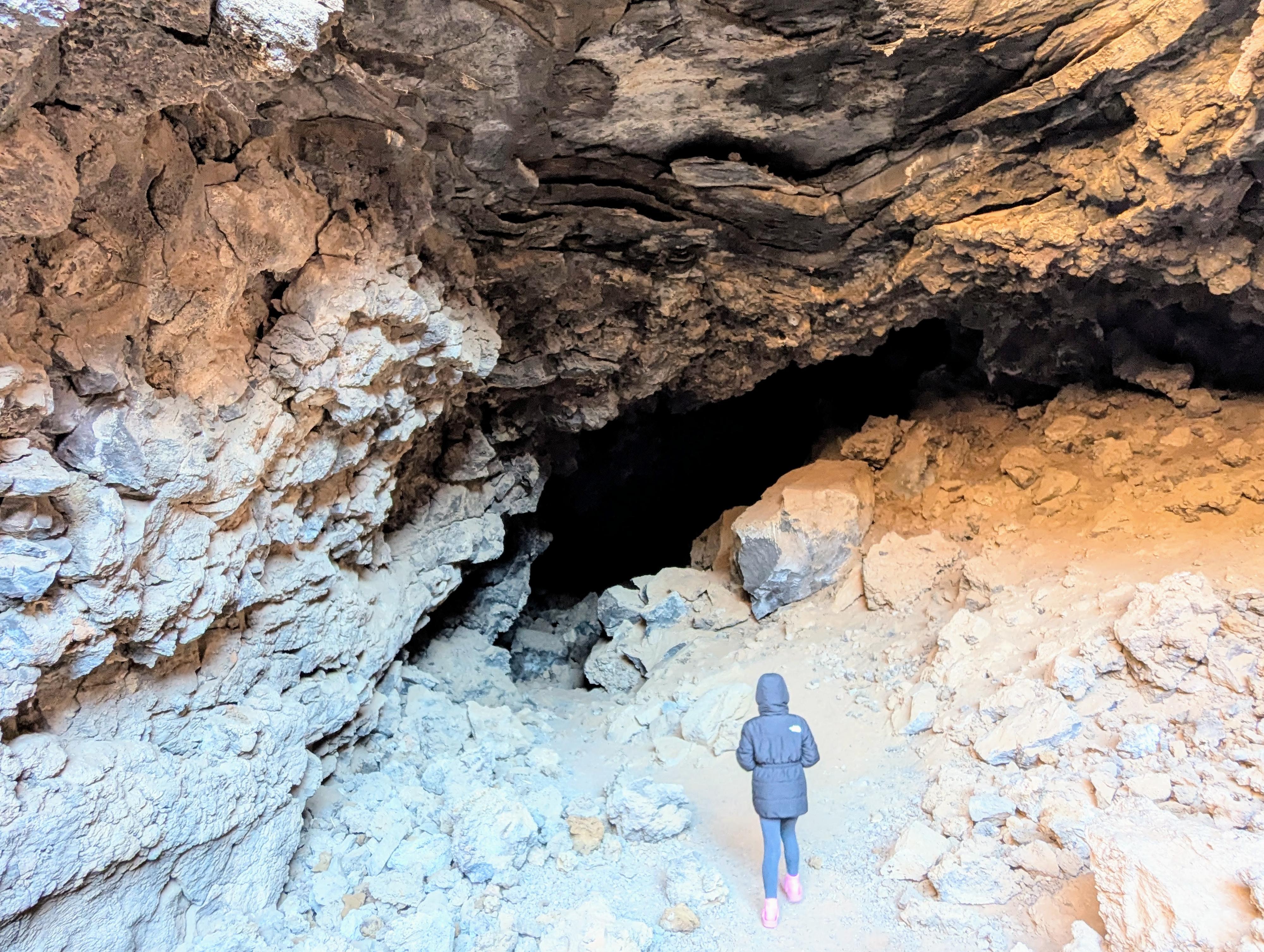
Heading into the south lava tube.
Getting There
The trailhead is either the Lava Flow Trailhead or Butterfly Trailhead in Snow Canyon State Park.
From the south entrance station to Snow Canyon State Park, drive north into the park for 2.7 miles to the Butterfly Trailhead, or continue another 0.4 miles to 3.1 miles from the entrance station for the Lava Flows trailhead
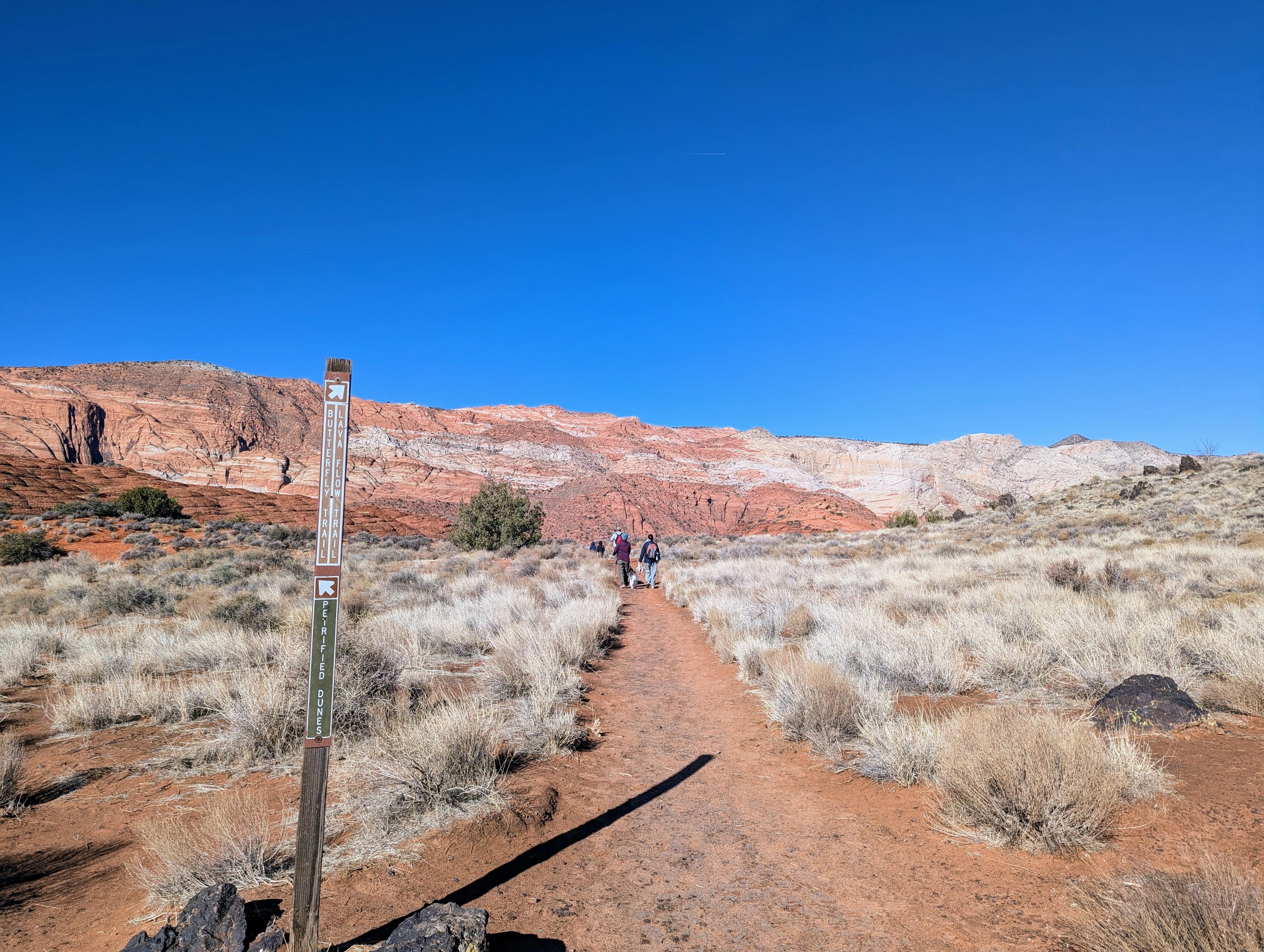
Junction not far from the Butterfly Trailhead. Go straight (slight right)
Route
You can reach the lava tubes from the Lava Flow Trail, or the Butterfly Trail. Or, you can do it as a loop using the two trails and a 0.4 miles of road walking.
Butterfly Trailhead (about 0.7 miles one way to the south lava tube)
Head west on the Butterfly Trail, staying straight at the junction for the Petrified Dunes. The trail crosses an open plain, then descends a slick rock slope before crossing a second open area to the junction with the Lava Flow Trail. Turn left at this junction and follow the trail a couple of minutes to the south lava tube.
South Lava Tube
Getting into the south lava tube requires a couple of moves down a "step" like feature. Suitable for most with a little care. Once in the bottom, simply head in as far as comfortable. There is one spot with a skylight that appears to be an alternate exit, but we didn't try it.
To reach the north lava tube, go back to the Butterfly/Lava Flow Trails junction but go straight on the Lava Flow Trail instead of right on the Butterfly Trail. The north lava tube is about 1/4 of a mile north of that junction along the Lava Flow Trail.
North Lava Tube
The north lava tube has two entrances. The large entrance, that is the first one you see, requires an exposed ledge travel and step down. Be cautious! We saw many groups doing this, but it is likely not recommended for beginners. Once down, the lava tube splits. Right dead ends soon, whereas left goes to a second entrance and splits again.
North Tube Alternate Entrance
From the main, large entrance, look to the left and a little beyond the main entrance. There is a second entrance that requires a downclimb and drop in a small hole. This is less exposed than the larger entrance, but still requires some skill to negotiate. The drop is maybe 8 ft. Be careful!
Lava Flow Trailhead (less than 1/2 mile one way to the north lava tube)
Head west on the Lava Flow Trail. About 0.4 miles from the trailhead, a junction is reached. Go left here for about 300 ft to reach the north lava tube.
Photos
Maps

| Butterfly Trailhead |
12S 265406mE 4122078mN N37° 12' 57" W113° 38' 38" |
| Lava Tube South |
12S 264875mE 4122529mN N37° 13' 11" W113° 38' 60" |
| Lava Tube North |
12S 265062mE 4122800mN N37° 13' 20" W113° 38' 53" |
| Whiterocks Jct |
12S 265108mE 4122860mN N37° 13' 22" W113° 38' 51" |
| Lava Flow Trailhead |
12S 265586mE 4122771mN N37° 13' 19" W113° 38' 31" |