 Hiking The Salmon
Boulder Mountain
Overview
|
Fri 66 | 45 |
Sat 66 | 42 |
Sun 56 | 39 |
Mon 57 | 34 |
Tue 62 | 39 |
| View Full Weather Details | ||||
|
Fri 66 | 45 |
Sat 66 | 42 |
Sun 56 | 39 |
Mon 57 | 34 |
Tue 62 | 39 |
| View Full Weather Details | ||||
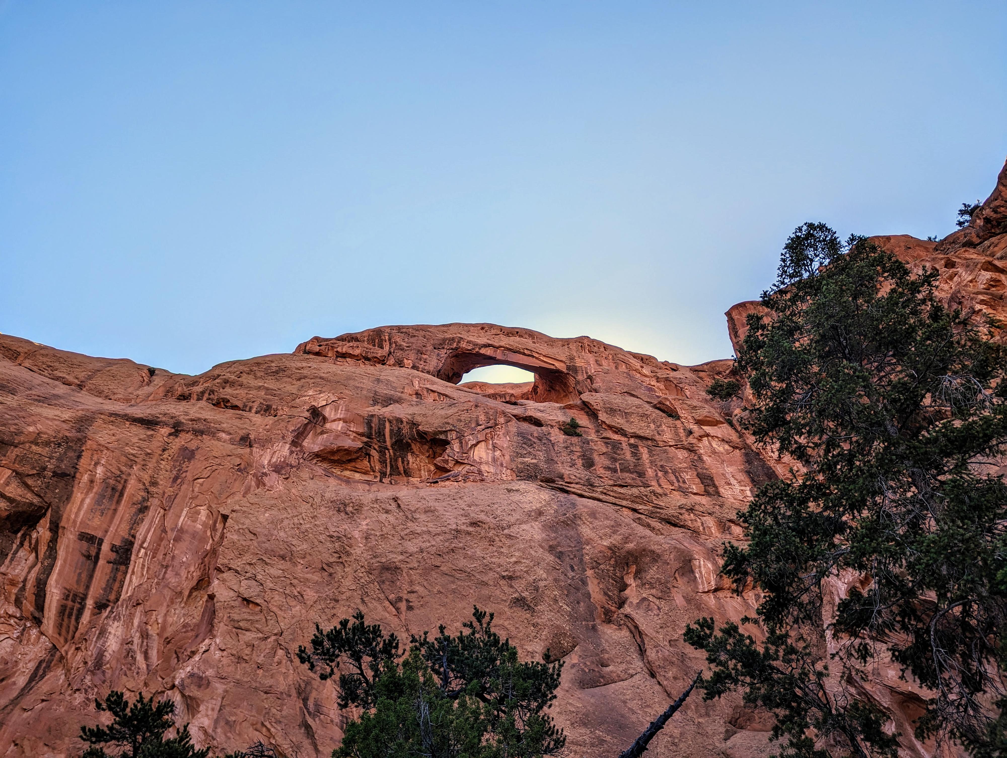
One of the arches at The Salmon
The Salmon is a sandstone formation east of Lower Bowns Reservoir. I was intrigued to find "Natural Arches" marked on the topographical map on the Salmon. Armed with just that information, the family and I went out to check it out. Turns out to be an easy hike, partly along a cattle trail, to the arches. There are two, but the highest is difficult to see, and really only visible from a distance. The second is easy to visit from the bottom and a fairly impressive arch.
This is probably not a destination hike, unless you are an arch enthusiast, but is a nice short hike if you are visiting the nearby Lower Pleasant Creek Falls or Tantalus Creek Corral.
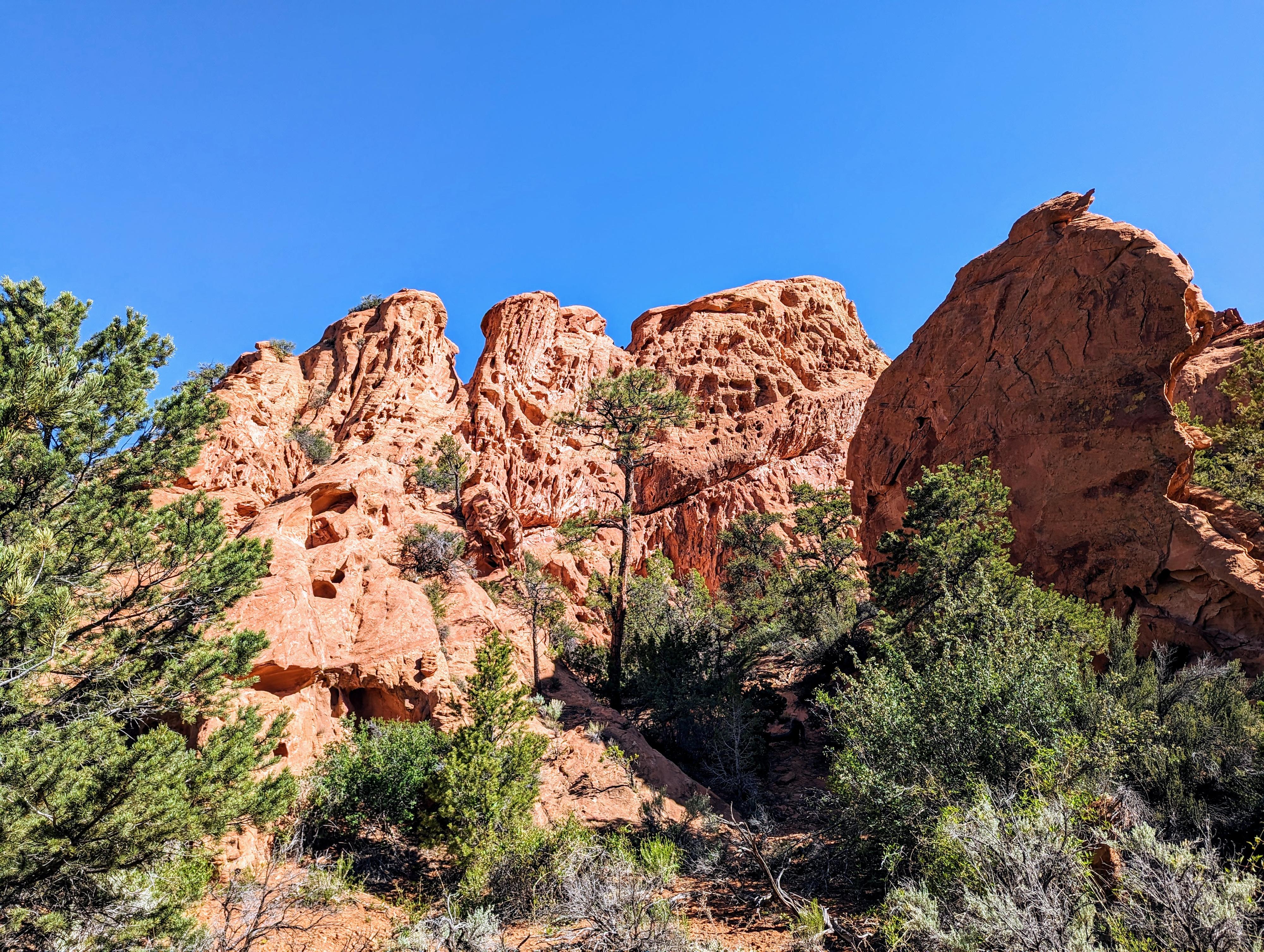
Nice rock features along the hike to the Salmon
Getting There
The trailhead is east of UT-12 beyond Lower Bown Reservoir. To get there, head south on UT-12 from the UT-24/UT-12 junction east of Torrey. Follow UT-12 for about 17 miles to milepost 106.1.
- MP 106.1 - Reset odometer as you turn off UT-12. This is signed Lower Bowns Reservoir. There are many side roads and primitive camping opportunities along the way. Stay on the main road until directed otherwise. ( 12S 470414mE 4216961mN / N38° 05' 60" W111° 20' 15" )
- 3.15 miles - Junction. Right goes to Lower Bowns Reservoir. Go left here, toward Jorgenson Flat and Tantalus Creek. ( 12S 474801mE 4217886mN / N38° 06' 30" W111° 17' 15" )
- 7.6 miles - Junction. Go right here, towards Captiol Reef. ( 12S 480225mE 4221827mN / N38° 08' 39" W111° 13' 32" )
- 8.25 miles - Smaller side road on the right that goes to the Tantalus Corral. Stay left. The road descends to Tantalus Creek and crosses it. The crossing can have a muddy spot or two. Be sure to check it before crossing. ( 12S 480717mE 4221404mN / N38° 08' 25" W111° 13' 12" )
- 9.6 miles - The Salmon Trailhead. This is at a nondescript spot just after the road made a couple of bends. This is also right where the juniper trees that are next to the road end. ( 12S 482085mE 4220295mN / N38° 07' 49" W111° 12' 16" )
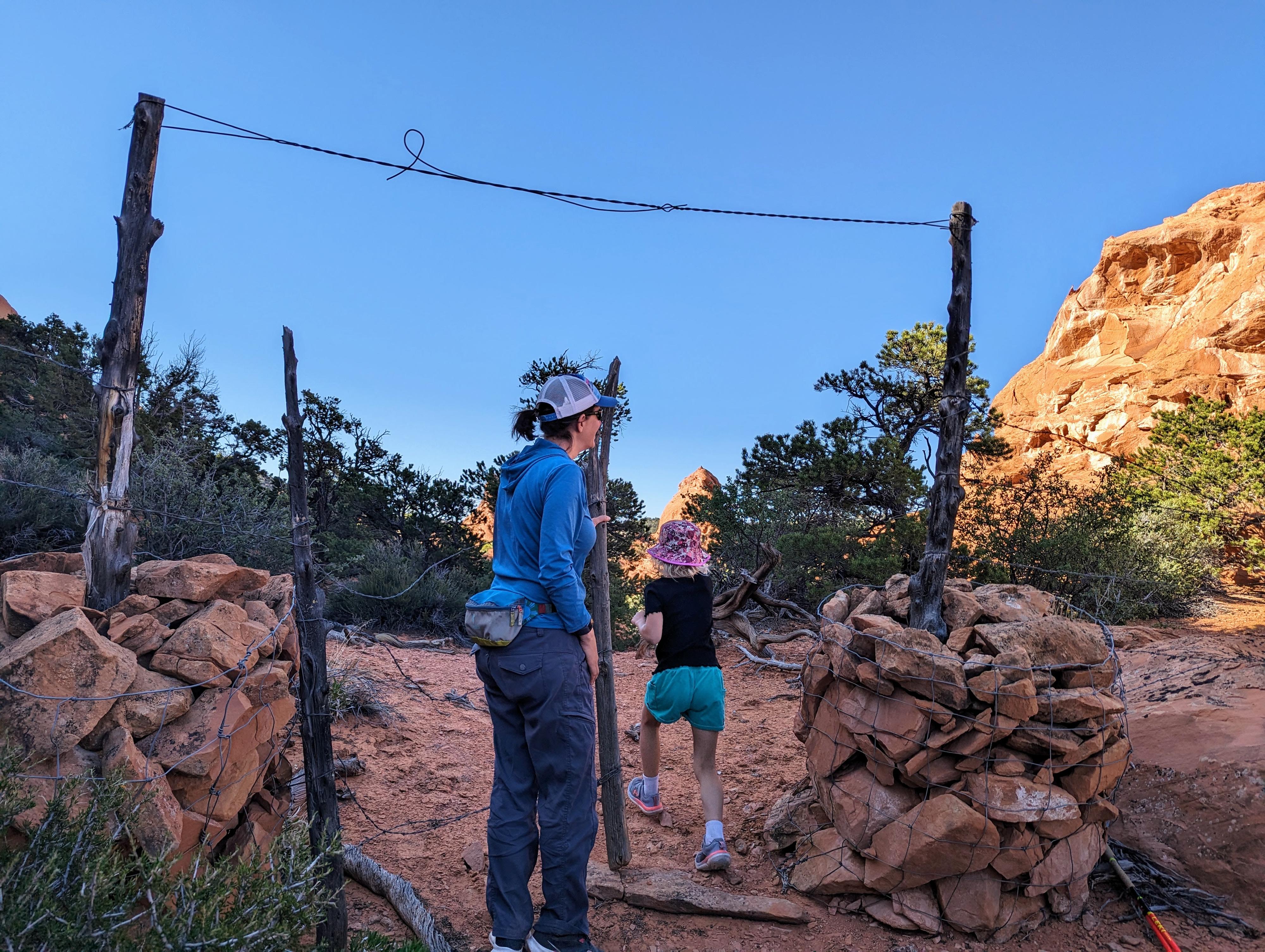
R and Diane at the gate along the way.
Route
The trailhead is fairly nondescript. The goal is to cross over the ridge south of the trailhead. From where you park, begin heading southwest. After just a few minutes, begin angling more south and up. On our visit, there had been recent cattle moved on an old trail here, and it was fairly easy to find and follow the path.
The path of least resistance will lead you to a gate/fence. Pass through it and continue over the top of the ridge. From the top of the ridge, on our visit, the cattle trail braids into many trails. Head down to Maverick Draw via whatever looks to be the easiest path. Just keep an eye on your route so you can find it again at the end of the hike!
Follow Maverick Draw up stream. The large sandstone feature, The Salmon, is easily visible in the distance. As you get closer, look for the arches. The highest arch is most visible from a distance. The lower arch is easy to spot up the first major drainage that goes to The Salmon. Return the same way.
Photos
Maps

| The Salmon Trailhead |
12S 482086mE 4220295mN N38° 07' 49" W111° 12' 16" |
| Gate |
12S 482068mE 4220034mN N38° 07' 41" W111° 12' 17" |
| Arch |
12S 482438mE 4219355mN N38° 07' 19" W111° 12' 01" |
| Arch 2 |
12S 482471mE 4219373mN N38° 07' 19" W111° 11' 60" |