 Hiking 20 Mile Dinosaur Track Site
Hole In The Rock
Overview
|
Sun 59 | 40 |
Mon 64 | 37 |
Tue 69 | 41 |
Wed 71 | 45 |
Thu 73 | 46 |
| View Full Weather Details | ||||
|
Sun 59 | 40 |
Mon 64 | 37 |
Tue 69 | 41 |
Wed 71 | 45 |
Thu 73 | 46 |
| View Full Weather Details | ||||
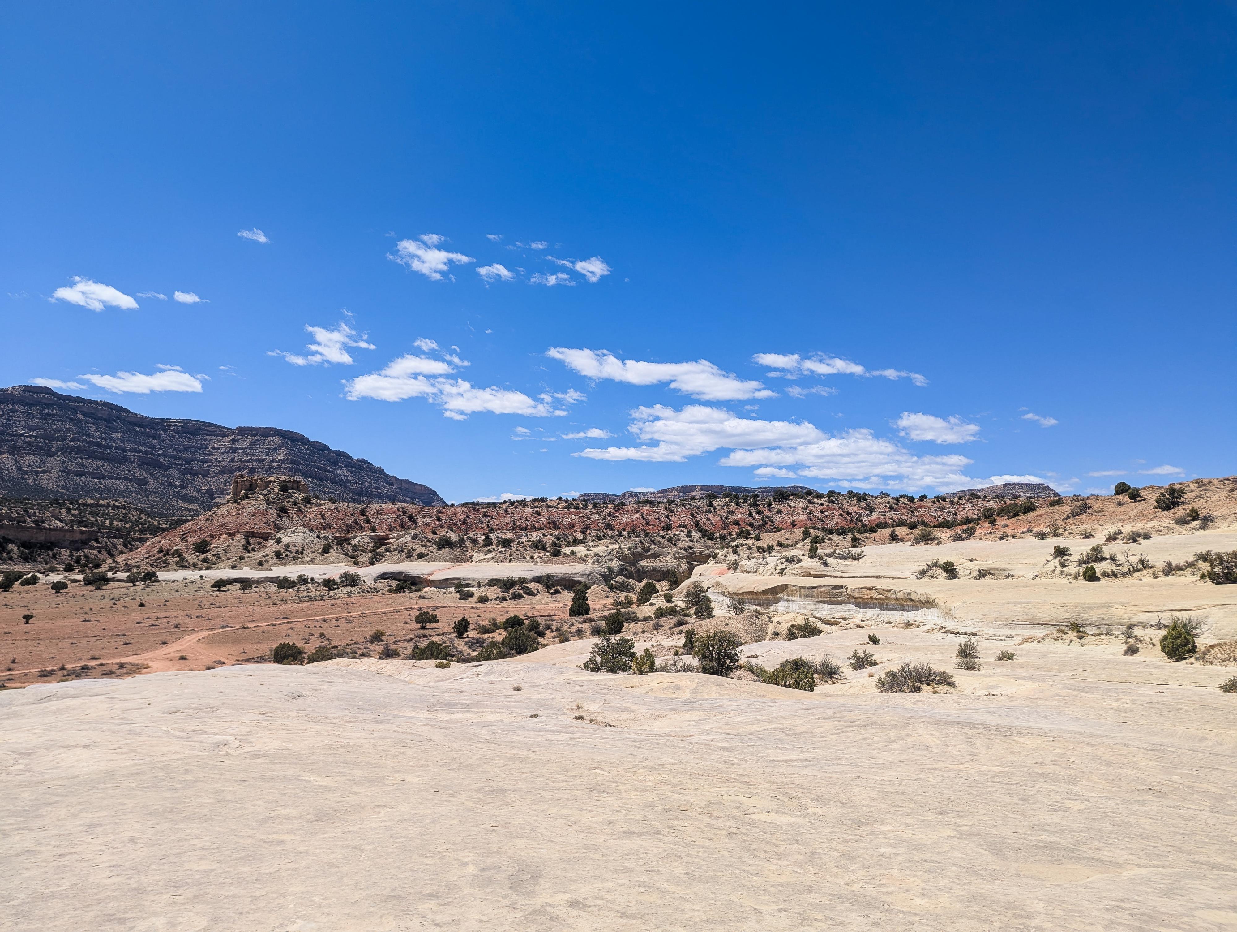
Views from the upper area.
I have visited quite a few dinosaur track sites on the Colorado Plateau over the years. This one, near the Hole-In-The-Rock Road, is extensive; there are hundreds of tracks preserved at the site. The tracks are faint, however. If you don't have some background in spotting tracks, you are likely to find them difficult to differentiate from simply weathered spots in the rock.
I found a few that seemed relatively distinct, but still much less obvious than other sites I have visited. Overall, an interesting stop, but a little disappointing compared to other dinosaur track sites I have visited in terms of seeing obvious and well-defined tracks.
The footprints are preserved in Entrada Sandstone, dating back to the Jurassic Period, approximately 150–180 million years ago. The tracks are believed to have been made by theropods (bipedal meat-eaters, relatives of T. rex) and possibly other dinosaur species.
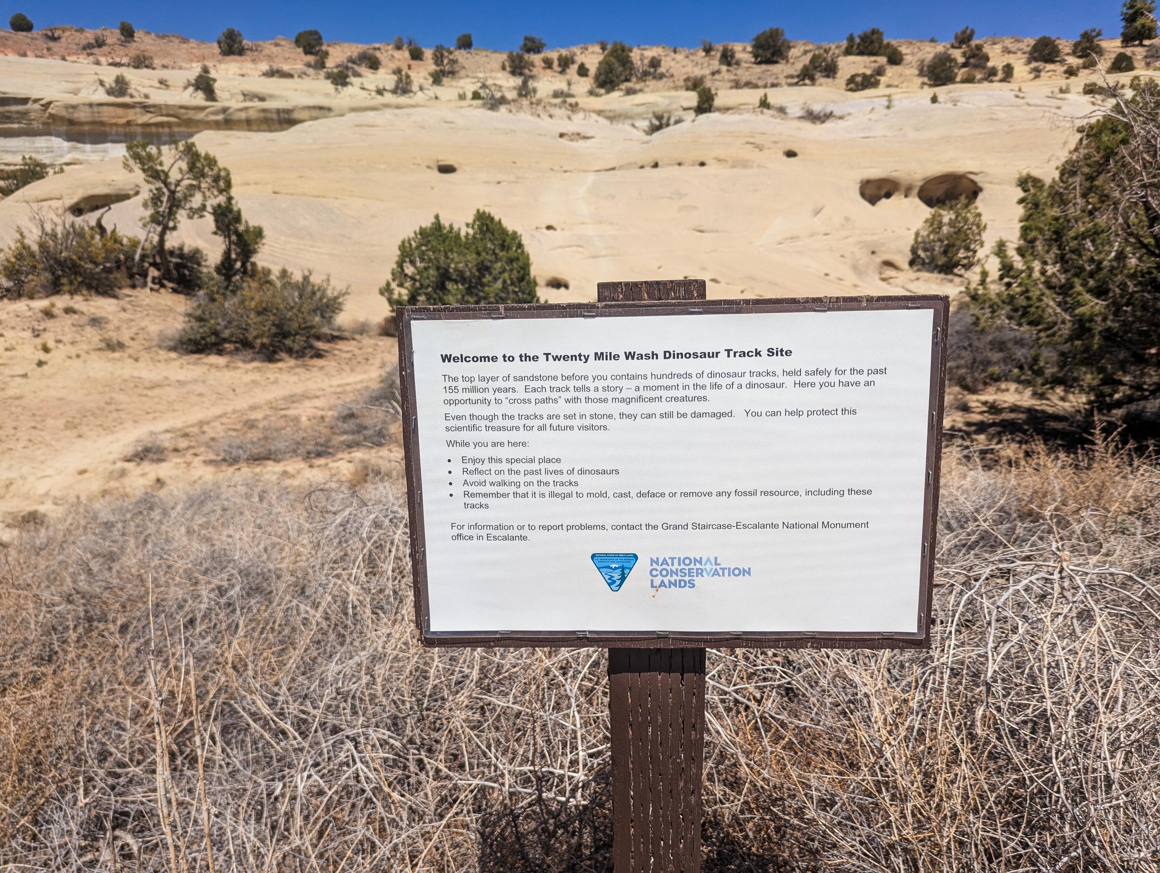
Welcome to the Twenty Mile Wash Dinosaur Track Site
The top layer of sandstone before you contains hundreds of dinosaur tracks, held safely for the past 155 million years. Each track tells a story – a moment in the life of a dinosaur. Here you have an opportunity to cross paths with those magnificent creatures.
Even though the tracks are set in stone, they can still be damaged. You can help protect this scientific treasure for all future visitors.
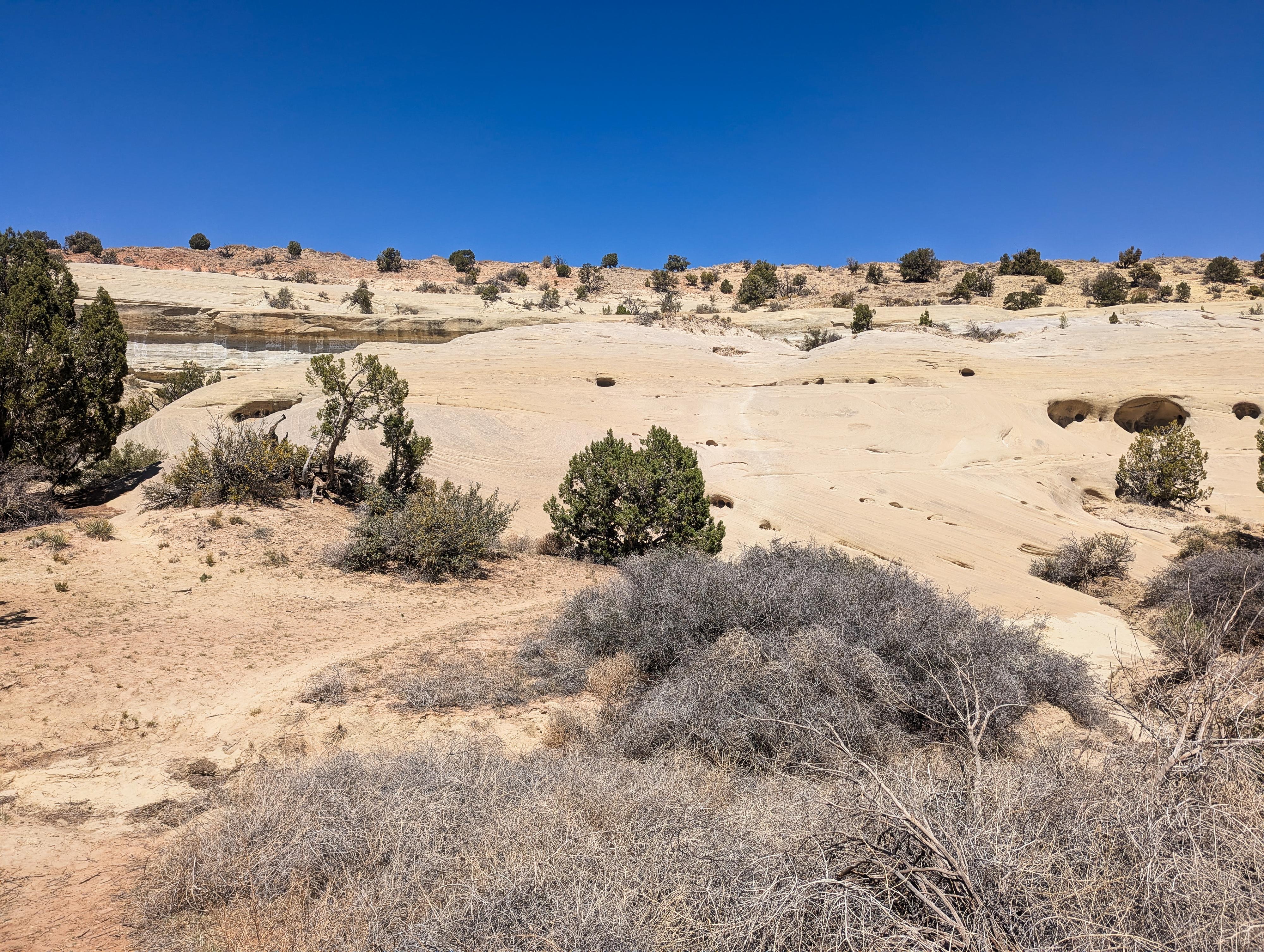
The trail up across the sand then up slickrock.
Getting There
Head east out of the town of Escalante about 5 miles on highway 12 until the well signed Hole in the Rock road on the south side of highway 12. Reset the odometer as you turn onto this road.
- Mile 0 - Hole-In-The-Rock Road Turnoff ( 12S 453167mE 4175716mN / N37° 43' 39" W111° 31' 53" )
- 4.5 miles - Small parking area on the north side of the road. This is the trailhead for West Big Horn/Big Horn Canyon. ( 12S 457467mE 4170148mN / N37° 40' 39" W111° 28' 56" )
- 8.0 miles - Parking area after a cattle guard. This is the Zebra/Tunnel trailhead. ( 12S 460681mE 4165896mN / N37° 38' 22" W111° 26' 44" )
- 12.3 miles - Devil's Garden turn off on the right. The trailhead is about 1/4 of a mile down this road. No camping, but a pit toilet. ( 12S 463808mE 4160175mN / N37° 35' 17" W111° 24' 36" )
- 14.45 Miles - Left Hand Collet Road on the right. This is the side road to 20 Mile Dinosaur Tracks. Reset your odometer as you turn off onto it. ( 12S 465665mE 4157425mN / N37° 33' 48" W111° 23' 20" )
- Left Hand Collet Road - Follow the Left Hand Collet Road for 2.3 miles to a side road on the right. Turn onto this side road. ( 12S 462641mE 4155383mN / N37° 32' 41" W111° 25' 22" )
- The side road is rough enough you likely want medium clearance. Follow it for about 1/2 mile as is approaches the sandstone slopes and curves left along the base. There is a small pullout here with a BLM information register. This is the trailhead. ( 12S 462454mE 4156036mN / N37° 33' 02" W111° 25' 30" )
Trailhead sign.
Route
From the trailhead, there was a sheet with some directions on our visit, saying the tracks are on the topmost layer visible from the trailhead. After poking around, that seems to be where the most obvious prints are.
Follow a social trail over to the slick rock, then work up to the top layer of sandstone. There are several easy routes; be sure to look around if you find it getting difficult. On the topmost layer and the layer below the top, there are areas that appear to have tracks. There are a couple of places where you can see what appear to be several large tracks in a row, which, I assume, is a dinosaur walking.
Return the same way after poking around.
Photos
Maps

| 14.45 miles HITR Road |
12S 465663mE 4157438mN N37° 33' 48" W111° 23' 20" |
| 2.3 miles |
12S 462641mE 4155383mN N37° 32' 41" W111° 25' 22" |
| Trailhead |
12S 462454mE 4156036mN N37° 33' 02" W111° 25' 30" |